Pulversheim geodata
Pulversheim (Grand Est) is a populated place; located in France in Europe/Paris (GMT+2) time zone. With population of 2,372 people, there are 4075 cities with bigger population in this country. Compared to other cities in France, 56.4% of cities are located further ↓South; 96.5% of cities are located further ←West and 72.2% of cities have lower elevation than Pulversheim. Note1
Administrative division(s):
- Level 1: Grand Est
- Level 2: Haut-Rhin
- Level 3: Arrondissement de Mulhouse
- Level 4: Pulversheim


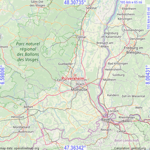
Pulversheim GPS coordinates[2]
47° 50' 15.108" North, 7° 18' 4.284" East
| Map corner | latitude | longitude |
|---|---|---|
| Upper-left | 48.30735°, | 6.59806° |
| Center: | 47.83753°, | 7.30119° |
| Lower-right: | 47.36342°, | 8.00431° |
| Map W x H: | 105×105 km | = 65.2×65.2mi |
| max Lat: | 51.07786° ⇑43.6% North |
| Pulversheim: | 47.83753° |
| min Lat: | ⇓56.4% South 41.3874° |
| min Long | Pulversheim | max Long |
| -5.08615° | 7.30119° | 9.52242° |
| W 96.5%⇐ | ⇒3.5% E |
Elevation
Elevation of Pulversheim is 231 m = 758 ft, and this is 37.3 m = 122 ft above average elevation for this country.
| Max E: |
2333 m = 7654 ft | 27.8% |
| Pulversheim | 231 m 758 ft | |
| Avg. | 193.7 m = 635 ft | |
Min E: |
-1 m = -3 ft | 72.2% |
See also: France elevation on elevation.city.
Geographical zone
Pulversheim is located in North temperate zone (between Tropic of Cancer and the Arctic Circle). Distance of this North polar circle is 2082.1 km =1293.8 mi to North.| Distance of | km | miles | from Pulversheim |
|---|---|---|---|
| North Pole | 4688 | 2913 | to North |
| Arctic Circle | 2082.1 | 1293.8 | to North |
| Tropic Cancer | 2713.1 | 1685.8 | to South |
| Equator | 5319 | 3305.1 | to South |


Nearby cities:
15 places around Pulversheim: (largest is in red/bold)
• Baldersheim
7.2 km =4.5 mi,  124°
124°
• Battenheim
6.3 km =3.9 mi,  107°
107°
• Berrwiller
6.3 km =3.9 mi,  282°
282°
• Bollwiller
3.7 km =2.3 mi,  308°
308°
• Ensisheim
4.8 km =3 mi,  49°
49°
• Feldkirch
3.6 km =2.2 mi,  326°
326°
• Hartmannswiller
6.9 km =4.3 mi,  292°
292°
• Kingersheim
5.5 km =3.4 mi,  159°
159°
• Raedersheim
5.9 km =3.7 mi,  346°
346°
• Richwiller
6.6 km =4.1 mi,  193°
193°
• Ruelisheim
4.5 km =2.8 mi, 109°
• Staffelfelden
3.8 km =2.4 mi,  251°
251°
• Ungersheim
4.6 km =2.9 mi,  6°
6°
• Wittelsheim
5.4 km =3.4 mi,  234°
234°
• Wittenheim
3.6 km =2.2 mi,  146°
146°
Sources, notices
• [Note1] Compared only with cities in France existing in our database
• [Src1] Map data: © OpenStreetMap contributors (CC-BY-SA)
• [Src2] Other city data from geonames.org with taken over terms of usage.
• [Src3] Geographical zone / Annual Mean Temperature by Robert A. Rohde @ Wikipedia
