Réguisheim geodata
Réguisheim (Grand Est) is a populated place; located in France in Europe/Paris (GMT+2) time zone. With population of 1,770 people, there are 5357 cities with bigger population in this country. Compared to other cities in France, 57.5% of cities are located further ↓South; 96.9% of cities are located further ←West and 68.6% of cities have lower elevation than Réguisheim. Note1
Administrative division(s):
- Level 1: Grand Est
- Level 2: Haut-Rhin
- Level 3: Arrondissement de Thann-Guebwiller
- Level 4: Réguisheim


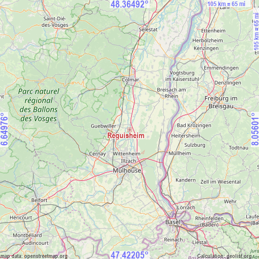
Réguisheim GPS coordinates[2]
47° 53' 44.268" North, 7° 21' 10.368" East
| Map corner | latitude | longitude |
|---|---|---|
| Upper-left | 48.36492°, | 6.64976° |
| Center: | 47.89563°, | 7.35288° |
| Lower-right: | 47.42205°, | 8.05601° |
| Map W x H: | 104.8×104.8 km | = 65.1×65.1mi |
| max Lat: | 51.07786° ⇑42.5% North |
| Réguisheim: | 47.89563° |
| min Lat: | ⇓57.5% South 41.3874° |
| min Long | Réguisheim | max Long |
| -5.08615° | 7.35288° | 9.52242° |
| W 96.9%⇐ | ⇒3.1% E |
Elevation
Elevation of Réguisheim is 212 m = 696 ft, and this is 18.3 m = 60 ft above average elevation for this country.
| Max E: |
2333 m = 7654 ft | 31.4% |
| Réguisheim | 212 m 696 ft | |
| Avg. | 193.7 m = 635 ft | |
Min E: |
-1 m = -3 ft | 68.6% |
See also: France elevation on elevation.city.
Geographical zone
Réguisheim is located in North temperate zone (between Tropic of Cancer and the Arctic Circle). Distance of this North polar circle is 2075.7 km =1289.8 mi to North.| Distance of | km | miles | from Réguisheim |
|---|---|---|---|
| North Pole | 4681.6 | 2909 | to North |
| Arctic Circle | 2075.7 | 1289.8 | to North |
| Tropic Cancer | 2719.6 | 1689.9 | to South |
| Equator | 5325.5 | 3309.1 | to South |


Nearby cities:
15 places around Réguisheim: (largest is in red/bold)
• Bollwiller
8 km =5 mi,  238°
238°
• Ensisheim
3.3 km =2.1 mi,  183°
183°
• Feldkirch
6.8 km =4.2 mi, 239°
• Gundolsheim
5.8 km =3.6 mi,  311°
311°
• Hirtzfelden
7.2 km =4.5 mi,  75°
75°
• Issenheim
7.5 km =4.7 mi,  276°
276°
• Merxheim
4.7 km =2.9 mi,  291°
291°
• Meyenheim
2 km =1.2 mi,  5°
5°
• Munchhouse
8 km =5 mi,  111°
111°
• Oberentzen
5.6 km =3.5 mi,  18°
18°
• Pulversheim
7.5 km =4.7 mi,  210°
210°
• Raedersheim
5.3 km =3.3 mi,  261°
261°
• Rouffach
8 km =5 mi,  330°
330°
• Ruelisheim
8 km =5 mi, 177°
• Ungersheim
3.9 km =2.4 mi, 240°
Sources, notices
• [Note1] Compared only with cities in France existing in our database
• [Src1] Map data: © OpenStreetMap contributors (CC-BY-SA)
• [Src2] Other city data from geonames.org with taken over terms of usage.
• [Src3] Geographical zone / Annual Mean Temperature by Robert A. Rohde @ Wikipedia
