Trévron geodata
Trévron (Brittany) is a populated place; located in France in Europe/Paris (GMT+2) time zone. With population of 692 people, there are 11913 cities with bigger population in this country. Compared to other cities in France, 66.2% of cities are located further ↓South; 95.1% of cities are located further →East and 75% of cities have higher elevation than Trévron. Note1
Administrative division(s):
- Level 1: Brittany
- Level 2: Département des Côtes-d’Armor
- Level 3: Arrondissement de Dinan
- Level 4: Trévron


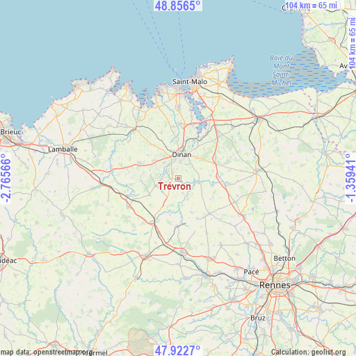
Trévron GPS coordinates[2]
48° 23' 30.264" North, 2° 3' 45.108" West
| Map corner | latitude | longitude |
|---|---|---|
| Upper-left | 48.8565°, | -2.76566° |
| Center: | 48.39174°, | -2.06253° |
| Lower-right: | 47.9227°, | -1.35941° |
| Map W x H: | 103.8×103.8 km | = 64.5×64.5mi |
| max Lat: | 51.07786° ⇑33.8% North |
| Trévron: | 48.39174° |
| min Lat: | ⇓66.2% South 41.3874° |
| min Long | Trévron | max Long |
| -5.08615° | -2.06253° | 9.52242° |
| W 4.9%⇐ | ⇒95.1% E |
Elevation
Elevation of Trévron is 67 m = 220 ft, and this is 126.7 m = 416 ft below average elevation for this country.
| Max E: |
2333 m = 7654 ft | 75% |
| Avg. | 193.7 m = 635 ft | |
| Trévron | 67 m = 220 ft | |
Min E: |
-1 m = -3 ft | 25% |
See also: France elevation on elevation.city.
Geographical zone
Trévron is located in North temperate zone (between Tropic of Cancer and the Arctic Circle). Distance of this North polar circle is 2020.5 km =1255.5 mi to North.| Distance of | km | miles | from Trévron |
|---|---|---|---|
| North Pole | 4626.4 | 2874.7 | to North |
| Arctic Circle | 2020.5 | 1255.5 | to North |
| Tropic Cancer | 2774.7 | 1724.1 | to South |
| Equator | 5380.7 | 3343.4 | to South |


Nearby cities:
15 places around Trévron: (largest is in red/bold)
• Aucaleuc
8.6 km =5.3 mi,  324°
324°
• Bobital
3.8 km =2.4 mi,  313°
313°
• Brusvily
4.8 km =3 mi,  268°
268°
• Dinan
7.1 km =4.4 mi,  7°
7°
• Lanvallay
7.5 km =4.7 mi,  19°
19°
• Le Hinglé
1.2 km =0.7 mi,  276°
276°
• Les Champs-Géraux
7.3 km =4.5 mi,  67°
67°
• Léhon
6 km =3.7 mi, 11°
• Plumaudan
6 km =3.7 mi,  230°
230°
• Quévert
8.2 km =5.1 mi,  347°
347°
• Saint-Carné
2.7 km =1.7 mi, 350°
• Saint-Juvat
4.5 km =2.8 mi,  162°
162°
• Trélivan
6 km =3.7 mi, 317°
• Vildé-Guingalan
8.7 km =5.4 mi, 305°
• Évran
6.2 km =3.9 mi,  102°
102°
Sources, notices
• [Note1] Compared only with cities in France existing in our database
• [Src1] Map data: © OpenStreetMap contributors (CC-BY-SA)
• [Src2] Other city data from geonames.org with taken over terms of usage.
• [Src3] Geographical zone / Annual Mean Temperature by Robert A. Rohde @ Wikipedia
