Saint-Juvat geodata
Saint-Juvat (Brittany) is a populated place; located in France in Europe/Paris (GMT+2) time zone. With population of 628 people, there are 12854 cities with bigger population in this country. Compared to other cities in France, 65.5% of cities are located further ↓South; 95% of cities are located further →East and 83.1% of cities have higher elevation than Saint-Juvat. Note1
Administrative division(s):
- Level 1: Brittany
- Level 2: Département des Côtes-d’Armor
- Level 3: Arrondissement de Dinan
- Level 4: Saint-Juvat


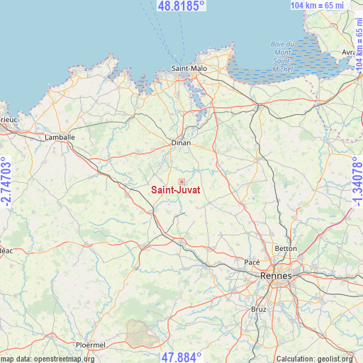
Saint-Juvat GPS coordinates[2]
48° 21' 12.204" North, 2° 2' 38.04" West
| Map corner | latitude | longitude |
|---|---|---|
| Upper-left | 48.8185°, | -2.74703° |
| Center: | 48.35339°, | -2.0439° |
| Lower-right: | 47.884°, | -1.34078° |
| Map W x H: | 103.9×103.9 km | = 64.6×64.6mi |
| max Lat: | 51.07786° ⇑34.5% North |
| Saint-Juvat: | 48.35339° |
| min Lat: | ⇓65.5% South 41.3874° |
| min Long | Saint-Juvat | max Long |
| -5.08615° | -2.0439° | 9.52242° |
| W 5%⇐ | ⇒95% E |
Elevation
Elevation of Saint-Juvat is 47 m = 154 ft, and this is 146.7 m = 481 ft below average elevation for this country.
| Max E: |
2333 m = 7654 ft | 83.1% |
| Avg. | 193.7 m = 635 ft | |
| Saint-Juvat | 47 m = 154 ft | |
Min E: |
-1 m = -3 ft | 16.9% |
See also: France elevation on elevation.city.
Geographical zone
Saint-Juvat is located in North temperate zone (between Tropic of Cancer and the Arctic Circle). Distance of this North polar circle is 2024.8 km =1258.2 mi to North.| Distance of | km | miles | from Saint-Juvat |
|---|---|---|---|
| North Pole | 4630.7 | 2877.4 | to North |
| Arctic Circle | 2024.8 | 1258.2 | to North |
| Tropic Cancer | 2770.5 | 1721.5 | to South |
| Equator | 5376.4 | 3340.7 | to South |


Nearby cities:
15 places around Saint-Juvat: (largest is in red/bold)
• Bobital
8 km =5 mi,  329°
329°
• Brusvily
7.5 km =4.7 mi,  303°
303°
• Bécherel
9.7 km =6 mi,  131°
131°
• Guitté
7.4 km =4.6 mi,  210°
210°
• Le Hinglé
5.1 km =3.2 mi, 329°
• Les Champs-Géraux
8.8 km =5.5 mi,  37°
37°
• Médréac
9.7 km =6 mi,  189°
189°
• Plouasne
6.5 km =4 mi,  154°
154°
• Plumaudan
6 km =3.7 mi,  274°
274°
• Saint-Carné
7.1 km =4.4 mi,  345°
345°
• Saint-Pern
8.5 km =5.3 mi, 149°
• Saint-Thual
8.3 km =5.2 mi,  102°
102°
• Trévron
4.5 km =2.8 mi,  342°
342°
• Trévérien
8.7 km =5.4 mi,  76°
76°
• Évran
5.5 km =3.4 mi,  57°
57°
Sources, notices
• [Note1] Compared only with cities in France existing in our database
• [Src1] Map data: © OpenStreetMap contributors (CC-BY-SA)
• [Src2] Other city data from geonames.org with taken over terms of usage.
• [Src3] Geographical zone / Annual Mean Temperature by Robert A. Rohde @ Wikipedia
