Tracy-le-Val geodata
Tracy-le-Val (Hauts-de-France) is a populated place; located in France in Europe/Paris (GMT+2) time zone. With population of 812 people, there are 10458 cities with bigger population in this country. Compared to other cities in France, 89.1% of cities are located further ↓South; 57.9% of cities are located further ←West and 76.6% of cities have higher elevation than Tracy-le-Val. Note1
Administrative division(s):
- Level 1: Hauts-de-France
- Level 2: Département de l'Oise
- Level 3: Arrondissement de Compiègne
- Level 4: Tracy-le-Val


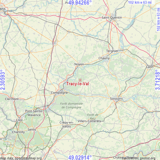
Tracy-le-Val GPS coordinates[2]
49° 29' 16.908" North, 3° 0' 32.58" East
| Map corner | latitude | longitude |
|---|---|---|
| Upper-left | 49.94266°, | 2.30593° |
| Center: | 49.48803°, | 3.00905° |
| Lower-right: | 49.02914°, | 3.71218° |
| Map W x H: | 101.6×101.6 km | = 63.1×63.1mi |
| max Lat: | 51.07786° ⇑10.9% North |
| Tracy-le-Val: | 49.48803° |
| min Lat: | ⇓89.1% South 41.3874° |
| min Long | Tracy-le-Val | max Long |
| -5.08615° | 3.00905° | 9.52242° |
| W 57.9%⇐ | ⇒42.1% E |
Elevation
Elevation of Tracy-le-Val is 63 m = 207 ft, and this is 130.7 m = 429 ft below average elevation for this country.
| Max E: |
2333 m = 7654 ft | 76.6% |
| Avg. | 193.7 m = 635 ft | |
| Tracy-le-Val | 63 m = 207 ft | |
Min E: |
-1 m = -3 ft | 23.4% |
See also: France elevation on elevation.city.
Geographical zone
Tracy-le-Val is located in North temperate zone (between Tropic of Cancer and the Arctic Circle). Distance of this North polar circle is 1898.6 km =1179.7 mi to North.| Distance of | km | miles | from Tracy-le-Val |
|---|---|---|---|
| North Pole | 4504.5 | 2799 | to North |
| Arctic Circle | 1898.6 | 1179.7 | to North |
| Tropic Cancer | 2896.6 | 1799.9 | to South |
| Equator | 5502.6 | 3419.2 | to South |


Nearby cities:
15 places around Tracy-le-Val: (largest is in red/bold)
• Attichy
9 km =5.6 mi,  161°
161°
• Bailly
3 km =1.9 mi,  286°
286°
• Berneuil-sur-Aisne
8.1 km =5 mi,  179°
179°
• Cambronne-lès-Ribécourt
8.3 km =5.2 mi,  284°
284°
• Carlepont
3.1 km =1.9 mi,  19°
19°
• Chiry-Ourscamp
7.6 km =4.7 mi,  324°
324°
• Cuts
8.1 km =5 mi,  53°
53°
• Dreslincourt
7.4 km =4.6 mi,  306°
306°
• Le Plessis-Brion
8.9 km =5.5 mi,  252°
252°
• Montmacq
7.7 km =4.8 mi,  264°
264°
• Pimprez
5.1 km =3.2 mi, 305°
• Saint-Léger-aux-Bois
3.9 km =2.4 mi, 262°
• Sempigny
7.9 km =4.9 mi,  352°
352°
• Tracy-le-Mont
1.8 km =1.1 mi, 179°
• Ville
8.8 km =5.5 mi,  325°
325°
Sources, notices
• [Note1] Compared only with cities in France existing in our database
• [Src1] Map data: © OpenStreetMap contributors (CC-BY-SA)
• [Src2] Other city data from geonames.org with taken over terms of usage.
• [Src3] Geographical zone / Annual Mean Temperature by Robert A. Rohde @ Wikipedia
