Cuts geodata
Cuts (Hauts-de-France) is a populated place; located in France in Europe/Paris (GMT+2) time zone. With population of 902 people, there are 9633 cities with bigger population in this country. Compared to other cities in France, 89.8% of cities are located further ↓South; 59.3% of cities are located further ←West and 70.1% of cities have higher elevation than Cuts. Note1
Administrative division(s):
- Level 1: Hauts-de-France
- Level 2: Département de l'Oise
- Level 3: Arrondissement de Compiègne
- Level 4: Cuts


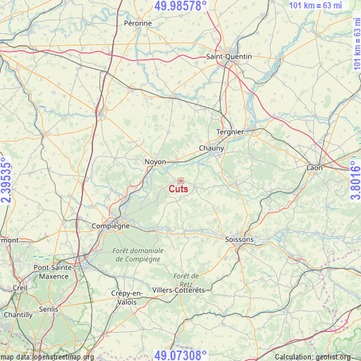
Cuts GPS coordinates[2]
49° 31' 53.616" North, 3° 5' 54.528" East
| Map corner | latitude | longitude |
|---|---|---|
| Upper-left | 49.98578°, | 2.39535° |
| Center: | 49.53156°, | 3.09848° |
| Lower-right: | 49.07308°, | 3.8016° |
| Map W x H: | 101.5×101.5 km | = 63.1×63.1mi |
| max Lat: | 51.07786° ⇑10.2% North |
| Cuts: | 49.53156° |
| min Lat: | ⇓89.8% South 41.3874° |
| min Long | Cuts | max Long |
| -5.08615° | 3.09848° | 9.52242° |
| W 59.3%⇐ | ⇒40.7% E |
Elevation
Elevation of Cuts is 78 m = 256 ft, and this is 115.7 m = 380 ft below average elevation for this country.
| Max E: |
2333 m = 7654 ft | 70.1% |
| Avg. | 193.7 m = 635 ft | |
| Cuts | 78 m = 256 ft | |
Min E: |
-1 m = -3 ft | 29.9% |
See also: France elevation on elevation.city.
Geographical zone
Cuts is located in North temperate zone (between Tropic of Cancer and the Arctic Circle). Distance of this North polar circle is 1893.8 km =1176.8 mi to North.| Distance of | km | miles | from Cuts |
|---|---|---|---|
| North Pole | 4499.7 | 2796 | to North |
| Arctic Circle | 1893.8 | 1176.8 | to North |
| Tropic Cancer | 2901.5 | 1802.9 | to South |
| Equator | 5507.4 | 3422.1 | to South |


Nearby cities:
15 places around Cuts: (largest is in red/bold)
• Appilly
5.9 km =3.7 mi,  12°
12°
• Autrêches
9.9 km =6.2 mi,  168°
168°
• Bailly
10.1 km =6.3 mi,  246°
246°
• Bichancourt
10.1 km =6.3 mi,  58°
58°
• Blérancourt
4.1 km =2.5 mi,  114°
114°
• Carlepont
5.8 km =3.6 mi, 250°
• Chiry-Ourscamp
11 km =6.8 mi,  277°
277°
• Morlincourt
6.2 km =3.9 mi,  313°
313°
• Noyon
9.1 km =5.7 mi, 309°
• Pimprez
10.7 km =6.6 mi,  260°
260°
• Salency
7.3 km =4.5 mi,  329°
329°
• Sempigny
8.1 km =5 mi,  291°
291°
• Tracy-le-Mont
9.2 km =5.7 mi,  224°
224°
• Tracy-le-Val
8.1 km =5 mi,  233°
233°
• Trosly-Loire
9.5 km =5.9 mi,  98°
98°
Sources, notices
• [Note1] Compared only with cities in France existing in our database
• [Src1] Map data: © OpenStreetMap contributors (CC-BY-SA)
• [Src2] Other city data from geonames.org with taken over terms of usage.
• [Src3] Geographical zone / Annual Mean Temperature by Robert A. Rohde @ Wikipedia
