Carlepont geodata
Carlepont (Hauts-de-France) is a populated place; located in France in Europe/Paris (GMT+2) time zone. With population of 1,436 people, there are 6450 cities with bigger population in this country. Compared to other cities in France, 89.5% of cities are located further ↓South; 58.2% of cities are located further ←West and 79.4% of cities have higher elevation than Carlepont. Note1
Administrative division(s):
- Level 1: Hauts-de-France
- Level 2: Département de l'Oise
- Level 3: Arrondissement de Compiègne
- Level 4: Carlepont


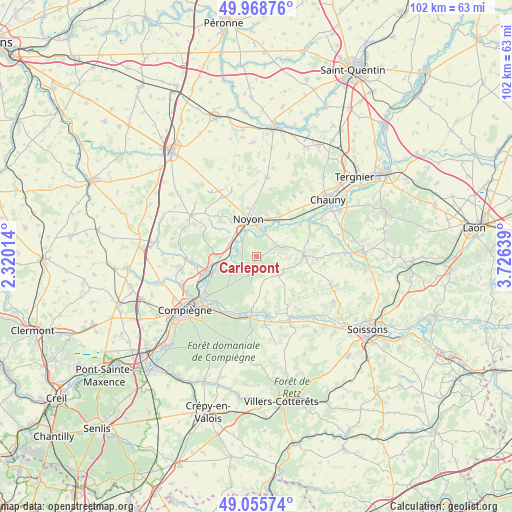
Carlepont GPS coordinates[2]
49° 30' 51.768" North, 3° 1' 23.772" East
| Map corner | latitude | longitude |
|---|---|---|
| Upper-left | 49.96876°, | 2.32014° |
| Center: | 49.51438°, | 3.02327° |
| Lower-right: | 49.05574°, | 3.72639° |
| Map W x H: | 101.5×101.5 km | = 63.1×63.1mi |
| max Lat: | 51.07786° ⇑10.5% North |
| Carlepont: | 49.51438° |
| min Lat: | ⇓89.5% South 41.3874° |
| min Long | Carlepont | max Long |
| -5.08615° | 3.02327° | 9.52242° |
| W 58.2%⇐ | ⇒41.8% E |
Elevation
Elevation of Carlepont is 56 m = 184 ft, and this is 137.7 m = 452 ft below average elevation for this country.
| Max E: |
2333 m = 7654 ft | 79.4% |
| Avg. | 193.7 m = 635 ft | |
| Carlepont | 56 m = 184 ft | |
Min E: |
-1 m = -3 ft | 20.6% |
See also: France elevation on elevation.city.
Geographical zone
Carlepont is located in North temperate zone (between Tropic of Cancer and the Arctic Circle). Distance of this North polar circle is 1895.7 km =1177.9 mi to North.| Distance of | km | miles | from Carlepont |
|---|---|---|---|
| North Pole | 4501.6 | 2797.2 | to North |
| Arctic Circle | 1895.7 | 1177.9 | to North |
| Tropic Cancer | 2899.6 | 1801.7 | to South |
| Equator | 5505.5 | 3421 | to South |


Nearby cities:
15 places around Carlepont: (largest is in red/bold)
• Bailly
4.4 km =2.7 mi,  241°
241°
• Blérancourt
9.2 km =5.7 mi,  88°
88°
• Cambronne-lès-Ribécourt
9.1 km =5.7 mi,  264°
264°
• Chiry-Ourscamp
6.4 km =4 mi,  300°
300°
• Cuts
5.8 km =3.6 mi,  70°
70°
• Dreslincourt
7.1 km =4.4 mi,  282°
282°
• Morlincourt
6.2 km =3.9 mi,  8°
8°
• Noyon
7.8 km =4.8 mi,  347°
347°
• Pimprez
5.2 km =3.2 mi,  270°
270°
• Saint-Léger-aux-Bois
6 km =3.7 mi,  234°
234°
• Salency
8.4 km =5.2 mi, 12°
• Sempigny
5.3 km =3.3 mi,  337°
337°
• Tracy-le-Mont
4.8 km =3 mi,  192°
192°
• Tracy-le-Val
3.1 km =1.9 mi,  199°
199°
• Ville
7.4 km =4.6 mi,  305°
305°
Sources, notices
• [Note1] Compared only with cities in France existing in our database
• [Src1] Map data: © OpenStreetMap contributors (CC-BY-SA)
• [Src2] Other city data from geonames.org with taken over terms of usage.
• [Src3] Geographical zone / Annual Mean Temperature by Robert A. Rohde @ Wikipedia
