Pédernec geodata
Pédernec (Brittany) is a populated place; located in France in Europe/Paris (GMT+2) time zone. With population of 1,725 people, there are 5461 cities with bigger population in this country. Compared to other cities in France, 70.8% of cities are located further ↓South; 97.9% of cities are located further →East and 51.2% of cities have higher elevation than Pédernec. Note1
Administrative division(s):
- Level 1: Brittany
- Level 2: Département des Côtes-d’Armor
- Level 3: Arrondissement de Guingamp
- Level 4: Pédernec


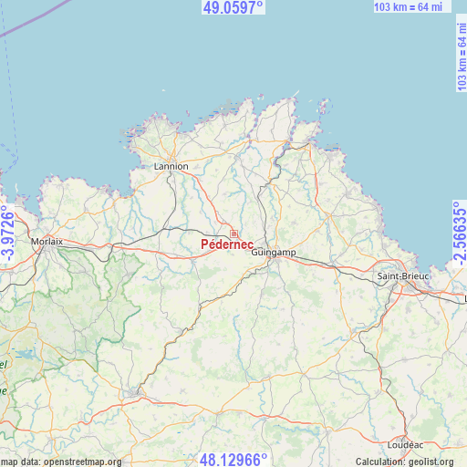
Pédernec GPS coordinates[2]
48° 35' 48.552" North, 3° 16' 10.128" West
| Map corner | latitude | longitude |
|---|---|---|
| Upper-left | 49.0597°, | -3.9726° |
| Center: | 48.59682°, | -3.26948° |
| Lower-right: | 48.12966°, | -2.56635° |
| Map W x H: | 103.4×103.4 km | = 64.2×64.2mi |
| max Lat: | 51.07786° ⇑29.2% North |
| Pédernec: | 48.59682° |
| min Lat: | ⇓70.8% South 41.3874° |
| min Long | Pédernec | max Long |
| -5.08615° | -3.26948° | 9.52242° |
| W 2.1%⇐ | ⇒97.9% E |
Elevation
Elevation of Pédernec is 128 m = 420 ft, and this is 65.7 m = 216 ft below average elevation for this country.
| Max E: |
2333 m = 7654 ft | 51.2% |
| Avg. | 193.7 m = 635 ft | |
| Pédernec | 128 m = 420 ft | |
Min E: |
-1 m = -3 ft | 48.8% |
See also: France elevation on elevation.city.
Geographical zone
Pédernec is located in North temperate zone (between Tropic of Cancer and the Arctic Circle). Distance of this North polar circle is 1997.7 km =1241.3 mi to North.| Distance of | km | miles | from Pédernec |
|---|---|---|---|
| North Pole | 4603.6 | 2860.5 | to North |
| Arctic Circle | 1997.7 | 1241.3 | to North |
| Tropic Cancer | 2797.5 | 1738.3 | to South |
| Equator | 5403.5 | 3357.6 | to South |


Nearby cities:
15 places around Pédernec: (largest is in red/bold)
• Belle-Isle-en-Terre
10.9 km =6.8 mi,  237°
237°
• Bégard
4.1 km =2.5 mi,  326°
326°
• Cavan
10.1 km =6.3 mi, 326°
• Coadout
10.7 km =6.6 mi,  145°
145°
• Grâces
7.6 km =4.7 mi,  125°
125°
• Guingamp
9.5 km =5.9 mi,  113°
113°
• Louargat
6.1 km =3.8 mi, 235°
• Moustéru
9.1 km =5.7 mi,  166°
166°
• Pabu
9.9 km =6.2 mi,  96°
96°
• Plouisy
6.6 km =4.1 mi, 108°
• Plouëc-du-Trieux
10.9 km =6.8 mi,  27°
27°
• Pluzunet
8.9 km =5.5 mi,  303°
303°
• Prat
9.1 km =5.7 mi,  347°
347°
• Squiffiec
9.2 km =5.7 mi,  67°
67°
• Tréglamus
4.4 km =2.7 mi,  184°
184°
Sources, notices
• [Note1] Compared only with cities in France existing in our database
• [Src1] Map data: © OpenStreetMap contributors (CC-BY-SA)
• [Src2] Other city data from geonames.org with taken over terms of usage.
• [Src3] Geographical zone / Annual Mean Temperature by Robert A. Rohde @ Wikipedia
