Bazoges-en-Pareds geodata
Bazoges-en-Pareds (Pays de la Loire) is a populated place; located in France in Europe/Paris (GMT+2) time zone. With population of 1,127 people, there are 7965 cities with bigger population in this country. Compared to other cities in France, 58.7% of cities are located further ↑North; 87.4% of cities are located further →East and 71.4% of cities have higher elevation than Bazoges-en-Pareds. Note1
Administrative division(s):
- Level 1: Pays de la Loire
- Level 2: Département de la Vendée
- Level 3: Arrondissement de Fontenay-le-Comte
- Level 4: Bazoges-en-Pareds


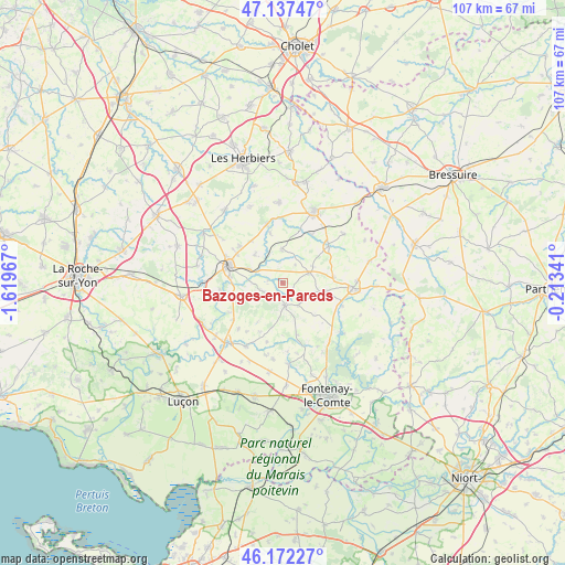
Bazoges-en-Pareds GPS coordinates[2]
46° 39' 25.272" North, 0° 54' 59.544" West
| Map corner | latitude | longitude |
|---|---|---|
| Upper-left | 47.13747°, | -1.61967° |
| Center: | 46.65702°, | -0.91654° |
| Lower-right: | 46.17227°, | -0.21341° |
| Map W x H: | 107.3×107.3 km | = 66.7×66.7mi |
| max Lat: | 51.07786° ⇑58.7% North |
| Bazoges-en-Pareds: | 46.65702° |
| min Lat: | ⇓41.3% South 41.3874° |
| min Long | Bazoges-en-Pare | max Long |
| -5.08615° | -0.91654° | 9.52242° |
| W 12.6%⇐ | ⇒87.4% E |
Elevation
Elevation of Bazoges-en-Pareds is 75 m = 246 ft, and this is 118.7 m = 389 ft below average elevation for this country.
| Max E: |
2333 m = 7654 ft | 71.4% |
| Avg. | 193.7 m = 635 ft | |
| Bazoges-en-Pareds | 75 m = 246 ft | |
Min E: |
-1 m = -3 ft | 28.6% |
See also: France elevation on elevation.city.
Geographical zone
Bazoges-en-Pareds is located in North temperate zone (between Tropic of Cancer and the Arctic Circle). Distance of this North polar circle is 2213.4 km =1375.3 mi to North.| Distance of | km | miles | from Bazoges-en-Pareds |
|---|---|---|---|
| North Pole | 4819.3 | 2994.6 | to North |
| Arctic Circle | 2213.4 | 1375.3 | to North |
| Tropic Cancer | 2581.9 | 1604.3 | to South |
| Equator | 5187.8 | 3223.5 | to South |


Nearby cities:
15 places around Bazoges-en-Pareds: (largest is in red/bold)
• Chantonnay
10.7 km =6.6 mi,  288°
288°
• Chavagnes-les-Redoux
6.4 km =4 mi,  358°
358°
• Cheffois
9.7 km =6 mi,  82°
82°
• La Jaudonnière
3.8 km =2.4 mi,  246°
246°
• La Meilleraie-Tillay
10.8 km =6.7 mi,  30°
30°
• La Réorthe
11.5 km =7.1 mi,  241°
241°
• Monsireigne
10 km =6.2 mi,  345°
345°
• Mouilleron-en-Pareds
5.6 km =3.5 mi,  67°
67°
• Réaumur
11.1 km =6.9 mi,  51°
51°
• Saint-Cyr-des-Gâts
10.1 km =6.3 mi,  165°
165°
• Saint-Germain-de-Prinçay
10.7 km =6.6 mi,  311°
311°
• Saint-Maurice-le-Girard
8.6 km =5.3 mi,  100°
100°
• Saint-Prouant
11.7 km =7.3 mi,  344°
344°
• Sigournais
7.7 km =4.8 mi,  316°
316°
• Thouarsais-Bouildroux
5 km =3.1 mi,  146°
146°
Sources, notices
• [Note1] Compared only with cities in France existing in our database
• [Src1] Map data: © OpenStreetMap contributors (CC-BY-SA)
• [Src2] Other city data from geonames.org with taken over terms of usage.
• [Src3] Geographical zone / Annual Mean Temperature by Robert A. Rohde @ Wikipedia
