Mouilleron-en-Pareds geodata
Mouilleron-en-Pareds (Pays de la Loire) is a populated place; located in France in Europe/Paris (GMT+2) time zone. With population of 1,324 people, there are 6924 cities with bigger population in this country. Compared to other cities in France, 58.4% of cities are located further ↑North; 86.9% of cities are located further →East and 57.6% of cities have higher elevation than Mouilleron-en-Pareds. Note1
Administrative division(s):
- Level 1: Pays de la Loire
- Level 2: Département de la Vendée
- Level 3: Arrondissement de Fontenay-le-Comte
- Level 4: Mouilleron-Saint-Germain


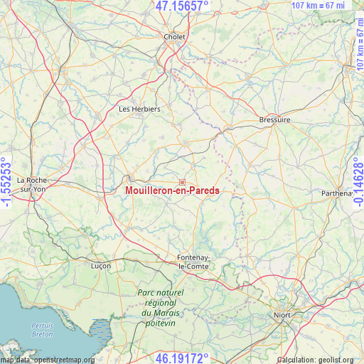
Mouilleron-en-Pareds GPS coordinates[2]
46° 40' 34.68" North, 0° 50' 57.84" West
| Map corner | latitude | longitude |
|---|---|---|
| Upper-left | 47.15657°, | -1.55253° |
| Center: | 46.6763°, | -0.8494° |
| Lower-right: | 46.19172°, | -0.14628° |
| Map W x H: | 107.3×107.3 km | = 66.7×66.7mi |
| max Lat: | 51.07786° ⇑58.4% North |
| Mouilleron-en-Pareds: | 46.6763° |
| min Lat: | ⇓41.6% South 41.3874° |
| min Long | Mouilleron-en-P | max Long |
| -5.08615° | -0.8494° | 9.52242° |
| W 13.1%⇐ | ⇒86.9% E |
Elevation
Elevation of Mouilleron-en-Pareds is 109 m = 358 ft, and this is 84.7 m = 278 ft below average elevation for this country.
| Max E: |
2333 m = 7654 ft | 57.6% |
| Avg. | 193.7 m = 635 ft | |
| Mouilleron-en-Pareds | 109 m = 358 ft | |
Min E: |
-1 m = -3 ft | 42.4% |
See also: France elevation on elevation.city.
Geographical zone
Mouilleron-en-Pareds is located in North temperate zone (between Tropic of Cancer and the Arctic Circle). Distance of this North polar circle is 2211.3 km =1374 mi to North.| Distance of | km | miles | from Mouilleron-en-Pareds |
|---|---|---|---|
| North Pole | 4817.1 | 2993.2 | to North |
| Arctic Circle | 2211.3 | 1374 | to North |
| Tropic Cancer | 2584 | 1605.6 | to South |
| Equator | 5189.9 | 3224.9 | to South |


Nearby cities:
15 places around Mouilleron-en-Pareds: (largest is in red/bold)
• Antigny
8.6 km =5.3 mi,  135°
135°
• Bazoges-en-Pareds
5.6 km =3.5 mi,  247°
247°
• Chavagnes-les-Redoux
6.8 km =4.2 mi,  309°
309°
• Cheffois
4.6 km =2.9 mi,  101°
101°
• La Châtaigneraie
9 km =5.6 mi,  110°
110°
• La Jaudonnière
9.4 km =5.8 mi, 246°
• La Meilleraie-Tillay
7.2 km =4.5 mi,  2°
2°
• La Tardière
9.2 km =5.7 mi, 100°
• Monsireigne
10.7 km =6.6 mi, 314°
• Montournais
9.7 km =6 mi,  41°
41°
• Pouzauges
11.5 km =7.1 mi,  5°
5°
• Réaumur
5.9 km =3.7 mi, 35°
• Saint-Maurice-le-Girard
5 km =3.1 mi, 137°
• Sigournais
11 km =6.8 mi,  288°
288°
• Thouarsais-Bouildroux
6.7 km =4.2 mi,  200°
200°
Sources, notices
• [Note1] Compared only with cities in France existing in our database
• [Src1] Map data: © OpenStreetMap contributors (CC-BY-SA)
• [Src2] Other city data from geonames.org with taken over terms of usage.
• [Src3] Geographical zone / Annual Mean Temperature by Robert A. Rohde @ Wikipedia
