Thorigné geodata
Thorigné (Nouvelle-Aquitaine) is a populated place; located in France in Europe/Paris (GMT+2) time zone. With population of 1,030 people, there are 8614 cities with bigger population in this country. Compared to other cities in France, 62.4% of cities are located further ↑North; 80.3% of cities are located further →East and 57.6% of cities have higher elevation than Thorigné. Note1
Administrative division(s):
- Level 1: Nouvelle-Aquitaine
- Level 2: Département des Deux-Sèvres
- Level 3: Arrondissement de Niort
- Level 4: Aigondigné


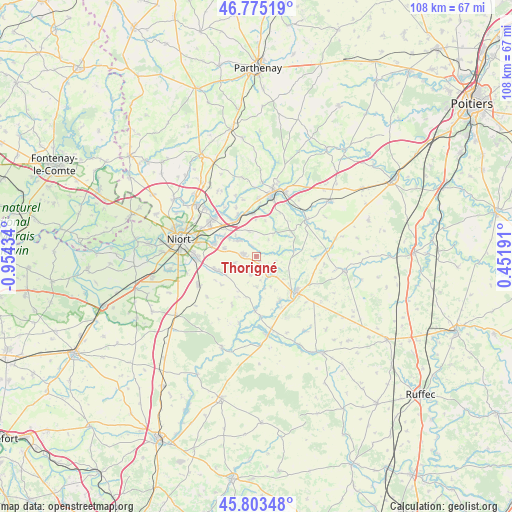
Thorigné GPS coordinates[2]
46° 17' 29.364" North, 0° 15' 4.392" West
| Map corner | latitude | longitude |
|---|---|---|
| Upper-left | 46.77519°, | -0.95434° |
| Center: | 46.29149°, | -0.25122° |
| Lower-right: | 45.80348°, | 0.45191° |
| Map W x H: | 108×108 km | = 67.1×67.1mi |
| max Lat: | 51.07786° ⇑62.4% North |
| Thorigné: | 46.29149° |
| min Lat: | ⇓37.6% South 41.3874° |
| min Long | Thorigné | max Long |
| -5.08615° | -0.25122° | 9.52242° |
| W 19.7%⇐ | ⇒80.3% E |
Elevation
Elevation of Thorigné is 109 m = 358 ft, and this is 84.7 m = 278 ft below average elevation for this country.
| Max E: |
2333 m = 7654 ft | 57.6% |
| Avg. | 193.7 m = 635 ft | |
| Thorigné | 109 m = 358 ft | |
Min E: |
-1 m = -3 ft | 42.4% |
See also: France elevation on elevation.city.
Geographical zone
Thorigné is located in North temperate zone (between Tropic of Cancer and the Arctic Circle). Distance of this North polar circle is 2254 km =1400.6 mi to North.| Distance of | km | miles | from Thorigné |
|---|---|---|---|
| North Pole | 4859.9 | 3019.8 | to North |
| Arctic Circle | 2254 | 1400.6 | to North |
| Tropic Cancer | 2541.2 | 1579 | to South |
| Equator | 5147.1 | 3198.3 | to South |


Nearby cities:
15 places around Thorigné: (largest is in red/bold)
• Brûlain
11.3 km =7 mi,  208°
208°
• Celles-sur-Belle
4.5 km =2.8 mi,  137°
137°
• La Crèche
9.2 km =5.7 mi,  335°
335°
• Melle
11.2 km =7 mi,  132°
132°
• Mougon
2.8 km =1.7 mi,  278°
278°
• Prahecq
8.1 km =5 mi,  243°
243°
• Prailles
4.2 km =2.6 mi,  35°
35°
• Romans
7.7 km =4.8 mi,  13°
13°
• Saint-Martin-de-Bernegoue
9.6 km =6 mi,  231°
231°
• Saint-Martin-lès-Melle
10.2 km =6.3 mi, 139°
• Saint-Romans-lès-Melle
10.5 km =6.5 mi,  153°
153°
• Sainte-Blandine
5.8 km =3.6 mi,  197°
197°
• Sainte-Néomaye
9.1 km =5.7 mi,  356°
356°
• Vitré
4.2 km =2.6 mi,  103°
103°
• Vouillé
9.3 km =5.8 mi,  286°
286°
Sources, notices
• [Note1] Compared only with cities in France existing in our database
• [Src1] Map data: © OpenStreetMap contributors (CC-BY-SA)
• [Src2] Other city data from geonames.org with taken over terms of usage.
• [Src3] Geographical zone / Annual Mean Temperature by Robert A. Rohde @ Wikipedia
