Sainte-Néomaye geodata
Sainte-Néomaye (Nouvelle-Aquitaine) is a populated place; located in France in Europe/Paris (GMT+2) time zone. With population of 868 people, there are 9914 cities with bigger population in this country. Compared to other cities in France, 61.4% of cities are located further ↑North; 80.4% of cities are located further →East and 65.3% of cities have higher elevation than Sainte-Néomaye. Note1
Administrative division(s):
- Level 1: Nouvelle-Aquitaine
- Level 2: Département des Deux-Sèvres
- Level 3: Arrondissement de Niort
- Level 4: Sainte-Néomaye


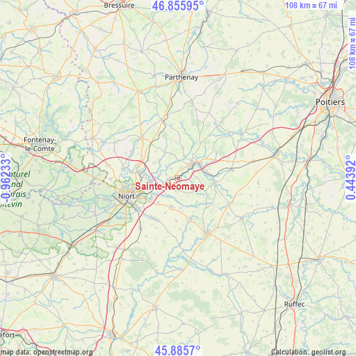
Sainte-Néomaye GPS coordinates[2]
46° 22' 22.728" North, 0° 15' 33.156" West
| Map corner | latitude | longitude |
|---|---|---|
| Upper-left | 46.85595°, | -0.96233° |
| Center: | 46.37298°, | -0.25921° |
| Lower-right: | 45.8857°, | 0.44392° |
| Map W x H: | 107.9×107.9 km | = 67×67mi |
| max Lat: | 51.07786° ⇑61.4% North |
| Sainte-Néomaye: | 46.37298° |
| min Lat: | ⇓38.6% South 41.3874° |
| min Long | Sainte-Néomaye | max Long |
| -5.08615° | -0.25921° | 9.52242° |
| W 19.6%⇐ | ⇒80.4% E |
Elevation
Elevation of Sainte-Néomaye is 89 m = 292 ft, and this is 104.7 m = 344 ft below average elevation for this country.
| Max E: |
2333 m = 7654 ft | 65.3% |
| Avg. | 193.7 m = 635 ft | |
| Sainte-Néomaye | 89 m = 292 ft | |
Min E: |
-1 m = -3 ft | 34.7% |
See also: France elevation on elevation.city.
Geographical zone
Sainte-Néomaye is located in North temperate zone (between Tropic of Cancer and the Arctic Circle). Distance of this North polar circle is 2245 km =1395 mi to North.| Distance of | km | miles | from Sainte-Néomaye |
|---|---|---|---|
| North Pole | 4850.9 | 3014.2 | to North |
| Arctic Circle | 2245 | 1395 | to North |
| Tropic Cancer | 2550.3 | 1584.7 | to South |
| Equator | 5156.2 | 3203.9 | to South |


Nearby cities:
15 places around Sainte-Néomaye: (largest is in red/bold)
• Augé
7.7 km =4.8 mi,  343°
343°
• Azay-le-Brûlé
3.3 km =2.1 mi,  16°
16°
• Chauray
9.2 km =5.7 mi,  261°
261°
• Cherveux
8.9 km =5.5 mi,  302°
302°
• Exireuil
8.4 km =5.2 mi,  37°
37°
• François
6.7 km =4.2 mi,  268°
268°
• La Crèche
3.2 km =2 mi, 257°
• Mougon
8.9 km =5.5 mi,  193°
193°
• Nanteuil
7.8 km =4.8 mi,  56°
56°
• Prailles
6.4 km =4 mi,  151°
151°
• Romans
2.9 km =1.8 mi,  123°
123°
• Saint-Martin-de-Saint-Maixent
5.6 km =3.5 mi, 63°
• Sainte-Eanne
8.5 km =5.3 mi,  82°
82°
• Saivres
6.9 km =4.3 mi,  14°
14°
• Thorigné
9.1 km =5.7 mi,  176°
176°
Sources, notices
• [Note1] Compared only with cities in France existing in our database
• [Src1] Map data: © OpenStreetMap contributors (CC-BY-SA)
• [Src2] Other city data from geonames.org with taken over terms of usage.
• [Src3] Geographical zone / Annual Mean Temperature by Robert A. Rohde @ Wikipedia
