Thizy-les-Bourgs geodata
Thizy-les-Bourgs (Auvergne-Rhône-Alpes) is a populated place; located in France in Europe/Paris (GMT+2) time zone. With population of 2,718 people, there are 3600 cities with bigger population in this country. Compared to other cities in France, 65.9% of cities are located further ↑North; 70.7% of cities are located further ←West and 93% of cities have lower elevation than Thizy-les-Bourgs. Note1
Administrative division(s):
- Level 1: Auvergne-Rhône-Alpes
- Level 2: Département du Rhône
- Level 3: Arrondissement de Villefranche-sur-Saône
- Level 4: Thizy-les-Bourgs


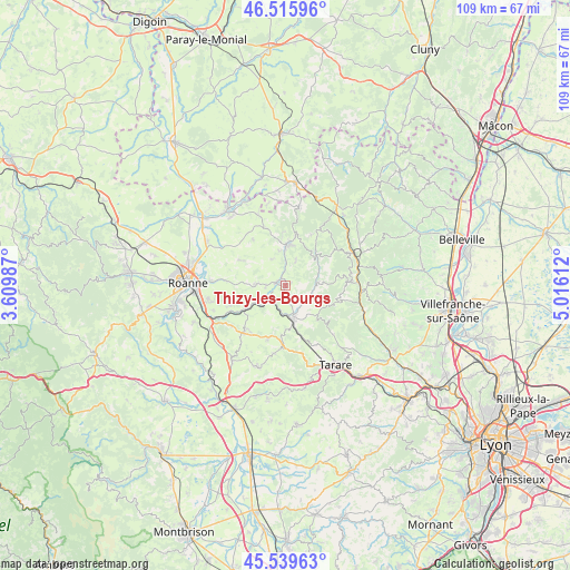
Thizy-les-Bourgs GPS coordinates[2]
46° 1' 47.82" North, 4° 18' 46.764" East
| Map corner | latitude | longitude |
|---|---|---|
| Upper-left | 46.51596°, | 3.60987° |
| Center: | 46.02995°, | 4.31299° |
| Lower-right: | 45.53963°, | 5.01612° |
| Map W x H: | 108.6×108.6 km | = 67.5×67.5mi |
| max Lat: | 51.07786° ⇑65.9% North |
| Thizy-les-Bourgs: | 46.02995° |
| min Lat: | ⇓34.1% South 41.3874° |
| min Long | Thizy-les-Bourg | max Long |
| -5.08615° | 4.31299° | 9.52242° |
| W 70.7%⇐ | ⇒29.3% E |
Elevation
Elevation of Thizy-les-Bourgs is 503 m = 1650 ft, and this is 309.3 m = 1015 ft above average elevation for this country.
| Max E: |
2333 m = 7654 ft | 7% |
| Thizy-les-Bourgs | 503 m 1650 ft | |
| Avg. | 193.7 m = 635 ft | |
Min E: |
-1 m = -3 ft | 93% |
See also: France elevation on elevation.city.
Geographical zone
Thizy-les-Bourgs is located in North temperate zone (between Tropic of Cancer and the Arctic Circle). Distance of this North polar circle is 2283.1 km =1418.7 mi to North.| Distance of | km | miles | from Thizy-les-Bourgs |
|---|---|---|---|
| North Pole | 4889 | 3037.9 | to North |
| Arctic Circle | 2283.1 | 1418.7 | to North |
| Tropic Cancer | 2512.1 | 1560.9 | to South |
| Equator | 5118.1 | 3180.2 | to South |


Nearby cities:
15 places around Thizy-les-Bourgs: (largest is in red/bold)
• Amplepuis
6.5 km =4 mi,  168°
168°
• Bourg-de-Thizy
1.2 km =0.7 mi,  291°
291°
• Cours-la-Ville
7.8 km =4.8 mi,  2°
2°
• Coutouvre
9.6 km =6 mi,  299°
299°
• Cublize
5.1 km =3.2 mi,  104°
104°
• La Gresle
5.7 km =3.5 mi,  337°
337°
• Le Cergne
10.2 km =6.3 mi,  358°
358°
• Mardore
4.9 km =3 mi,  22°
22°
• Marnand
1.4 km =0.9 mi,  64°
64°
• Pont-Trambouze
4.6 km =2.9 mi, 1°
• Ronno
7.3 km =4.5 mi,  133°
133°
• Régny
8.6 km =5.3 mi,  239°
239°
• Saint-Jean-la-Bussière
3.4 km =2.1 mi, 166°
• Saint-Victor-sur-Rhins
3.7 km =2.3 mi,  219°
219°
• Sevelinges
7.7 km =4.8 mi,  350°
350°
Sources, notices
• [Note1] Compared only with cities in France existing in our database
• [Src1] Map data: © OpenStreetMap contributors (CC-BY-SA)
• [Src2] Other city data from geonames.org with taken over terms of usage.
• [Src3] Geographical zone / Annual Mean Temperature by Robert A. Rohde @ Wikipedia
