Tarnos geodata
Tarnos (Nouvelle-Aquitaine) is a populated place; located in France in Europe/Paris (GMT+2) time zone. With population of 11,554 people, there are 834 cities with bigger population in this country. Compared to other cities in France, 92.5% of cities are located further ↑North; 92% of cities are located further →East and 83.1% of cities have higher elevation than Tarnos. Note1
Administrative division(s):
- Level 1: Nouvelle-Aquitaine
- Level 2: Landes
- Level 3: Arrondissement de Dax
- Level 4: Tarnos


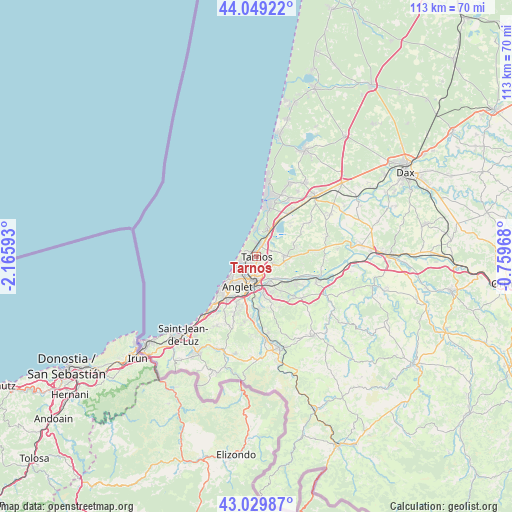
Tarnos GPS coordinates[2]
43° 32' 30.12" North, 1° 27' 46.116" West
| Map corner | latitude | longitude |
|---|---|---|
| Upper-left | 44.04922°, | -2.16593° |
| Center: | 43.5417°, | -1.46281° |
| Lower-right: | 43.02987°, | -0.75968° |
| Map W x H: | 113.3×113.3 km | = 70.4×70.4mi |
| max Lat: | 51.07786° ⇑92.5% North |
| Tarnos: | 43.5417° |
| min Lat: | ⇓7.5% South 41.3874° |
| min Long | Tarnos | max Long |
| -5.08615° | -1.46281° | 9.52242° |
| W 8%⇐ | ⇒92% E |
Elevation
Elevation of Tarnos is 47 m = 154 ft, and this is 146.7 m = 481 ft below average elevation for this country.
| Max E: |
2333 m = 7654 ft | 83.1% |
| Avg. | 193.7 m = 635 ft | |
| Tarnos | 47 m = 154 ft | |
Min E: |
-1 m = -3 ft | 16.9% |
See also: France elevation on elevation.city.
Geographical zone
Tarnos is located in North temperate zone (between Tropic of Cancer and the Arctic Circle). Distance of this Northern Tropic circle is 2235.5 km =1389.1 mi to South.| Distance of | km | miles | from Tarnos |
|---|---|---|---|
| North Pole | 5165.7 | 3209.8 | to North |
| Arctic Circle | 2559.8 | 1590.6 | to North |
| Tropic Cancer | 2235.5 | 1389.1 | to South |
| Equator | 4841.4 | 3008.3 | to South |


Nearby cities:
15 places around Tarnos: (largest is in red/bold)
• Anglet
8.3 km =5.2 mi,  209°
209°
• Bassussarry
11.8 km =7.3 mi,  201°
201°
• Bayonne
5.6 km =3.5 mi,  191°
191°
• Biarritz
10.1 km =6.3 mi,  227°
227°
• Biaudos
12.6 km =7.8 mi,  85°
85°
• Boucau
1.6 km =1 mi, 188°
• Capbreton
11.5 km =7.1 mi,  14°
14°
• Labenne
6.6 km =4.1 mi,  26°
26°
• Lahonce
8.8 km =5.5 mi,  138°
138°
• Mouguerre
9 km =5.6 mi,  156°
156°
• Ondres
2.9 km =1.8 mi, 30°
• Saint-André-de-Seignanx
9.1 km =5.7 mi,  78°
78°
• Saint-Martin-de-Seignanx
5.9 km =3.7 mi, 88°
• Urcuit
11.9 km =7.4 mi,  121°
121°
• Villefranque
11.7 km =7.3 mi,  176°
176°
Sources, notices
• [Note1] Compared only with cities in France existing in our database
• [Src1] Map data: © OpenStreetMap contributors (CC-BY-SA)
• [Src2] Other city data from geonames.org with taken over terms of usage.
• [Src3] Geographical zone / Annual Mean Temperature by Robert A. Rohde @ Wikipedia
