Suilly-la-Tour geodata
Suilly-la-Tour (Bourgogne-Franche-Comté) is a populated place; located in France in Europe/Paris (GMT+2) time zone. With population of 596 people, there are 13387 cities with bigger population in this country. Compared to other cities in France, 50.9% of cities are located further ↑North; 58.7% of cities are located further ←West and 60.7% of cities have lower elevation than Suilly-la-Tour. Note1
Administrative division(s):
- Level 1: Bourgogne-Franche-Comté
- Level 2: Département de la Nièvre
- Level 3: Arrondissement de Cosne-Cours-sur-Loire
- Level 4: Suilly-la-Tour


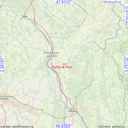
Suilly-la-Tour GPS coordinates[2]
47° 20' 13.74" North, 3° 3' 51.084" East
| Map corner | latitude | longitude |
|---|---|---|
| Upper-left | 47.8115°, | 2.36107° |
| Center: | 47.33715°, | 3.06419° |
| Lower-right: | 46.8585°, | 3.76732° |
| Map W x H: | 106×106 km | = 65.9×65.9mi |
| max Lat: | 51.07786° ⇑50.9% North |
| Suilly-la-Tour: | 47.33715° |
| min Lat: | ⇓49.1% South 41.3874° |
| min Long | Suilly-la-Tour | max Long |
| -5.08615° | 3.06419° | 9.52242° |
| W 58.7%⇐ | ⇒41.3% E |
Elevation
Elevation of Suilly-la-Tour is 173 m = 568 ft, and this is 20.7 m = 68 ft below average elevation for this country.
| Max E: |
2333 m = 7654 ft | 39.3% |
| Avg. | 193.7 m = 635 ft | |
| Suilly-la-Tour | 173 m = 568 ft | |
Min E: |
-1 m = -3 ft | 60.7% |
See also: France elevation on elevation.city.
Geographical zone
Suilly-la-Tour is located in North temperate zone (between Tropic of Cancer and the Arctic Circle). Distance of this North polar circle is 2137.8 km =1328.4 mi to North.| Distance of | km | miles | from Suilly-la-Tour |
|---|---|---|---|
| North Pole | 4743.7 | 2947.6 | to North |
| Arctic Circle | 2137.8 | 1328.4 | to North |
| Tropic Cancer | 2657.5 | 1651.3 | to South |
| Equator | 5263.4 | 3270.5 | to South |


Nearby cities:
15 places around Suilly-la-Tour: (largest is in red/bold)
• Alligny-Cosne
13 km =8.1 mi,  358°
358°
• Bannay
14.7 km =9.1 mi,  292°
292°
• Châteauneuf-Val-de-Bargis
13.7 km =8.5 mi,  116°
116°
• Cosne-Cours-sur-Loire
13.3 km =8.3 mi,  308°
308°
• Donzy
5.9 km =3.7 mi,  51°
51°
• Herry
15.8 km =9.8 mi,  211°
211°
• Mesves-sur-Loire
11.8 km =7.3 mi, 207°
• Myennes
15.6 km =9.7 mi,  320°
320°
• Narcy
11.1 km =6.9 mi,  178°
178°
• Pouilly-sur-Loire
10.2 km =6.3 mi,  234°
234°
• Raveau
16.8 km =10.4 mi, 176°
• Saint-Andelain
8.4 km =5.2 mi,  248°
248°
• Saint-Satur
17.1 km =10.6 mi,  270°
270°
• Tracy-sur-Loire
13.4 km =8.3 mi,  261°
261°
• Varennes-lès-Narcy
11.7 km =7.3 mi, 180°
Sources, notices
• [Note1] Compared only with cities in France existing in our database
• [Src1] Map data: © OpenStreetMap contributors (CC-BY-SA)
• [Src2] Other city data from geonames.org with taken over terms of usage.
• [Src3] Geographical zone / Annual Mean Temperature by Robert A. Rohde @ Wikipedia
