Donzy geodata
Donzy (Bourgogne-Franche-Comté) is a populated place; located in France in Europe/Paris (GMT+2) time zone. With population of 1,687 people, there are 5554 cities with bigger population in this country. Compared to other cities in France, 50.5% of cities are located further ↑North; 59.6% of cities are located further ←West and 62.1% of cities have lower elevation than Donzy. Note1
Administrative division(s):
- Level 1: Bourgogne-Franche-Comté
- Level 2: Département de la Nièvre
- Level 3: Arrondissement de Cosne-Cours-sur-Loire
- Level 4: Donzy


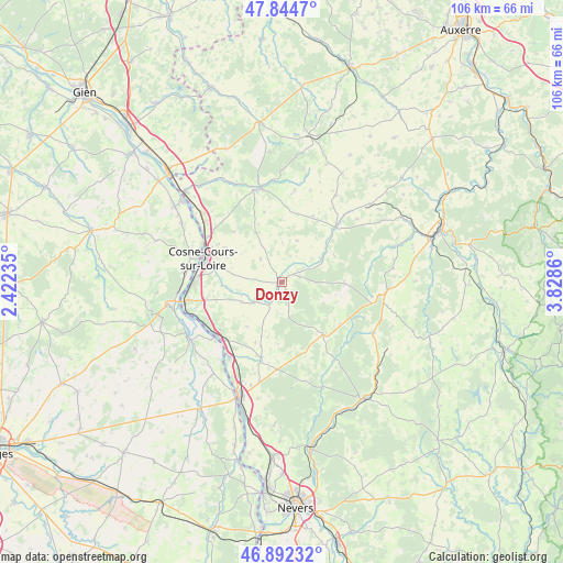
Donzy GPS coordinates[2]
47° 22' 14.376" North, 3° 7' 31.728" East
| Map corner | latitude | longitude |
|---|---|---|
| Upper-left | 47.8447°, | 2.42235° |
| Center: | 47.37066°, | 3.12548° |
| Lower-right: | 46.89232°, | 3.8286° |
| Map W x H: | 105.9×105.9 km | = 65.8×65.8mi |
| max Lat: | 51.07786° ⇑50.5% North |
| Donzy: | 47.37066° |
| min Lat: | ⇓49.5% South 41.3874° |
| min Long | Donzy | max Long |
| -5.08615° | 3.12548° | 9.52242° |
| W 59.6%⇐ | ⇒40.4% E |
Elevation
Elevation of Donzy is 180 m = 591 ft, and this is 13.7 m = 45 ft below average elevation for this country.
| Max E: |
2333 m = 7654 ft | 37.9% |
| Avg. | 193.7 m = 635 ft | |
| Donzy | 180 m = 591 ft | |
Min E: |
-1 m = -3 ft | 62.1% |
See also: France elevation on elevation.city.
Geographical zone
Donzy is located in North temperate zone (between Tropic of Cancer and the Arctic Circle). Distance of this North polar circle is 2134.1 km =1326.1 mi to North.| Distance of | km | miles | from Donzy |
|---|---|---|---|
| North Pole | 4739.9 | 2945.2 | to North |
| Arctic Circle | 2134.1 | 1326.1 | to North |
| Tropic Cancer | 2661.2 | 1653.6 | to South |
| Equator | 5267.1 | 3272.8 | to South |


Nearby cities:
15 places around Donzy: (largest is in red/bold)
• Alligny-Cosne
10.5 km =6.5 mi,  331°
331°
• Bannay
18.3 km =11.4 mi,  276°
276°
• Châteauneuf-Val-de-Bargis
12.4 km =7.7 mi,  142°
142°
• Cosne-Cours-sur-Loire
15.7 km =9.8 mi,  286°
286°
• Entrains-sur-Nohain
14.4 km =8.9 mi,  43°
43°
• La Celle-sur-Loire
18.6 km =11.6 mi,  307°
307°
• Mesves-sur-Loire
17.4 km =10.8 mi,  215°
215°
• Myennes
16.7 km =10.4 mi,  300°
300°
• Narcy
15.4 km =9.6 mi,  195°
195°
• Pouilly-sur-Loire
16.1 km =10 mi,  233°
233°
• Saint-Amand-en-Puisaye
18 km =11.2 mi,  347°
347°
• Saint-Andelain
14.2 km =8.8 mi,  241°
241°
• Suilly-la-Tour
5.9 km =3.7 mi, 231°
• Tracy-sur-Loire
18.8 km =11.7 mi,  252°
252°
• Varennes-lès-Narcy
16.1 km =10 mi, 196°
Sources, notices
• [Note1] Compared only with cities in France existing in our database
• [Src1] Map data: © OpenStreetMap contributors (CC-BY-SA)
• [Src2] Other city data from geonames.org with taken over terms of usage.
• [Src3] Geographical zone / Annual Mean Temperature by Robert A. Rohde @ Wikipedia
