Saint-Satur geodata
Saint-Satur (Centre) is a populated place; located in France in Europe/Paris (GMT+2) time zone. With population of 1,789 people, there are 5306 cities with bigger population in this country. Compared to other cities in France, 50.9% of cities are located further ↑North; 55.5% of cities are located further ←West and 58.9% of cities have lower elevation than Saint-Satur. Note1
Administrative division(s):
- Level 1: Centre
- Level 2: Cher
- Level 3: Arrondissement de Bourges
- Level 4: Saint-Satur


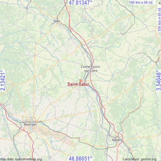
Saint-Satur GPS coordinates[2]
47° 20' 20.904" North, 2° 50' 14.424" East
| Map corner | latitude | longitude |
|---|---|---|
| Upper-left | 47.81347°, | 2.13421° |
| Center: | 47.33914°, | 2.83734° |
| Lower-right: | 46.86051°, | 3.54046° |
| Map W x H: | 106×106 km | = 65.9×65.9mi |
| max Lat: | 51.07786° ⇑50.9% North |
| Saint-Satur: | 47.33914° |
| min Lat: | ⇓49.1% South 41.3874° |
| min Long | Saint-Satur | max Long |
| -5.08615° | 2.83734° | 9.52242° |
| W 55.5%⇐ | ⇒44.5% E |
Elevation
Elevation of Saint-Satur is 165 m = 541 ft, and this is 28.7 m = 94 ft below average elevation for this country.
| Max E: |
2333 m = 7654 ft | 41.1% |
| Avg. | 193.7 m = 635 ft | |
| Saint-Satur | 165 m = 541 ft | |
Min E: |
-1 m = -3 ft | 58.9% |
See also: France elevation on elevation.city.
Geographical zone
Saint-Satur is located in North temperate zone (between Tropic of Cancer and the Arctic Circle). Distance of this North polar circle is 2137.6 km =1328.2 mi to North.| Distance of | km | miles | from Saint-Satur |
|---|---|---|---|
| North Pole | 4743.4 | 2947.4 | to North |
| Arctic Circle | 2137.6 | 1328.2 | to North |
| Tropic Cancer | 2657.7 | 1651.4 | to South |
| Equator | 5263.6 | 3270.6 | to South |


Nearby cities:
15 places around Saint-Satur: (largest is in red/bold)
• Bannay
6.5 km =4 mi,  32°
32°
• Boulleret
9.8 km =6.1 mi,  16°
16°
• Cosne-Cours-sur-Loire
10.4 km =6.5 mi,  39°
39°
• Crézancy-en-Sancerre
7.9 km =4.9 mi,  236°
236°
• Jars
13.3 km =8.3 mi,  298°
298°
• Léré
14.6 km =9.1 mi,  9°
9°
• Mesves-sur-Loire
15.8 km =9.8 mi,  132°
132°
• Myennes
13.9 km =8.6 mi, 31°
• Pouilly-sur-Loire
10.8 km =6.7 mi,  124°
124°
• Saint-Andelain
9.9 km =6.2 mi,  109°
109°
• Sancerre
1.2 km =0.7 mi,  190°
190°
• Savigny-en-Sancerre
11.6 km =7.2 mi,  349°
349°
• Sury-en-Vaux
4.1 km =2.5 mi,  322°
322°
• Tracy-sur-Loire
4.3 km =2.7 mi, 119°
• Veaugues
10.9 km =6.8 mi,  213°
213°
Sources, notices
• [Note1] Compared only with cities in France existing in our database
• [Src1] Map data: © OpenStreetMap contributors (CC-BY-SA)
• [Src2] Other city data from geonames.org with taken over terms of usage.
• [Src3] Geographical zone / Annual Mean Temperature by Robert A. Rohde @ Wikipedia
