Alligny-Cosne geodata
Alligny-Cosne (Bourgogne-Franche-Comté) is a populated place; located in France in Europe/Paris (GMT+2) time zone. With population of 831 people, there are 10280 cities with bigger population in this country. Compared to other cities in France, 50.6% of cities are located further ↓South; 58.7% of cities are located further ←West and 78.1% of cities have lower elevation than Alligny-Cosne. Note1
Administrative division(s):
- Level 1: Bourgogne-Franche-Comté
- Level 2: Département de la Nièvre
- Level 3: Arrondissement de Cosne-Cours-sur-Loire
- Level 4: Alligny-Cosne


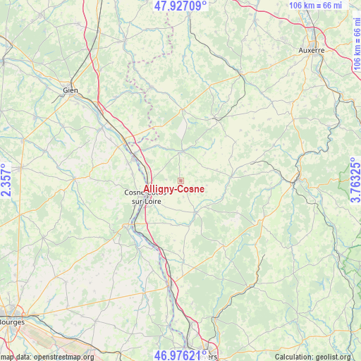
Alligny-Cosne GPS coordinates[2]
47° 27' 13.68" North, 3° 3' 36.432" East
| Map corner | latitude | longitude |
|---|---|---|
| Upper-left | 47.92709°, | 2.357° |
| Center: | 47.4538°, | 3.06012° |
| Lower-right: | 46.97621°, | 3.76325° |
| Map W x H: | 105.7×105.7 km | = 65.7×65.7mi |
| max Lat: | 51.07786° ⇑49.4% North |
| Alligny-Cosne: | 47.4538° |
| min Lat: | ⇓50.6% South 41.3874° |
| min Long | Alligny-Cosne | max Long |
| -5.08615° | 3.06012° | 9.52242° |
| W 58.7%⇐ | ⇒41.3% E |
Elevation
Elevation of Alligny-Cosne is 273 m = 896 ft, and this is 79.3 m = 260 ft above average elevation for this country.
| Max E: |
2333 m = 7654 ft | 21.9% |
| Alligny-Cosne | 273 m 896 ft | |
| Avg. | 193.7 m = 635 ft | |
Min E: |
-1 m = -3 ft | 78.1% |
See also: France elevation on elevation.city.
Geographical zone
Alligny-Cosne is located in North temperate zone (between Tropic of Cancer and the Arctic Circle). Distance of this North polar circle is 2124.8 km =1320.3 mi to North.| Distance of | km | miles | from Alligny-Cosne |
|---|---|---|---|
| North Pole | 4730.7 | 2939.5 | to North |
| Arctic Circle | 2124.8 | 1320.3 | to North |
| Tropic Cancer | 2670.4 | 1659.3 | to South |
| Equator | 5276.4 | 3278.6 | to South |


Nearby cities:
15 places around Alligny-Cosne: (largest is in red/bold)
• Arquian
11.2 km =7 mi,  331°
331°
• Bannay
15.2 km =9.4 mi,  241°
241°
• Belleville-sur-Loire
16.6 km =10.3 mi,  288°
288°
• Boulleret
14.4 km =8.9 mi,  256°
256°
• Cosne-Cours-sur-Loire
11.2 km =7 mi, 244°
• Donzy
10.5 km =6.5 mi,  151°
151°
• Entrains-sur-Nohain
14.8 km =9.2 mi,  85°
85°
• La Celle-sur-Loire
10.1 km =6.3 mi,  281°
281°
• Léré
14.4 km =8.9 mi, 276°
• Myennes
9.6 km =6 mi, 264°
• Neuvy-sur-Loire
15.4 km =9.6 mi,  300°
300°
• Saint-Amand-en-Puisaye
8.4 km =5.2 mi,  7°
7°
• Suilly-la-Tour
13 km =8.1 mi,  178°
178°
• Sury-près-Léré
14.9 km =9.3 mi, 283°
• Treigny
14.1 km =8.8 mi,  40°
40°
Sources, notices
• [Note1] Compared only with cities in France existing in our database
• [Src1] Map data: © OpenStreetMap contributors (CC-BY-SA)
• [Src2] Other city data from geonames.org with taken over terms of usage.
• [Src3] Geographical zone / Annual Mean Temperature by Robert A. Rohde @ Wikipedia
