Stotzheim geodata
Stotzheim (Grand Est) is a populated place; located in France in Europe/Paris (GMT+2) time zone. With population of 1,014 people, there are 8739 cities with bigger population in this country. Compared to other cities in France, 66% of cities are located further ↓South; 97.9% of cities are located further ←West and 58.3% of cities have lower elevation than Stotzheim. Note1
Administrative division(s):
- Level 1: Grand Est
- Level 2: Bas-Rhin
- Level 3: Arrondissement de Sélestat-Erstein
- Level 4: Stotzheim


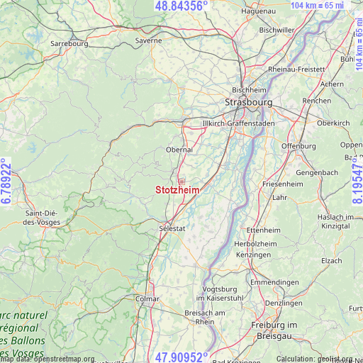
Stotzheim GPS coordinates[2]
48° 22' 43.248" North, 7° 29' 32.46" East
| Map corner | latitude | longitude |
|---|---|---|
| Upper-left | 48.84356°, | 6.78922° |
| Center: | 48.37868°, | 7.49235° |
| Lower-right: | 47.90952°, | 8.19547° |
| Map W x H: | 103.9×103.9 km | = 64.6×64.6mi |
| max Lat: | 51.07786° ⇑34% North |
| Stotzheim: | 48.37868° |
| min Lat: | ⇓66% South 41.3874° |
| min Long | Stotzheim | max Long |
| -5.08615° | 7.49235° | 9.52242° |
| W 97.9%⇐ | ⇒2.1% E |
Elevation
Elevation of Stotzheim is 162 m = 531 ft, and this is 31.7 m = 104 ft below average elevation for this country.
| Max E: |
2333 m = 7654 ft | 41.7% |
| Avg. | 193.7 m = 635 ft | |
| Stotzheim | 162 m = 531 ft | |
Min E: |
-1 m = -3 ft | 58.3% |
See also: France elevation on elevation.city.
Geographical zone
Stotzheim is located in North temperate zone (between Tropic of Cancer and the Arctic Circle). Distance of this North polar circle is 2022 km =1256.4 mi to North.| Distance of | km | miles | from Stotzheim |
|---|---|---|---|
| North Pole | 4627.9 | 2875.6 | to North |
| Arctic Circle | 2022 | 1256.4 | to North |
| Tropic Cancer | 2773.3 | 1723.2 | to South |
| Equator | 5379.2 | 3342.5 | to South |


Nearby cities:
15 places around Stotzheim: (largest is in red/bold)
• Andlau
5.6 km =3.5 mi,  278°
278°
• Barr
4.5 km =2.8 mi,  314°
314°
• Benfeld
7.5 km =4.7 mi,  96°
96°
• Epfig
3 km =1.9 mi,  223°
223°
• Gertwiller
4 km =2.5 mi,  333°
333°
• Goxwiller
6 km =3.7 mi,  354°
354°
• Heiligenstein
5.8 km =3.6 mi, 327°
• Huttenheim
6.7 km =4.2 mi,  109°
109°
• Kertzfeld
5.6 km =3.5 mi,  88°
88°
• Kogenheim
5.9 km =3.7 mi,  140°
140°
• Mittelbergheim
4.2 km =2.6 mi,  297°
297°
• Saint-Pierre
1.6 km =1 mi,  294°
294°
• Sermersheim
5.8 km =3.6 mi,  129°
129°
• Valff
5.2 km =3.2 mi,  23°
23°
• Zellwiller
2.1 km =1.3 mi,  8°
8°
Sources, notices
• [Note1] Compared only with cities in France existing in our database
• [Src1] Map data: © OpenStreetMap contributors (CC-BY-SA)
• [Src2] Other city data from geonames.org with taken over terms of usage.
• [Src3] Geographical zone / Annual Mean Temperature by Robert A. Rohde @ Wikipedia
