Kogenheim geodata
Kogenheim (Grand Est) is a populated place; located in France in Europe/Paris (GMT+2) time zone. With population of 893 people, there are 9714 cities with bigger population in this country. Compared to other cities in France, 65.2% of cities are located further ↓South; 98.3% of cities are located further ←West and 58% of cities have lower elevation than Kogenheim. Note1
Administrative division(s):
- Level 1: Grand Est
- Level 2: Bas-Rhin
- Level 3: Arrondissement de Sélestat-Erstein
- Level 4: Kogenheim


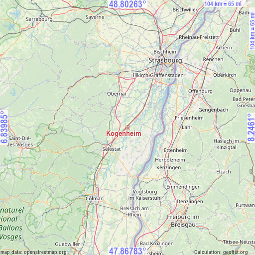
Kogenheim GPS coordinates[2]
48° 20' 14.532" North, 7° 32' 34.692" East
| Map corner | latitude | longitude |
|---|---|---|
| Upper-left | 48.80263°, | 6.83985° |
| Center: | 48.33737°, | 7.54297° |
| Lower-right: | 47.86783°, | 8.2461° |
| Map W x H: | 103.9×103.9 km | = 64.6×64.6mi |
| max Lat: | 51.07786° ⇑34.8% North |
| Kogenheim: | 48.33737° |
| min Lat: | ⇓65.2% South 41.3874° |
| min Long | Kogenheim | max Long |
| -5.08615° | 7.54297° | 9.52242° |
| W 98.3%⇐ | ⇒1.7% E |
Elevation
Elevation of Kogenheim is 161 m = 528 ft, and this is 32.7 m = 107 ft below average elevation for this country.
| Max E: |
2333 m = 7654 ft | 42% |
| Avg. | 193.7 m = 635 ft | |
| Kogenheim | 161 m = 528 ft | |
Min E: |
-1 m = -3 ft | 58% |
See also: France elevation on elevation.city.
Geographical zone
Kogenheim is located in North temperate zone (between Tropic of Cancer and the Arctic Circle). Distance of this North polar circle is 2026.6 km =1259.3 mi to North.| Distance of | km | miles | from Kogenheim |
|---|---|---|---|
| North Pole | 4632.5 | 2878.5 | to North |
| Arctic Circle | 2026.6 | 1259.3 | to North |
| Tropic Cancer | 2768.7 | 1720.4 | to South |
| Equator | 5374.6 | 3339.6 | to South |


Nearby cities:
15 places around Kogenheim: (largest is in red/bold)
• Benfeld
5.3 km =3.3 mi,  45°
45°
• Bindernheim
7.7 km =4.8 mi,  141°
141°
• Ebersheim
4.9 km =3 mi,  221°
221°
• Ebersmunster
3.2 km =2 mi,  204°
204°
• Epfig
6.3 km =3.9 mi,  292°
292°
• Herbsheim
6.6 km =4.1 mi,  78°
78°
• Hilsenheim
5.7 km =3.5 mi,  164°
164°
• Huttenheim
3.5 km =2.2 mi, 47°
• Kertzfeld
5.1 km =3.2 mi,  21°
21°
• Rossfeld
5.4 km =3.4 mi,  88°
88°
• Saint-Pierre
7.4 km =4.6 mi,  315°
315°
• Sand
7.2 km =4.5 mi, 45°
• Sermersheim
1.2 km =0.7 mi,  36°
36°
• Stotzheim
5.9 km =3.7 mi, 320°
• Zellwiller
7.5 km =4.7 mi,  332°
332°
Sources, notices
• [Note1] Compared only with cities in France existing in our database
• [Src1] Map data: © OpenStreetMap contributors (CC-BY-SA)
• [Src2] Other city data from geonames.org with taken over terms of usage.
• [Src3] Geographical zone / Annual Mean Temperature by Robert A. Rohde @ Wikipedia
