Somloire geodata
Somloire (Pays de la Loire) is a populated place; located in France in Europe/Paris (GMT+2) time zone. With population of 837 people, there are 10216 cities with bigger population in this country. Compared to other cities in France, 55% of cities are located further ↑North; 84.6% of cities are located further →East and 53.3% of cities have higher elevation than Somloire. Note1
Administrative division(s):
- Level 1: Pays de la Loire
- Level 2: Département de Maine-et-Loire
- Level 3: Arrondissement de Cholet
- Level 4: Somloire


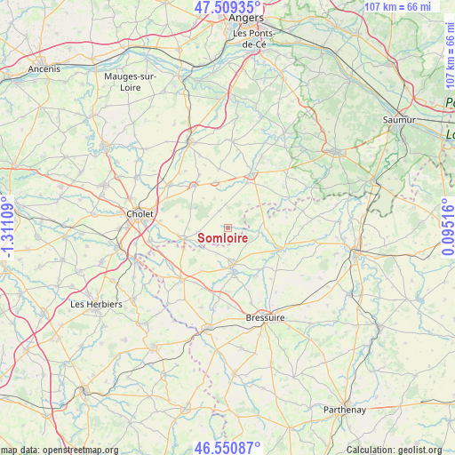
Somloire GPS coordinates[2]
47° 1' 56.136" North, 0° 36' 28.692" West
| Map corner | latitude | longitude |
|---|---|---|
| Upper-left | 47.50935°, | -1.31109° |
| Center: | 47.03226°, | -0.60797° |
| Lower-right: | 46.55087°, | 0.09516° |
| Map W x H: | 106.6×106.6 km | = 66.2×66.2mi |
| max Lat: | 51.07786° ⇑55% North |
| Somloire: | 47.03226° |
| min Lat: | ⇓45% South 41.3874° |
| min Long | Somloire | max Long |
| -5.08615° | -0.60797° | 9.52242° |
| W 15.4%⇐ | ⇒84.6% E |
Elevation
Elevation of Somloire is 121 m = 397 ft, and this is 72.7 m = 239 ft below average elevation for this country.
| Max E: |
2333 m = 7654 ft | 53.3% |
| Avg. | 193.7 m = 635 ft | |
| Somloire | 121 m = 397 ft | |
Min E: |
-1 m = -3 ft | 46.7% |
See also: France elevation on elevation.city.
Geographical zone
Somloire is located in North temperate zone (between Tropic of Cancer and the Arctic Circle). Distance of this North polar circle is 2171.7 km =1349.4 mi to North.| Distance of | km | miles | from Somloire |
|---|---|---|---|
| North Pole | 4777.6 | 2968.7 | to North |
| Arctic Circle | 2171.7 | 1349.4 | to North |
| Tropic Cancer | 2623.6 | 1630.2 | to South |
| Equator | 5229.5 | 3249.5 | to South |


Nearby cities:
15 places around Somloire: (largest is in red/bold)
• Argenton-les-Vallées
13.1 km =8.1 mi,  113°
113°
• Boësse
12 km =7.5 mi,  121°
121°
• Chanteloup-les-Bois
9 km =5.6 mi,  320°
320°
• Coron
10.9 km =6.8 mi,  345°
345°
• La Plaine
4.5 km =2.8 mi,  331°
331°
• Maulévrier
10.5 km =6.5 mi,  255°
255°
• Nueil-les-Aubiers
11.2 km =7 mi,  170°
170°
• Saint-Maurice
7.5 km =4.7 mi,  88°
88°
• Saint-Paul-du-Bois
7.1 km =4.4 mi,  42°
42°
• Saint-Pierre-des-Échaubrognes
11.4 km =7.1 mi,  245°
245°
• Toutlemonde
12.2 km =7.6 mi,  281°
281°
• Vezins
12.4 km =7.7 mi, 321°
• Vihiers
13.9 km =8.6 mi,  24°
24°
• Voulmentin
12.1 km =7.5 mi,  144°
144°
• Yzernay
7.3 km =4.5 mi, 261°
Sources, notices
• [Note1] Compared only with cities in France existing in our database
• [Src1] Map data: © OpenStreetMap contributors (CC-BY-SA)
• [Src2] Other city data from geonames.org with taken over terms of usage.
• [Src3] Geographical zone / Annual Mean Temperature by Robert A. Rohde @ Wikipedia
