Vezins geodata
Vezins (Pays de la Loire) is a populated place; located in France in Europe/Paris (GMT+2) time zone. With population of 1,680 people, there are 5577 cities with bigger population in this country. Compared to other cities in France, 54% of cities are located further ↑North; 85.6% of cities are located further →East and 53.9% of cities have lower elevation than Vezins. Note1
Administrative division(s):
- Level 1: Pays de la Loire
- Level 2: Département de Maine-et-Loire
- Level 3: Arrondissement de Cholet
- Level 4: Vezins


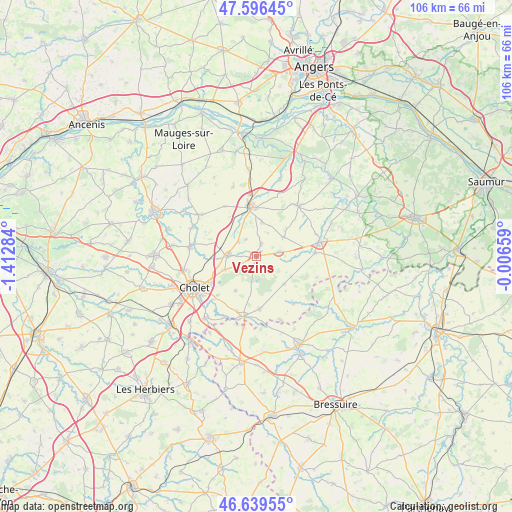
Vezins GPS coordinates[2]
47° 7' 12.54" North, 0° 42' 34.956" West
| Map corner | latitude | longitude |
|---|---|---|
| Upper-left | 47.59645°, | -1.41284° |
| Center: | 47.12015°, | -0.70971° |
| Lower-right: | 46.63955°, | -0.00659° |
| Map W x H: | 106.4×106.4 km | = 66.1×66.1mi |
| max Lat: | 51.07786° ⇑54% North |
| Vezins: | 47.12015° |
| min Lat: | ⇓46% South 41.3874° |
| min Long | Vezins | max Long |
| -5.08615° | -0.70971° | 9.52242° |
| W 14.4%⇐ | ⇒85.6% E |
Elevation
Elevation of Vezins is 146 m = 479 ft, and this is 47.7 m = 156 ft below average elevation for this country.
| Max E: |
2333 m = 7654 ft | 46.1% |
| Avg. | 193.7 m = 635 ft | |
| Vezins | 146 m = 479 ft | |
Min E: |
-1 m = -3 ft | 53.9% |
See also: France elevation on elevation.city.
Geographical zone
Vezins is located in North temperate zone (between Tropic of Cancer and the Arctic Circle). Distance of this North polar circle is 2161.9 km =1343.3 mi to North.| Distance of | km | miles | from Vezins |
|---|---|---|---|
| North Pole | 4767.8 | 2962.6 | to North |
| Arctic Circle | 2161.9 | 1343.3 | to North |
| Tropic Cancer | 2633.4 | 1636.3 | to South |
| Equator | 5239.3 | 3255.5 | to South |


Nearby cities:
15 places around Vezins: (largest is in red/bold)
• Chanteloup-les-Bois
3.5 km =2.2 mi,  145°
145°
• Chemillé-Melay
10.6 km =6.6 mi,  353°
353°
• Coron
5 km =3.1 mi,  80°
80°
• La Chapelle-Rousselin
12.2 km =7.6 mi,  328°
328°
• La Plaine
8 km =5 mi,  136°
136°
• La Salle-de-Vihiers
6.8 km =4.2 mi,  54°
54°
• La Tourlandry
2.8 km =1.7 mi,  20°
20°
• Maulévrier
12.6 km =7.8 mi,  191°
191°
• Mazières-en-Mauges
11.6 km =7.2 mi,  224°
224°
• Melay
7.1 km =4.4 mi,  9°
9°
• Nuaillé
7 km =4.3 mi,  246°
246°
• Somloire
12.4 km =7.7 mi, 141°
• Toutlemonde
8.4 km =5.2 mi,  210°
210°
• Trémentines
5.7 km =3.5 mi,  273°
273°
• Yzernay
10.9 km =6.8 mi,  177°
177°
Sources, notices
• [Note1] Compared only with cities in France existing in our database
• [Src1] Map data: © OpenStreetMap contributors (CC-BY-SA)
• [Src2] Other city data from geonames.org with taken over terms of usage.
• [Src3] Geographical zone / Annual Mean Temperature by Robert A. Rohde @ Wikipedia
