Boutavent geodata
Boutavent (Hauts-de-France) is a seat of a fourth-order administrative division; located in France in Europe/Paris (GMT+2) time zone. With population of 83 people, there are 15243 cities with bigger population in this country. Compared to other cities in France, 90.5% of cities are located further ↓South; 59.4% of cities are located further →East and 63.3% of cities have lower elevation than Boutavent. Note1
Administrative division(s):
- Level 1: Hauts-de-France
- Level 2: Département de l'Oise
- Level 3: Arrondissement de Beauvais
- Level 4: Ernemont-Boutavent


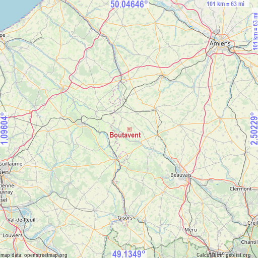
Boutavent GPS coordinates[2]
49° 35' 34.116" North, 1° 47' 56.976" East
| Map corner | latitude | longitude |
|---|---|---|
| Upper-left | 50.04646°, | 1.09604° |
| Center: | 49.59281°, | 1.79916° |
| Lower-right: | 49.1349°, | 2.50229° |
| Map W x H: | 101.4×101.4 km | = 63×63mi |
| max Lat: | 51.07786° ⇑9.5% North |
| Boutavent: | 49.59281° |
| min Lat: | ⇓90.5% South 41.3874° |
| min Long | Boutavent | max Long |
| -5.08615° | 1.79916° | 9.52242° |
| W 40.6%⇐ | ⇒59.4% E |
Elevation
Elevation of Boutavent is 186 m = 610 ft, and this is 7.7 m = 25 ft below average elevation for this country.
| Max E: |
2333 m = 7654 ft | 36.7% |
| Avg. | 193.7 m = 635 ft | |
| Boutavent | 186 m = 610 ft | |
Min E: |
-1 m = -3 ft | 63.3% |
See also: France elevation on elevation.city.
Geographical zone
Boutavent is located in North temperate zone (between Tropic of Cancer and the Arctic Circle). Distance of this North polar circle is 1887 km =1172.5 mi to North.| Distance of | km | miles | from Boutavent |
|---|---|---|---|
| North Pole | 4492.9 | 2791.8 | to North |
| Arctic Circle | 1887 | 1172.5 | to North |
| Tropic Cancer | 2908.3 | 1807.1 | to South |
| Equator | 5514.2 | 3426.4 | to South |


Nearby cities:
15 places around Boutavent: (largest is in red/bold)
• Abancourt
11.7 km =7.3 mi,  347°
347°
• Cempuis
15.7 km =9.8 mi,  61°
61°
• Feuquières
6.9 km =4.3 mi,  30°
30°
• Formerie
8 km =5 mi,  322°
322°
• Gaillefontaine
14.9 km =9.3 mi,  297°
297°
• Gournay-en-Bray
13.4 km =8.3 mi,  203°
203°
• Grandvilliers
13 km =8.1 mi,  51°
51°
• Hanvoile
11 km =6.8 mi,  146°
146°
• Marseille-en-Beauvaisis
11.4 km =7.1 mi,  99°
99°
• Moliens
8.3 km =5.2 mi,  5°
5°
• Romescamps
13.2 km =8.2 mi,  1°
1°
• Saint-Germer-de-Fly
16.7 km =10.4 mi,  184°
184°
• Saint-Omer-en-Chaussée
16.2 km =10.1 mi,  114°
114°
• Senantes
12.1 km =7.5 mi,  167°
167°
• Songeons
6.2 km =3.9 mi,  141°
141°
Sources, notices
• [Note1] Compared only with cities in France existing in our database
• [Src1] Map data: © OpenStreetMap contributors (CC-BY-SA)
• [Src2] Other city data from geonames.org with taken over terms of usage.
• [Src3] Geographical zone / Annual Mean Temperature by Robert A. Rohde @ Wikipedia
