Cheviré-le-Rouge geodata
Cheviré-le-Rouge (Pays de la Loire) is a populated place; located in France in Europe/Paris (GMT+2) time zone. With population of 814 people, there are 10439 cities with bigger population in this country. Compared to other cities in France, 52.6% of cities are located further ↓South; 79.4% of cities are located further →East and 72.3% of cities have higher elevation than Cheviré-le-Rouge. Note1
Administrative division(s):
- Level 1: Pays de la Loire
- Level 2: Département de Maine-et-Loire
- Level 3: Arrondissement de Saumur
- Level 4: Baugé-en-Anjou


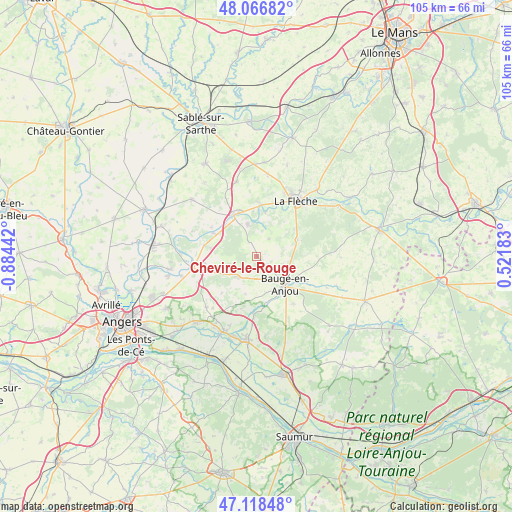
Cheviré-le-Rouge GPS coordinates[2]
47° 35' 41.28" North, 0° 10' 52.68" West
| Map corner | latitude | longitude |
|---|---|---|
| Upper-left | 48.06682°, | -0.88442° |
| Center: | 47.5948°, | -0.1813° |
| Lower-right: | 47.11848°, | 0.52183° |
| Map W x H: | 105.4×105.4 km | = 65.5×65.5mi |
| max Lat: | 51.07786° ⇑47.4% North |
| Cheviré-le-Rouge: | 47.5948° |
| min Lat: | ⇓52.6% South 41.3874° |
| min Long | Cheviré-le-Rou | max Long |
| -5.08615° | -0.1813° | 9.52242° |
| W 20.6%⇐ | ⇒79.4% E |
Elevation
Elevation of Cheviré-le-Rouge is 73 m = 240 ft, and this is 120.7 m = 396 ft below average elevation for this country.
| Max E: |
2333 m = 7654 ft | 72.3% |
| Avg. | 193.7 m = 635 ft | |
| Cheviré-le-Rouge | 73 m = 240 ft | |
Min E: |
-1 m = -3 ft | 27.7% |
See also: France elevation on elevation.city.
Geographical zone
Cheviré-le-Rouge is located in North temperate zone (between Tropic of Cancer and the Arctic Circle). Distance of this North polar circle is 2109.1 km =1310.5 mi to North.| Distance of | km | miles | from Cheviré-le-Rouge |
|---|---|---|---|
| North Pole | 4715 | 2929.8 | to North |
| Arctic Circle | 2109.1 | 1310.5 | to North |
| Tropic Cancer | 2686.1 | 1669.1 | to South |
| Equator | 5292 | 3288.3 | to South |


Nearby cities:
15 places around Cheviré-le-Rouge: (largest is in red/bold)
• Baugé-en-Anjou
7.9 km =4.9 mi,  134°
134°
• Bauné
14.8 km =9.2 mi,  224°
224°
• Bazouges-sur-le-Loir
10.5 km =6.5 mi,  5°
5°
• Bocé
12.3 km =7.6 mi,  142°
142°
• Clefs-Val d'Anjou
9 km =5.6 mi,  68°
68°
• Cré-sur-Loir
9.3 km =5.8 mi, 10°
• Durtal
9.5 km =5.9 mi,  335°
335°
• Fontaine-Guérin
12 km =7.5 mi,  182°
182°
• Fougeré
4.4 km =2.7 mi,  33°
33°
• Jarzé
5.8 km =3.6 mi, 221°
• La Flèche
14 km =8.7 mi, 34°
• Le Vieil-Baugé
8.4 km =5.2 mi,  146°
146°
• Les Rairies
6.5 km =4 mi, 343°
• Lézigné
9.8 km =6.1 mi,  298°
298°
• Seiches-sur-le-Loir
13.3 km =8.3 mi,  259°
259°
Sources, notices
• [Note1] Compared only with cities in France existing in our database
• [Src1] Map data: © OpenStreetMap contributors (CC-BY-SA)
• [Src2] Other city data from geonames.org with taken over terms of usage.
• [Src3] Geographical zone / Annual Mean Temperature by Robert A. Rohde @ Wikipedia
