Savonnières-devant-Bar geodata
Savonnières-devant-Bar (Grand Est) is a populated place; located in France in Europe/Paris (GMT+2) time zone. With population of 556 people, there are 14098 cities with bigger population in this country. Compared to other cities in France, 74.5% of cities are located further ↓South; 79.5% of cities are located further ←West and 63.8% of cities have lower elevation than Savonnières-devant-Bar. Note1
Administrative division(s):
- Level 1: Grand Est
- Level 2: Meuse
- Level 3: Arrondissement de Bar-le-Duc
- Level 4: Savonnières-devant-Bar
Current local time in Savonnières-devant-Bar:
02:41 AM, SaturdayDifference from your time zone: hours


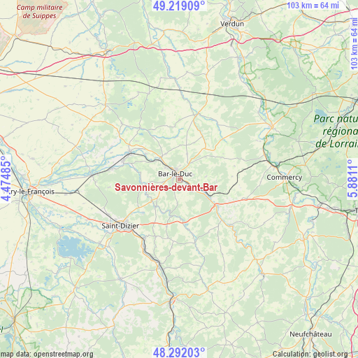
Savonnières-devant-Bar GPS coordinates[2]
48° 45' 27.72" North, 5° 10' 40.728" East
| Map corner | latitude | longitude |
|---|---|---|
| Upper-left | 49.21909°, | 4.47485° |
| Center: | 48.7577°, | 5.17798° |
| Lower-right: | 48.29203°, | 5.8811° |
| Map W x H: | 103.1×103.1 km | = 64.1×64.1mi |
| max Lat: | 51.07786° ⇑25.5% North |
| Savonnières-devant-Bar: | 48.7577° |
| min Lat: | ⇓74.5% South 41.3874° |
| min Long | Savonnières-de | max Long |
| -5.08615° | 5.17798° | 9.52242° |
| W 79.5%⇐ | ⇒20.5% E |
Elevation
Elevation of Savonnières-devant-Bar is 188 m = 617 ft, and this is 5.7 m = 19 ft below average elevation for this country.
| Max E: |
2333 m = 7654 ft | 36.2% |
| Avg. | 193.7 m = 635 ft | |
| Savonnières-devant-Bar | 188 m = 617 ft | |
Min E: |
-1 m = -3 ft | 63.8% |
See also: France elevation on elevation.city.
Geographical zone
Savonnières-devant-Bar is located in North temperate zone (between Tropic of Cancer and the Arctic Circle). Distance of this North polar circle is 1979.8 km =1230.2 mi to North.| Distance of | km | miles | from Savonnières-devant-Bar |
|---|---|---|---|
| North Pole | 4585.7 | 2849.4 | to North |
| Arctic Circle | 1979.8 | 1230.2 | to North |
| Tropic Cancer | 2815.4 | 1749.4 | to South |
| Equator | 5421.3 | 3368.6 | to South |


Nearby cities:
15 places around Savonnières-devant-Bar: (largest is in red/bold)
• Bar-le-Duc
2.1 km =1.3 mi,  323°
323°
• Behonne
4 km =2.5 mi,  4°
4°
• Beurey-sur-Saulx
11.1 km =6.9 mi,  269°
269°
• Brillon-en-Barrois
7.9 km =4.9 mi,  230°
230°
• Combles-en-Barrois
4.6 km =2.9 mi,  260°
260°
• Fains-Véel
4.3 km =2.7 mi,  311°
311°
• Haironville
10.4 km =6.5 mi,  220°
220°
• Ligny-en-Barrois
13.3 km =8.3 mi,  125°
125°
• Lisle-en-Rigault
10.6 km =6.6 mi,  244°
244°
• Longeville-en-Barrois
2.8 km =1.7 mi, 126°
• Naives-Rosières
4 km =2.5 mi,  44°
44°
• Robert-Espagne
10.9 km =6.8 mi, 262°
• Tronville-en-Barrois
8.5 km =5.3 mi,  119°
119°
• Trémont-sur-Saulx
8.7 km =5.4 mi, 263°
• Velaines
11.4 km =7.1 mi, 125°
Sources, notices
• [Note1] Compared only with cities in France existing in our database
• [Src1] Map data: © OpenStreetMap contributors (CC-BY-SA)
• [Src2] Other city data from geonames.org with taken over terms of usage.
• [Src3] Geographical zone / Annual Mean Temperature by Robert A. Rohde @ Wikipedia
