Longeville-en-Barrois geodata
Longeville-en-Barrois (Grand Est) is a populated place; located in France in Europe/Paris (GMT+2) time zone. With population of 1,285 people, there are 7101 cities with bigger population in this country. Compared to other cities in France, 74.1% of cities are located further ↓South; 79.9% of cities are located further ←West and 64.9% of cities have lower elevation than Longeville-en-Barrois. Note1
Administrative division(s):
- Level 1: Grand Est
- Level 2: Meuse
- Level 3: Arrondissement de Bar-le-Duc
- Level 4: Longeville-en-Barrois
Current local time in Longeville-en-Barrois:
02:39 AM, SaturdayDifference from your time zone: hours


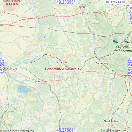
Longeville-en-Barrois GPS coordinates[2]
48° 44' 32.712" North, 5° 12' 32.58" East
| Map corner | latitude | longitude |
|---|---|---|
| Upper-left | 49.20396°, | 4.50592° |
| Center: | 48.74242°, | 5.20905° |
| Lower-right: | 48.27661°, | 5.91217° |
| Map W x H: | 103.1×103.1 km | = 64.1×64.1mi |
| max Lat: | 51.07786° ⇑25.9% North |
| Longeville-en-Barrois: | 48.74242° |
| min Lat: | ⇓74.1% South 41.3874° |
| min Long | Longeville-en-B | max Long |
| -5.08615° | 5.20905° | 9.52242° |
| W 79.9%⇐ | ⇒20.1% E |
Elevation
Elevation of Longeville-en-Barrois is 193 m = 633 ft, and this is 0.69999999999999 m = 2 ft below average elevation for this country.
| Max E: |
2333 m = 7654 ft | 35.1% |
| Avg. | 193.7 m = 635 ft | |
| Longeville-en-Barrois | 193 m = 633 ft | |
Min E: |
-1 m = -3 ft | 64.9% |
See also: France elevation on elevation.city.
Geographical zone
Longeville-en-Barrois is located in North temperate zone (between Tropic of Cancer and the Arctic Circle). Distance of this North polar circle is 1981.5 km =1231.2 mi to North.| Distance of | km | miles | from Longeville-en-Barrois |
|---|---|---|---|
| North Pole | 4587.4 | 2850.5 | to North |
| Arctic Circle | 1981.5 | 1231.2 | to North |
| Tropic Cancer | 2813.7 | 1748.4 | to South |
| Equator | 5419.6 | 3367.6 | to South |


Nearby cities:
15 places around Longeville-en-Barrois: (largest is in red/bold)
• Bar-le-Duc
4.9 km =3 mi,  313°
313°
• Behonne
6 km =3.7 mi,  341°
341°
• Beurey-sur-Saulx
13.5 km =8.4 mi,  277°
277°
• Brillon-en-Barrois
9 km =5.6 mi,  248°
248°
• Combles-en-Barrois
6.9 km =4.3 mi, 278°
• Fains-Véel
7.2 km =4.5 mi, 309°
• Haironville
11 km =6.8 mi,  235°
235°
• Ligny-en-Barrois
10.4 km =6.5 mi,  125°
125°
• Lisle-en-Rigault
12.2 km =7.6 mi,  256°
256°
• Naives-Rosières
4.6 km =2.9 mi,  6°
6°
• Robert-Espagne
13.1 km =8.1 mi,  270°
270°
• Savonnières-devant-Bar
2.8 km =1.7 mi, 306°
• Tronville-en-Barrois
5.7 km =3.5 mi,  116°
116°
• Trémont-sur-Saulx
10.9 km =6.8 mi, 273°
• Velaines
8.5 km =5.3 mi, 124°
Sources, notices
• [Note1] Compared only with cities in France existing in our database
• [Src1] Map data: © OpenStreetMap contributors (CC-BY-SA)
• [Src2] Other city data from geonames.org with taken over terms of usage.
• [Src3] Geographical zone / Annual Mean Temperature by Robert A. Rohde @ Wikipedia
