Saugues geodata
Saugues (Auvergne-Rhône-Alpes) is a populated place; located in France in Europe/Paris (GMT+2) time zone. With population of 2,250 people, there are 4279 cities with bigger population in this country. Compared to other cities in France, 80% of cities are located further ↑North; 64.7% of cities are located further ←West and 99% of cities have lower elevation than Saugues. Note1
Administrative division(s):
- Level 1: Auvergne-Rhône-Alpes
- Level 2: Haute-Loire
- Level 3: Arrondissement de Brioude
- Level 4: Saugues


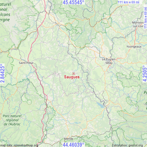
Saugues GPS coordinates[2]
44° 57' 36.288" North, 3° 32' 50.532" East
| Map corner | latitude | longitude |
|---|---|---|
| Upper-left | 45.45545°, | 2.84425° |
| Center: | 44.96008°, | 3.54737° |
| Lower-right: | 44.46039°, | 4.2505° |
| Map W x H: | 110.6×110.6 km | = 68.7×68.7mi |
| max Lat: | 51.07786° ⇑80% North |
| Saugues: | 44.96008° |
| min Lat: | ⇓20% South 41.3874° |
| min Long | Saugues | max Long |
| -5.08615° | 3.54737° | 9.52242° |
| W 64.7%⇐ | ⇒35.3% E |
Elevation
Elevation of Saugues is 971 m = 3186 ft, and this is 777.3 m = 2550 ft above average elevation for this country.
| Max E: |
2333 m = 7654 ft | 1% |
| Saugues | 971 m 3186 ft | |
| Avg. | 193.7 m = 635 ft | |
Min E: |
-1 m = -3 ft | 99% |
See also: France elevation on elevation.city.
Geographical zone
Saugues is located in North temperate zone (between Tropic of Cancer and the Arctic Circle). Distance of this Northern Tropic circle is 2393.2 km =1487.1 mi to South.| Distance of | km | miles | from Saugues |
|---|---|---|---|
| North Pole | 5008 | 3111.8 | to North |
| Arctic Circle | 2402.1 | 1492.6 | to North |
| Tropic Cancer | 2393.2 | 1487.1 | to South |
| Equator | 4999.1 | 3106.3 | to South |


Nearby cities:
15 places around Saugues: (largest is in red/bold)
• Bains
18.7 km =11.6 mi,  72°
72°
• Cayres
20.8 km =12.9 mi,  100°
100°
• Cerzat
23 km =14.3 mi,  346°
346°
• Chaspuzac
19.9 km =12.4 mi,  52°
52°
• Costaros
24.9 km =15.5 mi,  106°
106°
• Cussac-sur-Loire
26.7 km =16.6 mi,  83°
83°
• Grandrieu
20.8 km =12.9 mi,  160°
160°
• Landos
25.9 km =16.1 mi,  120°
120°
• Langeac
16.1 km =10 mi,  344°
344°
• Le Brignon
26.3 km =16.3 mi, 96°
• Le Malzieu-Ville
20.4 km =12.7 mi,  235°
235°
• Loudes
21.3 km =13.2 mi, 48°
• Saint-Alban-sur-Limagnole
23.5 km =14.6 mi,  212°
212°
• Saint-Christophe-sur-Dolaison
21.8 km =13.5 mi, 79°
• Solignac-sur-Loire
26.7 km =16.6 mi,  88°
88°
Sources, notices
• [Note1] Compared only with cities in France existing in our database
• [Src1] Map data: © OpenStreetMap contributors (CC-BY-SA)
• [Src2] Other city data from geonames.org with taken over terms of usage.
• [Src3] Geographical zone / Annual Mean Temperature by Robert A. Rohde @ Wikipedia
