Le Malzieu-Ville geodata
Le Malzieu-Ville (Occitanie) is a populated place; located in France in Europe/Paris (GMT+2) time zone. With population of 1,023 people, there are 8668 cities with bigger population in this country. Compared to other cities in France, 80.8% of cities are located further ↑North; 62.4% of cities are located further ←West and 98.4% of cities have lower elevation than Le Malzieu-Ville. Note1
Administrative division(s):
- Level 1: Occitanie
- Level 2: Département de la Lozère
- Level 3: Arrondissement de Mende
- Level 4: Le Malzieu-Ville


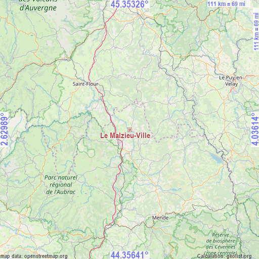
Le Malzieu-Ville GPS coordinates[2]
44° 51' 25.164" North, 3° 19' 58.872" East
| Map corner | latitude | longitude |
|---|---|---|
| Upper-left | 45.35326°, | 2.62989° |
| Center: | 44.85699°, | 3.33302° |
| Lower-right: | 44.35641°, | 4.03614° |
| Map W x H: | 110.8×110.8 km | = 68.8×68.8mi |
| max Lat: | 51.07786° ⇑80.8% North |
| Le Malzieu-Ville: | 44.85699° |
| min Lat: | ⇓19.2% South 41.3874° |
| min Long | Le Malzieu-Vill | max Long |
| -5.08615° | 3.33302° | 9.52242° |
| W 62.4%⇐ | ⇒37.6% E |
Elevation
Elevation of Le Malzieu-Ville is 868 m = 2848 ft, and this is 674.3 m = 2212 ft above average elevation for this country.
| Max E: |
2333 m = 7654 ft | 1.6% |
| Le Malzieu-Ville | 868 m 2848 ft | |
| Avg. | 193.7 m = 635 ft | |
Min E: |
-1 m = -3 ft | 98.4% |
See also: France elevation on elevation.city.
Geographical zone
Le Malzieu-Ville is located in North temperate zone (between Tropic of Cancer and the Arctic Circle). Distance of this Northern Tropic circle is 2381.7 km =1479.9 mi to South.| Distance of | km | miles | from Le Malzieu-Ville |
|---|---|---|---|
| North Pole | 5019.4 | 3118.9 | to North |
| Arctic Circle | 2413.5 | 1499.7 | to North |
| Tropic Cancer | 2381.7 | 1479.9 | to South |
| Equator | 4987.6 | 3099.1 | to South |


Nearby cities:
15 places around Le Malzieu-Ville: (largest is in red/bold)
• Aumont-Aubrac
15.5 km =9.6 mi,  194°
194°
• Chaudes-Aigues
25.9 km =16.1 mi,  269°
269°
• Grandrieu
25.1 km =15.6 mi,  108°
108°
• Langeac
29.9 km =18.6 mi,  25°
25°
• Nasbinals
31.3 km =19.4 mi,  226°
226°
• Neuvéglise
28.7 km =17.8 mi,  286°
286°
• Rieutort-de-Randon
27.6 km =17.1 mi,  154°
154°
• Rimeize
10.3 km =6.4 mi,  183°
183°
• Roffiac
31.8 km =19.8 mi,  313°
313°
• Saint-Alban-sur-Limagnole
9.5 km =5.9 mi, 152°
• Saint-Chély-d’Apcher
7.3 km =4.5 mi,  219°
219°
• Saint-Flour
27.3 km =17 mi,  316°
316°
• Saint-Urcize
31.5 km =19.6 mi,  235°
235°
• Saugues
20.4 km =12.7 mi,  55°
55°
• Villedieu
26.4 km =16.4 mi, 306°
Sources, notices
• [Note1] Compared only with cities in France existing in our database
• [Src1] Map data: © OpenStreetMap contributors (CC-BY-SA)
• [Src2] Other city data from geonames.org with taken over terms of usage.
• [Src3] Geographical zone / Annual Mean Temperature by Robert A. Rohde @ Wikipedia
