Saint-Sulpice-Laurière geodata
Saint-Sulpice-Laurière (Nouvelle-Aquitaine) is a populated place; located in France in Europe/Paris (GMT+2) time zone. With population of 914 people, there are 9537 cities with bigger population in this country. Compared to other cities in France, 65.7% of cities are located further ↑North; 63.4% of cities are located further →East and 87.4% of cities have lower elevation than Saint-Sulpice-Laurière. Note1
Administrative division(s):
- Level 1: Nouvelle-Aquitaine
- Level 2: Haute-Vienne
- Level 3: Arrondissement de Limoges
- Level 4: Saint-Sulpice-Laurière
Current local time in Saint-Sulpice-Laurière:
08:42 AM, SaturdayDifference from your time zone: hours


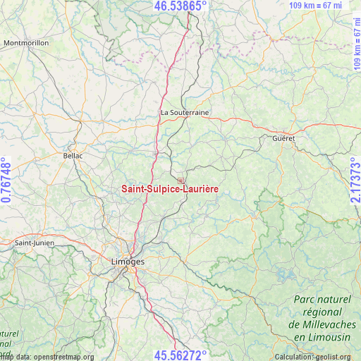
Saint-Sulpice-Laurière GPS coordinates[2]
46° 3' 10.224" North, 1° 28' 14.196" East
| Map corner | latitude | longitude |
|---|---|---|
| Upper-left | 46.53865°, | 0.76748° |
| Center: | 46.05284°, | 1.47061° |
| Lower-right: | 45.56272°, | 2.17373° |
| Map W x H: | 108.5×108.5 km | = 67.4×67.4mi |
| max Lat: | 51.07786° ⇑65.7% North |
| Saint-Sulpice-Laurière: | 46.05284° |
| min Lat: | ⇓34.3% South 41.3874° |
| min Long | Saint-Sulpice-L | max Long |
| -5.08615° | 1.47061° | 9.52242° |
| W 36.6%⇐ | ⇒63.4% E |
Elevation
Elevation of Saint-Sulpice-Laurière is 380 m = 1247 ft, and this is 186.3 m = 611 ft above average elevation for this country.
| Max E: |
2333 m = 7654 ft | 12.6% |
| Saint-Sulpice-Laurière | 380 m 1247 ft | |
| Avg. | 193.7 m = 635 ft | |
Min E: |
-1 m = -3 ft | 87.4% |
See also: France elevation on elevation.city.
Geographical zone
Saint-Sulpice-Laurière is located in North temperate zone (between Tropic of Cancer and the Arctic Circle). Distance of this North polar circle is 2280.6 km =1417.1 mi to North.| Distance of | km | miles | from Saint-Sulpice-Laurière |
|---|---|---|---|
| North Pole | 4886.5 | 3036.3 | to North |
| Arctic Circle | 2280.6 | 1417.1 | to North |
| Tropic Cancer | 2514.7 | 1562.6 | to South |
| Equator | 5120.6 | 3181.8 | to South |


Nearby cities:
15 places around Saint-Sulpice-Laurière: (largest is in red/bold)
• Ambazac
11.9 km =7.4 mi,  207°
207°
• Bersac-sur-Rivalier
4.6 km =2.9 mi,  312°
312°
• Bessines-sur-Gartempe
10.1 km =6.3 mi, 308°
• Bénévent-l’Abbaye
14.1 km =8.8 mi,  59°
59°
• Folles
7 km =4.3 mi,  353°
353°
• Fromental
13.1 km =8.1 mi,  334°
334°
• La Jonchère-Saint-Maurice
6 km =3.7 mi,  182°
182°
• Laurière
2.6 km =1.6 mi,  8°
8°
• Marsac
10.3 km =6.4 mi, 60°
• Mourioux-Vieilleville
14.2 km =8.8 mi,  76°
76°
• Razès
10 km =6.2 mi,  257°
257°
• Saint-Laurent-les-Églises
11.7 km =7.3 mi,  169°
169°
• Saint-Pierre-de-Fursac
11 km =6.8 mi,  17°
17°
• Saint-Sylvestre
9.6 km =6 mi,  228°
228°
• Saint-Étienne-de-Fursac
10.7 km =6.6 mi, 18°
Sources, notices
• [Note1] Compared only with cities in France existing in our database
• [Src1] Map data: © OpenStreetMap contributors (CC-BY-SA)
• [Src2] Other city data from geonames.org with taken over terms of usage.
• [Src3] Geographical zone / Annual Mean Temperature by Robert A. Rohde @ Wikipedia
