Saint-Sornin geodata
Saint-Sornin (Nouvelle-Aquitaine) is a populated place; located in France in Europe/Paris (GMT+2) time zone. With population of 743 people, there are 11253 cities with bigger population in this country. Compared to other cities in France, 71% of cities are located further ↑North; 74% of cities are located further →East and 50.5% of cities have higher elevation than Saint-Sornin. Note1
Administrative division(s):
- Level 1: Nouvelle-Aquitaine
- Level 2: Charente
- Level 3: Arrondissement d’Angoulême
- Level 4: Saint-Sornin


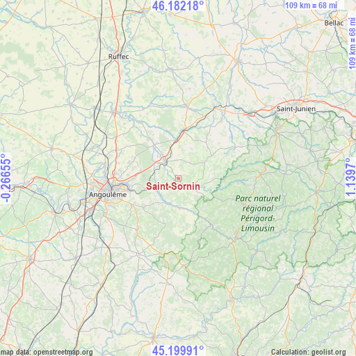
Saint-Sornin GPS coordinates[2]
45° 41' 35.52" North, 0° 26' 11.688" East
| Map corner | latitude | longitude |
|---|---|---|
| Upper-left | 46.18218°, | -0.26655° |
| Center: | 45.6932°, | 0.43658° |
| Lower-right: | 45.19991°, | 1.1397° |
| Map W x H: | 109.2×109.2 km | = 67.9×67.9mi |
| max Lat: | 51.07786° ⇑71% North |
| Saint-Sornin: | 45.6932° |
| min Lat: | ⇓29% South 41.3874° |
| min Long | Saint-Sornin | max Long |
| -5.08615° | 0.43658° | 9.52242° |
| W 26%⇐ | ⇒74% E |
Elevation
Elevation of Saint-Sornin is 130 m = 427 ft, and this is 63.7 m = 209 ft below average elevation for this country.
| Max E: |
2333 m = 7654 ft | 50.5% |
| Avg. | 193.7 m = 635 ft | |
| Saint-Sornin | 130 m = 427 ft | |
Min E: |
-1 m = -3 ft | 49.5% |
See also: France elevation on elevation.city.
Geographical zone
Saint-Sornin is located in North temperate zone (between Tropic of Cancer and the Arctic Circle). Distance of this North polar circle is 2320.6 km =1442 mi to North.| Distance of | km | miles | from Saint-Sornin |
|---|---|---|---|
| North Pole | 4926.5 | 3061.2 | to North |
| Arctic Circle | 2320.6 | 1442 | to North |
| Tropic Cancer | 2474.7 | 1537.7 | to South |
| Equator | 5080.6 | 3156.9 | to South |


Nearby cities:
15 places around Saint-Sornin: (largest is in red/bold)
• Agris
12.1 km =7.5 mi,  319°
319°
• Bouëx
12.6 km =7.8 mi,  227°
227°
• Chazelles
7.4 km =4.6 mi, 226°
• La Rochefoucauld
6.6 km =4.1 mi, 323°
• Marillac-le-Franc
4.5 km =2.8 mi,  356°
356°
• Marthon
8.7 km =5.4 mi,  176°
176°
• Montbron
5.7 km =3.5 mi,  120°
120°
• Montembœuf
13 km =8.1 mi,  43°
43°
• Pranzac
7.3 km =4.5 mi,  246°
246°
• Rivières
8.8 km =5.5 mi, 318°
• Saint-Projet-Saint-Constant
8.5 km =5.3 mi,  296°
296°
• Taponnat-Fleurignac
9.7 km =6 mi,  347°
347°
• Vitrac-Saint-Vincent
12.2 km =7.6 mi,  21°
21°
• Vouzan
12.4 km =7.7 mi,  213°
213°
• Écuras
10.2 km =6.3 mi,  95°
95°
Sources, notices
• [Note1] Compared only with cities in France existing in our database
• [Src1] Map data: © OpenStreetMap contributors (CC-BY-SA)
• [Src2] Other city data from geonames.org with taken over terms of usage.
• [Src3] Geographical zone / Annual Mean Temperature by Robert A. Rohde @ Wikipedia
