Rivières geodata
Rivières (Nouvelle-Aquitaine) is a populated place; located in France in Europe/Paris (GMT+2) time zone. With population of 1,905 people, there are 5021 cities with bigger population in this country. Compared to other cities in France, 70% of cities are located further ↑North; 74.7% of cities are located further →East and 63.2% of cities have higher elevation than Rivières. Note1
Administrative division(s):
- Level 1: Nouvelle-Aquitaine
- Level 2: Charente
- Level 3: Arrondissement d’Angoulême
- Level 4: Rivières


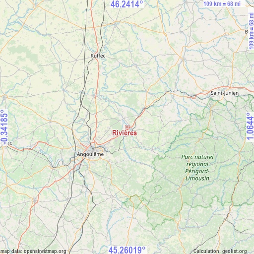
Rivières GPS coordinates[2]
45° 45' 10.62" North, 0° 21' 40.608" East
| Map corner | latitude | longitude |
|---|---|---|
| Upper-left | 46.2414°, | -0.34185° |
| Center: | 45.75295°, | 0.36128° |
| Lower-right: | 45.26019°, | 1.0644° |
| Map W x H: | 109.1×109.1 km | = 67.8×67.8mi |
| max Lat: | 51.07786° ⇑70% North |
| Rivières: | 45.75295° |
| min Lat: | ⇓30% South 41.3874° |
| min Long | Rivières | max Long |
| -5.08615° | 0.36128° | 9.52242° |
| W 25.3%⇐ | ⇒74.7% E |
Elevation
Elevation of Rivières is 94 m = 308 ft, and this is 99.7 m = 327 ft below average elevation for this country.
| Max E: |
2333 m = 7654 ft | 63.2% |
| Avg. | 193.7 m = 635 ft | |
| Rivières | 94 m = 308 ft | |
Min E: |
-1 m = -3 ft | 36.8% |
See also: France elevation on elevation.city.
Geographical zone
Rivières is located in North temperate zone (between Tropic of Cancer and the Arctic Circle). Distance of this North polar circle is 2313.9 km =1437.8 mi to North.| Distance of | km | miles | from Rivières |
|---|---|---|---|
| North Pole | 4919.8 | 3057 | to North |
| Arctic Circle | 2313.9 | 1437.8 | to North |
| Tropic Cancer | 2481.3 | 1541.8 | to South |
| Equator | 5087.3 | 3161.1 | to South |


Nearby cities:
15 places around Rivières: (largest is in red/bold)
• Agris
3.2 km =2 mi,  320°
320°
• Anais
12.1 km =7.5 mi,  281°
281°
• Brie
9.5 km =5.9 mi,  259°
259°
• Chasseneuil-sur-Bonnieure
9.9 km =6.2 mi,  44°
44°
• Chazelles
11.8 km =7.3 mi,  177°
177°
• Jauldes
8.8 km =5.5 mi,  294°
294°
• La Rochefoucauld
2.3 km =1.4 mi,  126°
126°
• La Rochette
6.4 km =4 mi,  325°
325°
• Marillac-le-Franc
6 km =3.7 mi,  111°
111°
• Mornac
10.7 km =6.6 mi,  223°
223°
• Pranzac
9.6 km =6 mi,  185°
185°
• Saint-Projet-Saint-Constant
3.3 km =2.1 mi,  212°
212°
• Saint-Sornin
8.8 km =5.5 mi,  138°
138°
• Taponnat-Fleurignac
4.7 km =2.9 mi,  52°
52°
• Vitrac-Saint-Vincent
11.3 km =7 mi,  65°
65°
Sources, notices
• [Note1] Compared only with cities in France existing in our database
• [Src1] Map data: © OpenStreetMap contributors (CC-BY-SA)
• [Src2] Other city data from geonames.org with taken over terms of usage.
• [Src3] Geographical zone / Annual Mean Temperature by Robert A. Rohde @ Wikipedia
