Saint-Romain-de-Benet geodata
Saint-Romain-de-Benet (Nouvelle-Aquitaine) is a populated place; located in France in Europe/Paris (GMT+2) time zone. With population of 1,472 people, there are 6289 cities with bigger population in this country. Compared to other cities in France, 71% of cities are located further ↑North; 86.9% of cities are located further →East and 90.3% of cities have higher elevation than Saint-Romain-de-Benet. Note1
Administrative division(s):
- Level 1: Nouvelle-Aquitaine
- Level 2: Charente-Maritime
- Level 3: Arrondissement de Saintes
- Level 4: Saint-Romain-de-Benet
Current local time in Saint-Romain-de-Benet:
12:56 PM, SaturdayDifference from your time zone: hours


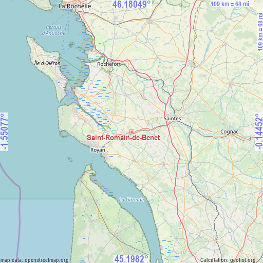
Saint-Romain-de-Benet GPS coordinates[2]
45° 41' 29.4" North, 0° 50' 51.54" West
| Map corner | latitude | longitude |
|---|---|---|
| Upper-left | 46.18049°, | -1.55077° |
| Center: | 45.6915°, | -0.84765° |
| Lower-right: | 45.1982°, | -0.14452° |
| Map W x H: | 109.2×109.2 km | = 67.9×67.9mi |
| max Lat: | 51.07786° ⇑71% North |
| Saint-Romain-de-Benet: | 45.6915° |
| min Lat: | ⇓29% South 41.3874° |
| min Long | Saint-Romain-de | max Long |
| -5.08615° | -0.84765° | 9.52242° |
| W 13.1%⇐ | ⇒86.9% E |
Elevation
Elevation of Saint-Romain-de-Benet is 29 m = 95 ft, and this is 164.7 m = 540 ft below average elevation for this country.
| Max E: |
2333 m = 7654 ft | 90.3% |
| Avg. | 193.7 m = 635 ft | |
| Saint-Romain-de-Benet | 29 m = 95 ft | |
Min E: |
-1 m = -3 ft | 9.7% |
See also: France elevation on elevation.city.
Geographical zone
Saint-Romain-de-Benet is located in North temperate zone (between Tropic of Cancer and the Arctic Circle). Distance of this North polar circle is 2320.8 km =1442.1 mi to North.| Distance of | km | miles | from Saint-Romain-de-Benet |
|---|---|---|---|
| North Pole | 4926.6 | 3061.2 | to North |
| Arctic Circle | 2320.8 | 1442.1 | to North |
| Tropic Cancer | 2474.5 | 1537.6 | to South |
| Equator | 5080.4 | 3156.8 | to South |


Nearby cities:
15 places around Saint-Romain-de-Benet: (largest is in red/bold)
• Corme-Royal
6.4 km =4 mi,  23°
23°
• Corme-Écluse
6.9 km =4.3 mi,  186°
186°
• Grézac
9.8 km =6.1 mi,  176°
176°
• Le Chay
6.9 km =4.3 mi,  212°
212°
• Le Gua
8.5 km =5.3 mi,  297°
297°
• Meursac
5.6 km =3.5 mi,  146°
146°
• Montpellier-de-Médillan
10.2 km =6.3 mi,  128°
128°
• Médis
10.4 km =6.5 mi,  239°
239°
• Pessines
10.9 km =6.8 mi,  68°
68°
• Rétaud
9.4 km =5.8 mi,  99°
99°
• Sablonceaux
3.7 km =2.3 mi, 302°
• Sainte-Gemme
9.5 km =5.9 mi,  340°
340°
• Saujon
6.4 km =4 mi,  251°
251°
• Soulignonne
10.7 km =6.6 mi,  26°
26°
• Varzay
9.2 km =5.7 mi,  79°
79°
Sources, notices
• [Note1] Compared only with cities in France existing in our database
• [Src1] Map data: © OpenStreetMap contributors (CC-BY-SA)
• [Src2] Other city data from geonames.org with taken over terms of usage.
• [Src3] Geographical zone / Annual Mean Temperature by Robert A. Rohde @ Wikipedia
