Saint-Rémy-sur-Durolle geodata
Saint-Rémy-sur-Durolle (Auvergne-Rhône-Alpes) is a populated place; located in France in Europe/Paris (GMT+2) time zone. With population of 1,805 people, there are 5259 cities with bigger population in this country. Compared to other cities in France, 67.9% of cities are located further ↑North; 65% of cities are located further ←West and 96.1% of cities have lower elevation than Saint-Rémy-sur-Durolle. Note1
Administrative division(s):
- Level 1: Auvergne-Rhône-Alpes
- Level 2: Département du Puy-de-Dôme
- Level 3: Arrondissement de Thiers
- Level 4: Saint-Rémy-sur-Durolle


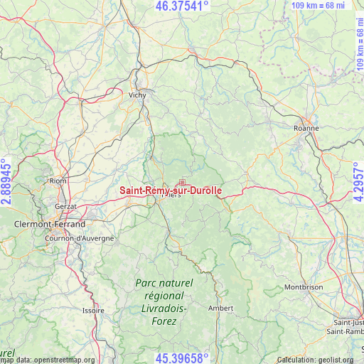
Saint-Rémy-sur-Durolle GPS coordinates[2]
45° 53' 17.34" North, 3° 35' 33.252" East
| Map corner | latitude | longitude |
|---|---|---|
| Upper-left | 46.37541°, | 2.88945° |
| Center: | 45.88815°, | 3.59257° |
| Lower-right: | 45.39658°, | 4.2957° |
| Map W x H: | 108.8×108.8 km | = 67.6×67.6mi |
| max Lat: | 51.07786° ⇑67.9% North |
| Saint-Rémy-sur-Durolle: | 45.88815° |
| min Lat: | ⇓32.1% South 41.3874° |
| min Long | Saint-Rémy-sur | max Long |
| -5.08615° | 3.59257° | 9.52242° |
| W 65%⇐ | ⇒35% E |
Elevation
Elevation of Saint-Rémy-sur-Durolle is 653 m = 2142 ft, and this is 459.3 m = 1507 ft above average elevation for this country.
| Max E: |
2333 m = 7654 ft | 3.9% |
| Saint-Rémy-sur-Durolle | 653 m 2142 ft | |
| Avg. | 193.7 m = 635 ft | |
Min E: |
-1 m = -3 ft | 96.1% |
See also: France elevation on elevation.city.
Geographical zone
Saint-Rémy-sur-Durolle is located in North temperate zone (between Tropic of Cancer and the Arctic Circle). Distance of this North polar circle is 2298.9 km =1428.5 mi to North.| Distance of | km | miles | from Saint-Rémy-sur-Durolle |
|---|---|---|---|
| North Pole | 4904.8 | 3047.7 | to North |
| Arctic Circle | 2298.9 | 1428.5 | to North |
| Tropic Cancer | 2496.4 | 1551.2 | to South |
| Equator | 5102.3 | 3170.4 | to South |


Nearby cities:
15 places around Saint-Rémy-sur-Durolle: (largest is in red/bold)
• Arconsat
9.3 km =5.8 mi,  89°
89°
• Celles-sur-Durolle
4.7 km =2.9 mi,  135°
135°
• Chabreloche
8.1 km =5 mi,  97°
97°
• Châteldon
11.3 km =7 mi,  330°
330°
• Dorat
8.6 km =5.3 mi,  273°
273°
• Escoutoux
8 km =5 mi,  196°
196°
• La Monnerie-le-Montel
2 km =1.2 mi,  160°
160°
• Orléat
13.6 km =8.5 mi,  257°
257°
• Palladuc
3.3 km =2.1 mi,  56°
56°
• Paslières
8.6 km =5.3 mi,  301°
301°
• Peschadoires
10.4 km =6.5 mi,  228°
228°
• Puy-Guillaume
12.2 km =7.6 mi,  311°
311°
• Ris
14 km =8.7 mi, 331°
• Thiers
4.9 km =3 mi,  224°
224°
• Vollore-Ville
11.5 km =7.1 mi,  176°
176°
Sources, notices
• [Note1] Compared only with cities in France existing in our database
• [Src1] Map data: © OpenStreetMap contributors (CC-BY-SA)
• [Src2] Other city data from geonames.org with taken over terms of usage.
• [Src3] Geographical zone / Annual Mean Temperature by Robert A. Rohde @ Wikipedia
