Froidfond geodata
Froidfond (Pays de la Loire) is a populated place; located in France in Europe/Paris (GMT+2) time zone. With population of 1,001 people, there are 8828 cities with bigger population in this country. Compared to other cities in France, 56.5% of cities are located further ↑North; 93.8% of cities are located further →East and 84.5% of cities have higher elevation than Froidfond. Note1
Administrative division(s):
- Level 1: Pays de la Loire
- Level 2: Département de la Vendée
- Level 3: Arrondissement des Sables-d'Olonne
- Level 4: Froidfond


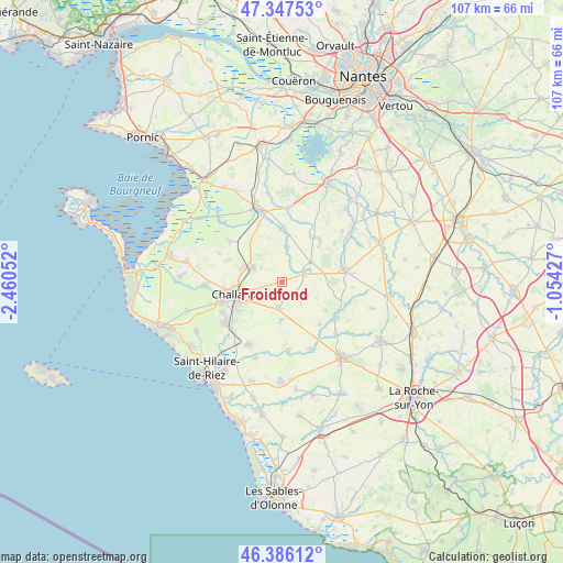
Froidfond GPS coordinates[2]
46° 52' 8.328" North, 1° 45' 26.64" West
| Map corner | latitude | longitude |
|---|---|---|
| Upper-left | 47.34753°, | -2.46052° |
| Center: | 46.86898°, | -1.7574° |
| Lower-right: | 46.38612°, | -1.05427° |
| Map W x H: | 106.9×106.9 km | = 66.4×66.4mi |
| max Lat: | 51.07786° ⇑56.5% North |
| Froidfond: | 46.86898° |
| min Lat: | ⇓43.5% South 41.3874° |
| min Long | Froidfond | max Long |
| -5.08615° | -1.7574° | 9.52242° |
| W 6.2%⇐ | ⇒93.8% E |
Elevation
Elevation of Froidfond is 43 m = 141 ft, and this is 150.7 m = 494 ft below average elevation for this country.
| Max E: |
2333 m = 7654 ft | 84.5% |
| Avg. | 193.7 m = 635 ft | |
| Froidfond | 43 m = 141 ft | |
Min E: |
-1 m = -3 ft | 15.5% |
See also: France elevation on elevation.city.
Geographical zone
Froidfond is located in North temperate zone (between Tropic of Cancer and the Arctic Circle). Distance of this North polar circle is 2189.8 km =1360.7 mi to North.| Distance of | km | miles | from Froidfond |
|---|---|---|---|
| North Pole | 4795.7 | 2979.9 | to North |
| Arctic Circle | 2189.8 | 1360.7 | to North |
| Tropic Cancer | 2605.4 | 1618.9 | to South |
| Equator | 5211.3 | 3238.2 | to South |


Nearby cities:
15 places around Froidfond: (largest is in red/bold)
• Apremont
13.5 km =8.4 mi,  174°
174°
• Bois-de-Cené
12.4 km =7.7 mi,  307°
307°
• Challans
9.4 km =5.8 mi,  252°
252°
• Châteauneuf
13.4 km =8.3 mi,  294°
294°
• Commequiers
13.6 km =8.5 mi,  207°
207°
• Falleron
4.4 km =2.7 mi,  71°
71°
• La Garnache
6.2 km =3.9 mi, 294°
• Legé
12 km =7.5 mi,  81°
81°
• Palluau
12.7 km =7.9 mi,  124°
124°
• Paulx
10.3 km =6.4 mi,  0°
0°
• Saint-Christophe-du-Ligneron
5 km =3.1 mi,  187°
187°
• Saint-Paul-Mont-Penit
10.8 km =6.7 mi,  138°
138°
• Saint-Étienne-de-Mer-Morte
6.7 km =4.2 mi,  9°
9°
• Saint-Étienne-du-Bois
12.9 km =8 mi,  109°
109°
• Touvois
6.7 km =4.2 mi,  56°
56°
Sources, notices
• [Note1] Compared only with cities in France existing in our database
• [Src1] Map data: © OpenStreetMap contributors (CC-BY-SA)
• [Src2] Other city data from geonames.org with taken over terms of usage.
• [Src3] Geographical zone / Annual Mean Temperature by Robert A. Rohde @ Wikipedia
