Monsireigne geodata
Monsireigne (Pays de la Loire) is a populated place; located in France in Europe/Paris (GMT+2) time zone. With population of 795 people, there are 10669 cities with bigger population in this country. Compared to other cities in France, 57.8% of cities are located further ↑North; 87.7% of cities are located further →East and 61.2% of cities have higher elevation than Monsireigne. Note1
Administrative division(s):
- Level 1: Pays de la Loire
- Level 2: Département de la Vendée
- Level 3: Arrondissement de Fontenay-le-Comte
- Level 4: Monsireigne


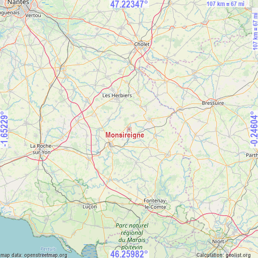
Monsireigne GPS coordinates[2]
46° 44' 37.68" North, 0° 56' 56.976" West
| Map corner | latitude | longitude |
|---|---|---|
| Upper-left | 47.22347°, | -1.65229° |
| Center: | 46.7438°, | -0.94916° |
| Lower-right: | 46.25982°, | -0.24604° |
| Map W x H: | 107.1×107.1 km | = 66.5×66.5mi |
| max Lat: | 51.07786° ⇑57.8% North |
| Monsireigne: | 46.7438° |
| min Lat: | ⇓42.2% South 41.3874° |
| min Long | Monsireigne | max Long |
| -5.08615° | -0.94916° | 9.52242° |
| W 12.3%⇐ | ⇒87.7% E |
Elevation
Elevation of Monsireigne is 99 m = 325 ft, and this is 94.7 m = 311 ft below average elevation for this country.
| Max E: |
2333 m = 7654 ft | 61.2% |
| Avg. | 193.7 m = 635 ft | |
| Monsireigne | 99 m = 325 ft | |
Min E: |
-1 m = -3 ft | 38.8% |
See also: France elevation on elevation.city.
Geographical zone
Monsireigne is located in North temperate zone (between Tropic of Cancer and the Arctic Circle). Distance of this North polar circle is 2203.8 km =1369.4 mi to North.| Distance of | km | miles | from Monsireigne |
|---|---|---|---|
| North Pole | 4809.6 | 2988.5 | to North |
| Arctic Circle | 2203.8 | 1369.4 | to North |
| Tropic Cancer | 2591.5 | 1610.3 | to South |
| Equator | 5197.4 | 3229.5 | to South |


Nearby cities:
15 places around Monsireigne: (largest is in red/bold)
• Bazoges-en-Pareds
10 km =6.2 mi,  165°
165°
• Chantonnay
10 km =6.2 mi,  230°
230°
• Chavagnes-les-Redoux
4 km =2.5 mi,  143°
143°
• La Meilleraie-Tillay
7.9 km =4.9 mi,  92°
92°
• Le Boupère
6 km =3.7 mi,  16°
16°
• Mouchamps
9.5 km =5.9 mi,  295°
295°
• Mouilleron-en-Pareds
10.7 km =6.6 mi,  134°
134°
• Pouzauges
9.5 km =5.9 mi,  65°
65°
• Rochetrejoux
6.2 km =3.9 mi,  324°
324°
• Saint-Germain-de-Prinçay
6.1 km =3.8 mi,  245°
245°
• Saint-Michel-Mont-Mercure
10.8 km =6.7 mi,  27°
27°
• Saint-Paul-en-Pareds
9.2 km =5.7 mi,  340°
340°
• Saint-Prouant
1.7 km =1.1 mi, 339°
• Saint-Vincent-Sterlanges
10.6 km =6.6 mi,  267°
267°
• Sigournais
5 km =3.1 mi,  214°
214°
Sources, notices
• [Note1] Compared only with cities in France existing in our database
• [Src1] Map data: © OpenStreetMap contributors (CC-BY-SA)
• [Src2] Other city data from geonames.org with taken over terms of usage.
• [Src3] Geographical zone / Annual Mean Temperature by Robert A. Rohde @ Wikipedia
