Saint-Mars-la-Réorthe geodata
Saint-Mars-la-Réorthe (Pays de la Loire) is a populated place; located in France in Europe/Paris (GMT+2) time zone. With population of 819 people, there are 10400 cities with bigger population in this country. Compared to other cities in France, 56.6% of cities are located further ↑North; 87.5% of cities are located further →East and 53.1% of cities have lower elevation than Saint-Mars-la-Réorthe. Note1
Administrative division(s):
- Level 1: Pays de la Loire
- Level 2: Département de la Vendée
- Level 3: Arrondissement de La Roche-sur-Yon
- Level 4: Saint-Mars-la-Réorthe
Current local time in Saint-Mars-la-Réorthe:
09:59 AM, SaturdayDifference from your time zone: hours


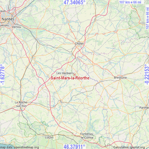
Saint-Mars-la-Réorthe GPS coordinates[2]
46° 51' 43.308" North, 0° 55' 28.74" West
| Map corner | latitude | longitude |
|---|---|---|
| Upper-left | 47.34065°, | -1.62778° |
| Center: | 46.86203°, | -0.92465° |
| Lower-right: | 46.37911°, | -0.22153° |
| Map W x H: | 106.9×106.9 km | = 66.4×66.4mi |
| max Lat: | 51.07786° ⇑56.6% North |
| Saint-Mars-la-Réorthe: | 46.86203° |
| min Lat: | ⇓43.4% South 41.3874° |
| min Long | Saint-Mars-la-R | max Long |
| -5.08615° | -0.92465° | 9.52242° |
| W 12.5%⇐ | ⇒87.5% E |
Elevation
Elevation of Saint-Mars-la-Réorthe is 143 m = 469 ft, and this is 50.7 m = 166 ft below average elevation for this country.
| Max E: |
2333 m = 7654 ft | 46.9% |
| Avg. | 193.7 m = 635 ft | |
| Saint-Mars-la-Réorthe | 143 m = 469 ft | |
Min E: |
-1 m = -3 ft | 53.1% |
See also: France elevation on elevation.city.
Geographical zone
Saint-Mars-la-Réorthe is located in North temperate zone (between Tropic of Cancer and the Arctic Circle). Distance of this North polar circle is 2190.6 km =1361.2 mi to North.| Distance of | km | miles | from Saint-Mars-la-Réorthe |
|---|---|---|---|
| North Pole | 4796.5 | 2980.4 | to North |
| Arctic Circle | 2190.6 | 1361.2 | to North |
| Tropic Cancer | 2604.7 | 1618.5 | to South |
| Equator | 5210.6 | 3237.7 | to South |


Nearby cities:
15 places around Saint-Mars-la-Réorthe: (largest is in red/bold)
• Chambretaud
7.3 km =4.5 mi,  335°
335°
• La Flocellière
5.8 km =3.6 mi,  125°
125°
• La Pommeraie-sur-Sèvre
11.6 km =7.2 mi,  104°
104°
• Le Boupère
7.3 km =4.5 mi,  181°
181°
• Les Châtelliers-Châteaumur
8 km =5 mi, 95°
• Les Epesses
3 km =1.9 mi,  38°
38°
• Les Herbiers
7 km =4.3 mi,  274°
274°
• Pouzauges
11.4 km =7.1 mi,  143°
143°
• Rochetrejoux
9.7 km =6 mi,  213°
213°
• Saint-Amand-sur-Sèvre
9.8 km =6.1 mi,  85°
85°
• Saint-Laurent-sur-Sèvre
10.9 km =6.8 mi,  12°
12°
• Saint-Malô-du-Bois
8.1 km =5 mi, 13°
• Saint-Michel-Mont-Mercure
4.8 km =3 mi, 138°
• Saint-Paul-en-Pareds
6.6 km =4.1 mi,  228°
228°
• Treize-Vents
8.7 km =5.4 mi, 41°
Sources, notices
• [Note1] Compared only with cities in France existing in our database
• [Src1] Map data: © OpenStreetMap contributors (CC-BY-SA)
• [Src2] Other city data from geonames.org with taken over terms of usage.
• [Src3] Geographical zone / Annual Mean Temperature by Robert A. Rohde @ Wikipedia
