Saint-Nicolas-de-Port geodata
Saint-Nicolas-de-Port (Grand Est) is a populated place; located in France in Europe/Paris (GMT+2) time zone. With population of 7,653 people, there are 1266 cities with bigger population in this country. Compared to other cities in France, 71.5% of cities are located further ↓South; 90.1% of cities are located further ←West and 69.2% of cities have lower elevation than Saint-Nicolas-de-Port. Note1
Administrative division(s):
- Level 1: Grand Est
- Level 2: Meurthe-et-Moselle
- Level 3: Arrondissement de Nancy
- Level 4: Saint-Nicolas-de-Port
Current local time in Saint-Nicolas-de-Port:
02:36 AM, SaturdayDifference from your time zone: hours


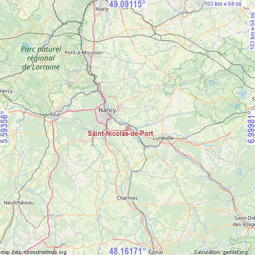
Saint-Nicolas-de-Port GPS coordinates[2]
48° 37' 42.852" North, 6° 17' 48.048" East
| Map corner | latitude | longitude |
|---|---|---|
| Upper-left | 49.09115°, | 5.59356° |
| Center: | 48.62857°, | 6.29668° |
| Lower-right: | 48.16171°, | 6.99981° |
| Map W x H: | 103.3×103.3 km | = 64.2×64.2mi |
| max Lat: | 51.07786° ⇑28.5% North |
| Saint-Nicolas-de-Port: | 48.62857° |
| min Lat: | ⇓71.5% South 41.3874° |
| min Long | Saint-Nicolas-d | max Long |
| -5.08615° | 6.29668° | 9.52242° |
| W 90.1%⇐ | ⇒9.9% E |
Elevation
Elevation of Saint-Nicolas-de-Port is 215 m = 705 ft, and this is 21.3 m = 70 ft above average elevation for this country.
| Max E: |
2333 m = 7654 ft | 30.8% |
| Saint-Nicolas-de-Port | 215 m 705 ft | |
| Avg. | 193.7 m = 635 ft | |
Min E: |
-1 m = -3 ft | 69.2% |
See also: France elevation on elevation.city.
Geographical zone
Saint-Nicolas-de-Port is located in North temperate zone (between Tropic of Cancer and the Arctic Circle). Distance of this North polar circle is 1994.2 km =1239.1 mi to North.| Distance of | km | miles | from Saint-Nicolas-de-Port |
|---|---|---|---|
| North Pole | 4600.1 | 2858.4 | to North |
| Arctic Circle | 1994.2 | 1239.1 | to North |
| Tropic Cancer | 2801.1 | 1740.5 | to South |
| Equator | 5407 | 3359.8 | to South |


Nearby cities:
15 places around Saint-Nicolas-de-Port: (largest is in red/bold)
• Art-sur-Meurthe
3.9 km =2.4 mi,  325°
325°
• Cerville
7.6 km =4.7 mi,  8°
8°
• Crévic
8 km =5 mi,  81°
81°
• Dombasle-sur-Meurthe
4.5 km =2.8 mi,  104°
104°
• Fléville-devant-Nancy
6.9 km =4.3 mi,  266°
266°
• Haraucourt
6.1 km =3.8 mi,  53°
53°
• Heillecourt
7.8 km =4.8 mi,  288°
288°
• Jarville-la-Malgrange
8.1 km =5 mi,  301°
301°
• Laneuveville-devant-Nancy
6 km =3.7 mi, 301°
• Rosières-aux-Salines
4.7 km =2.9 mi,  146°
146°
• Saulxures-lès-Nancy
7.7 km =4.8 mi, 329°
• Sommerviller
5.9 km =3.7 mi,  86°
86°
• Tomblaine
8.5 km =5.3 mi,  316°
316°
• Varangéville
1.9 km =1.2 mi,  60°
60°
• Ville-en-Vermois
3.5 km =2.2 mi,  243°
243°
Sources, notices
• [Note1] Compared only with cities in France existing in our database
• [Src1] Map data: © OpenStreetMap contributors (CC-BY-SA)
• [Src2] Other city data from geonames.org with taken over terms of usage.
• [Src3] Geographical zone / Annual Mean Temperature by Robert A. Rohde @ Wikipedia
