Saint-Maurice-sur-Eygues geodata
Saint-Maurice-sur-Eygues (Auvergne-Rhône-Alpes) is a populated place; located in France in Europe/Paris (GMT+2) time zone. With population of 582 people, there are 13612 cities with bigger population in this country. Compared to other cities in France, 84.9% of cities are located further ↑North; 77.8% of cities are located further ←West and 62.1% of cities have lower elevation than Saint-Maurice-sur-Eygues. Note1
Administrative division(s):
- Level 1: Auvergne-Rhône-Alpes
- Level 2: Département de la Drôme
- Level 3: Arrondissement de Nyons
- Level 4: Saint-Maurice-sur-Eygues
Current local time in Saint-Maurice-sur-Eygues:
02:37 AM, SundayDifference from your time zone: hours


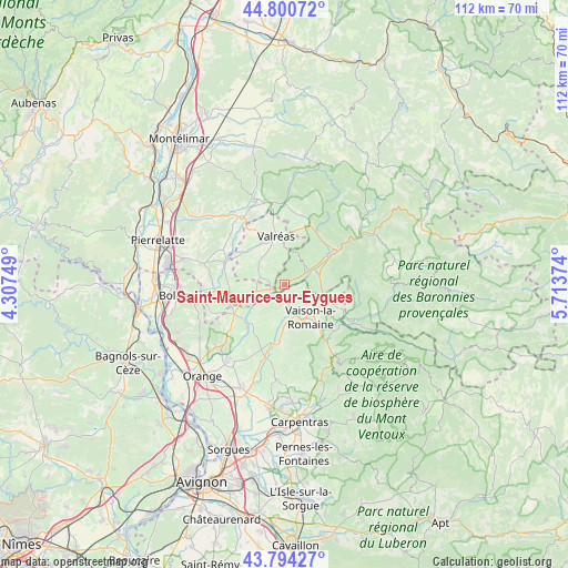
Saint-Maurice-sur-Eygues GPS coordinates[2]
44° 17' 58.74" North, 5° 0' 38.232" East
| Map corner | latitude | longitude |
|---|---|---|
| Upper-left | 44.80072°, | 4.30749° |
| Center: | 44.29965°, | 5.01062° |
| Lower-right: | 43.79427°, | 5.71374° |
| Map W x H: | 111.9×111.9 km | = 69.5×69.5mi |
| max Lat: | 51.07786° ⇑84.9% North |
| Saint-Maurice-sur-Eygues: | 44.29965° |
| min Lat: | ⇓15.1% South 41.3874° |
| min Long | Saint-Maurice-s | max Long |
| -5.08615° | 5.01062° | 9.52242° |
| W 77.8%⇐ | ⇒22.2% E |
Elevation
Elevation of Saint-Maurice-sur-Eygues is 180 m = 591 ft, and this is 13.7 m = 45 ft below average elevation for this country.
| Max E: |
2333 m = 7654 ft | 37.9% |
| Avg. | 193.7 m = 635 ft | |
| Saint-Maurice-sur-Eygues | 180 m = 591 ft | |
Min E: |
-1 m = -3 ft | 62.1% |
See also: France elevation on elevation.city.
Geographical zone
Saint-Maurice-sur-Eygues is located in North temperate zone (between Tropic of Cancer and the Arctic Circle). Distance of this Northern Tropic circle is 2319.7 km =1441.4 mi to South.| Distance of | km | miles | from Saint-Maurice-sur-Eygues |
|---|---|---|---|
| North Pole | 5081.4 | 3157.4 | to North |
| Arctic Circle | 2475.5 | 1538.2 | to North |
| Tropic Cancer | 2319.7 | 1441.4 | to South |
| Equator | 4925.7 | 3060.7 | to South |


Nearby cities:
15 places around Saint-Maurice-sur-Eygues: (largest is in red/bold)
• Bouchet
10.9 km =6.8 mi,  269°
269°
• Cairanne
9.7 km =6 mi,  219°
219°
• Mirabel-aux-Baronnies
7.2 km =4.5 mi,  80°
80°
• Puyméras
9.9 km =6.2 mi,  109°
109°
• Rasteau
7.9 km =4.9 mi,  193°
193°
• Richerenches
10.3 km =6.4 mi,  310°
310°
• Roaix
6 km =3.7 mi,  175°
175°
• Saint-Romain-en-Viennois
9.1 km =5.7 mi,  120°
120°
• Séguret
10.5 km =6.5 mi,  174°
174°
• Tulette
6.5 km =4 mi,  257°
257°
• Vaison-la-Romaine
8.5 km =5.3 mi,  142°
142°
• Valréas
9.6 km =6 mi,  350°
350°
• Villedieu
2.6 km =1.6 mi,  131°
131°
• Vinsobres
5.5 km =3.4 mi,  47°
47°
• Visan
5.1 km =3.2 mi,  289°
289°
Sources, notices
• [Note1] Compared only with cities in France existing in our database
• [Src1] Map data: © OpenStreetMap contributors (CC-BY-SA)
• [Src2] Other city data from geonames.org with taken over terms of usage.
• [Src3] Geographical zone / Annual Mean Temperature by Robert A. Rohde @ Wikipedia
