Vaison-la-Romaine geodata
Vaison-la-Romaine (Provence-Alpes-Côte d'Azur) is a populated place; located in France in Europe/Paris (GMT+2) time zone. With population of 6,207 people, there are 1594 cities with bigger population in this country. Compared to other cities in France, 85.2% of cities are located further ↑North; 78.4% of cities are located further ←West and 68.6% of cities have lower elevation than Vaison-la-Romaine. Note1
Administrative division(s):
- Level 1: Provence-Alpes-Côte d'Azur
- Level 2: Département du Vaucluse
- Level 3: Arrondissement de Carpentras
- Level 4: Vaison-la-Romaine


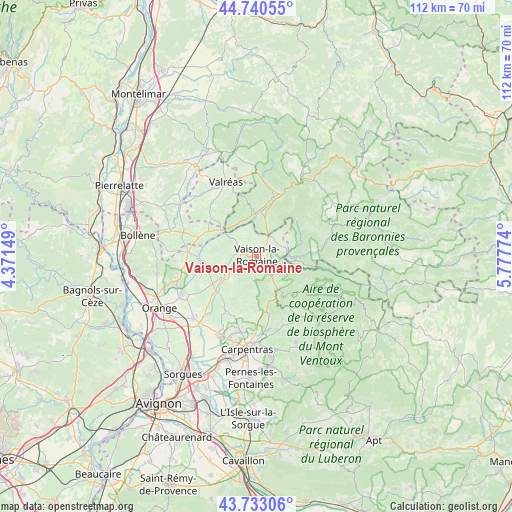
Vaison-la-Romaine GPS coordinates[2]
44° 14' 20.256" North, 5° 4' 28.596" East
| Map corner | latitude | longitude |
|---|---|---|
| Upper-left | 44.74055°, | 4.37149° |
| Center: | 44.23896°, | 5.07461° |
| Lower-right: | 43.73306°, | 5.77774° |
| Map W x H: | 112×112 km | = 69.6×69.6mi |
| max Lat: | 51.07786° ⇑85.2% North |
| Vaison-la-Romaine: | 44.23896° |
| min Lat: | ⇓14.8% South 41.3874° |
| min Long | Vaison-la-Romai | max Long |
| -5.08615° | 5.07461° | 9.52242° |
| W 78.4%⇐ | ⇒21.6% E |
Elevation
Elevation of Vaison-la-Romaine is 212 m = 696 ft, and this is 18.3 m = 60 ft above average elevation for this country.
| Max E: |
2333 m = 7654 ft | 31.4% |
| Vaison-la-Romaine | 212 m 696 ft | |
| Avg. | 193.7 m = 635 ft | |
Min E: |
-1 m = -3 ft | 68.6% |
See also: France elevation on elevation.city.
Geographical zone
Vaison-la-Romaine is located in North temperate zone (between Tropic of Cancer and the Arctic Circle). Distance of this Northern Tropic circle is 2313 km =1437.2 mi to South.| Distance of | km | miles | from Vaison-la-Romaine |
|---|---|---|---|
| North Pole | 5088.2 | 3161.7 | to North |
| Arctic Circle | 2482.3 | 1542.4 | to North |
| Tropic Cancer | 2313 | 1437.2 | to South |
| Equator | 4918.9 | 3056.5 | to South |


Nearby cities:
15 places around Vaison-la-Romaine: (largest is in red/bold)
• Cairanne
11.3 km =7 mi,  266°
266°
• Entrechaux
5.6 km =3.5 mi,  115°
115°
• Gigondas
10 km =6.2 mi,  213°
213°
• Malaucène
8.6 km =5.3 mi,  147°
147°
• Mirabel-aux-Baronnies
8.1 km =5 mi,  14°
14°
• Mollans-sur-Ouvèze
9.2 km =5.7 mi,  91°
91°
• Puyméras
5.5 km =3.4 mi,  50°
50°
• Rasteau
7 km =4.3 mi,  262°
262°
• Roaix
4.7 km =2.9 mi,  279°
279°
• Sablet
7.5 km =4.7 mi,  226°
226°
• Saint-Maurice-sur-Eygues
8.5 km =5.3 mi,  322°
322°
• Saint-Romain-en-Viennois
3.5 km =2.2 mi, 52°
• Séguret
5.5 km =3.4 mi, 228°
• Villedieu
5.9 km =3.7 mi,  327°
327°
• Vinsobres
10.5 km =6.5 mi,  354°
354°
Sources, notices
• [Note1] Compared only with cities in France existing in our database
• [Src1] Map data: © OpenStreetMap contributors (CC-BY-SA)
• [Src2] Other city data from geonames.org with taken over terms of usage.
• [Src3] Geographical zone / Annual Mean Temperature by Robert A. Rohde @ Wikipedia
