Saint-Maurice-lès-Charencey geodata
Saint-Maurice-lès-Charencey (Normandy) is a populated place; located in France in Europe/Paris (GMT+2) time zone. With population of 557 people, there are 14072 cities with bigger population in this country. Compared to other cities in France, 72% of cities are located further ↓South; 70.9% of cities are located further →East and 68.8% of cities have lower elevation than Saint-Maurice-lès-Charencey. Note1
Administrative division(s):
- Level 1: Normandy
- Level 2: Département de l'Orne
- Level 3: Arrondissement de Mortagne-au-Perche
- Level 4: Charencey
Current local time in Saint-Maurice-lès-Charencey:
12:44 PM, SaturdayDifference from your time zone: hours


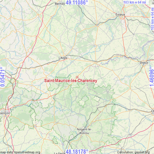
Saint-Maurice-lès-Charencey GPS coordinates[2]
48° 38' 54.456" North, 0° 45' 28.188" East
| Map corner | latitude | longitude |
|---|---|---|
| Upper-left | 49.11086°, | 0.05471° |
| Center: | 48.64846°, | 0.75783° |
| Lower-right: | 48.18178°, | 1.46096° |
| Map W x H: | 103.3×103.3 km | = 64.2×64.2mi |
| max Lat: | 51.07786° ⇑28% North |
| Saint-Maurice-lès-Charencey: | 48.64846° |
| min Lat: | ⇓72% South 41.3874° |
| min Long | Saint-Maurice-l | max Long |
| -5.08615° | 0.75783° | 9.52242° |
| W 29.1%⇐ | ⇒70.9% E |
Elevation
Elevation of Saint-Maurice-lès-Charencey is 213 m = 699 ft, and this is 19.3 m = 63 ft above average elevation for this country.
| Max E: |
2333 m = 7654 ft | 31.2% |
| Saint-Maurice-lès-Charencey | 213 m 699 ft | |
| Avg. | 193.7 m = 635 ft | |
Min E: |
-1 m = -3 ft | 68.8% |
See also: France elevation on elevation.city.
Geographical zone
Saint-Maurice-lès-Charencey is located in North temperate zone (between Tropic of Cancer and the Arctic Circle). Distance of this North polar circle is 1992 km =1237.8 mi to North.| Distance of | km | miles | from Saint-Maurice-lès-Charencey |
|---|---|---|---|
| North Pole | 4597.9 | 2857 | to North |
| Arctic Circle | 1992 | 1237.8 | to North |
| Tropic Cancer | 2803.3 | 1741.9 | to South |
| Equator | 5409.2 | 3361.1 | to South |


Nearby cities:
15 places around Saint-Maurice-lès-Charencey: (largest is in red/bold)
• Boissy-lès-Perche
10.5 km =6.5 mi,  67°
67°
• Bourth
13.9 km =8.6 mi,  15°
15°
• Chandai
11.7 km =7.3 mi,  353°
353°
• Crulai
9.1 km =5.7 mi,  313°
313°
• Francheville
16.8 km =10.4 mi, 23°
• La Ferté-Vidame
11.3 km =7 mi,  111°
111°
• Longny-au-Perche
13.2 km =8.2 mi,  181°
181°
• Neuilly-sur-Eure
16 km =9.9 mi,  137°
137°
• Rai
17.1 km =10.6 mi, 311°
• Randonnai
6.1 km =3.8 mi,  270°
270°
• Saint-Ouen-sur-Iton
10.7 km =6.6 mi,  335°
335°
• Saint-Sulpice-sur-Risle
16.4 km =10.2 mi,  333°
333°
• Soligny-la-Trappe
16.8 km =10.4 mi,  256°
256°
• Tourouvre
10.1 km =6.3 mi,  229°
229°
• Verneuil-sur-Avre
16 km =9.9 mi,  50°
50°
Sources, notices
• [Note1] Compared only with cities in France existing in our database
• [Src1] Map data: © OpenStreetMap contributors (CC-BY-SA)
• [Src2] Other city data from geonames.org with taken over terms of usage.
• [Src3] Geographical zone / Annual Mean Temperature by Robert A. Rohde @ Wikipedia
