Boissy-lès-Perche geodata
Boissy-lès-Perche (Centre) is a populated place; located in France in Europe/Paris (GMT+2) time zone. With population of 558 people, there are 14045 cities with bigger population in this country. Compared to other cities in France, 72.9% of cities are located further ↓South; 69.8% of cities are located further →East and 63.8% of cities have lower elevation than Boissy-lès-Perche. Note1
Administrative division(s):
- Level 1: Centre
- Level 2: Département d'Eure-et-Loir
- Level 3: Arrondissement de Dreux
- Level 4: Boissy-lès-Perche


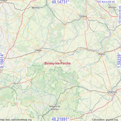
Boissy-lès-Perche GPS coordinates[2]
48° 41' 6.9" North, 0° 53' 21.336" East
| Map corner | latitude | longitude |
|---|---|---|
| Upper-left | 49.14731°, | 0.18614° |
| Center: | 48.68525°, | 0.88926° |
| Lower-right: | 48.21891°, | 1.59239° |
| Map W x H: | 103.2×103.2 km | = 64.1×64.1mi |
| max Lat: | 51.07786° ⇑27.1% North |
| Boissy-lès-Perche: | 48.68525° |
| min Lat: | ⇓72.9% South 41.3874° |
| min Long | Boissy-lès-Per | max Long |
| -5.08615° | 0.88926° | 9.52242° |
| W 30.2%⇐ | ⇒69.8% E |
Elevation
Elevation of Boissy-lès-Perche is 188 m = 617 ft, and this is 5.7 m = 19 ft below average elevation for this country.
| Max E: |
2333 m = 7654 ft | 36.2% |
| Avg. | 193.7 m = 635 ft | |
| Boissy-lès-Perche | 188 m = 617 ft | |
Min E: |
-1 m = -3 ft | 63.8% |
See also: France elevation on elevation.city.
Geographical zone
Boissy-lès-Perche is located in North temperate zone (between Tropic of Cancer and the Arctic Circle). Distance of this North polar circle is 1987.9 km =1235.2 mi to North.| Distance of | km | miles | from Boissy-lès-Perche |
|---|---|---|---|
| North Pole | 4593.8 | 2854.5 | to North |
| Arctic Circle | 1987.9 | 1235.2 | to North |
| Tropic Cancer | 2807.4 | 1744.4 | to South |
| Equator | 5413.3 | 3363.7 | to South |


Nearby cities:
15 places around Boissy-lès-Perche: (largest is in red/bold)
• Bourth
11 km =6.8 mi,  327°
327°
• Breteuil
16.6 km =10.3 mi,  6°
6°
• Brezolles
13.6 km =8.5 mi,  87°
87°
• Chandai
13.3 km =8.3 mi,  304°
304°
• Crulai
16.4 km =10.2 mi,  277°
277°
• Francheville
11.6 km =7.2 mi,  345°
345°
• La Ferté-Vidame
8.2 km =5.1 mi,  173°
173°
• La Guéroulde
14.2 km =8.8 mi,  359°
359°
• Neuilly-sur-Eure
16 km =9.9 mi,  176°
176°
• Piseux
11.6 km =7.2 mi,  32°
32°
• Randonnai
16.2 km =10.1 mi,  255°
255°
• Saint-Maurice-lès-Charencey
10.5 km =6.5 mi,  247°
247°
• Saint-Ouen-sur-Iton
15.2 km =9.4 mi,  291°
291°
• Tillières-sur-Avre
14.4 km =8.9 mi,  56°
56°
• Verneuil-sur-Avre
6.6 km =4.1 mi,  24°
24°
Sources, notices
• [Note1] Compared only with cities in France existing in our database
• [Src1] Map data: © OpenStreetMap contributors (CC-BY-SA)
• [Src2] Other city data from geonames.org with taken over terms of usage.
• [Src3] Geographical zone / Annual Mean Temperature by Robert A. Rohde @ Wikipedia
