Saint-Martin-en-Bière geodata
Saint-Martin-en-Bière (Île-de-France) is a populated place; located in France in Europe/Paris (GMT+2) time zone. With population of 833 people, there are 10260 cities with bigger population in this country. Compared to other cities in France, 67% of cities are located further ↓South; 51.6% of cities are located further ←West and 71.4% of cities have higher elevation than Saint-Martin-en-Bière. Note1
Administrative division(s):
- Level 1: Île-de-France
- Level 2: Seine-et-Marne
- Level 3: Arrondissement de Fontainebleau
- Level 4: Saint-Martin-en-Bière
Current local time in Saint-Martin-en-Bière:
06:44 AM, SaturdayDifference from your time zone: hours


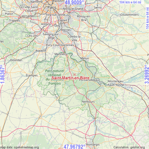
Saint-Martin-en-Bière GPS coordinates[2]
48° 26' 11.58" North, 2° 34' 0.444" East
| Map corner | latitude | longitude |
|---|---|---|
| Upper-left | 48.9009°, | 1.86367° |
| Center: | 48.43655°, | 2.56679° |
| Lower-right: | 47.96792°, | 3.26992° |
| Map W x H: | 103.7×103.7 km | = 64.4×64.4mi |
| max Lat: | 51.07786° ⇑33% North |
| Saint-Martin-en-Bière: | 48.43655° |
| min Lat: | ⇓67% South 41.3874° |
| min Long | Saint-Martin-en | max Long |
| -5.08615° | 2.56679° | 9.52242° |
| W 51.6%⇐ | ⇒48.4% E |
Elevation
Elevation of Saint-Martin-en-Bière is 75 m = 246 ft, and this is 118.7 m = 389 ft below average elevation for this country.
| Max E: |
2333 m = 7654 ft | 71.4% |
| Avg. | 193.7 m = 635 ft | |
| Saint-Martin-en-Bière | 75 m = 246 ft | |
Min E: |
-1 m = -3 ft | 28.6% |
See also: France elevation on elevation.city.
Geographical zone
Saint-Martin-en-Bière is located in North temperate zone (between Tropic of Cancer and the Arctic Circle). Distance of this North polar circle is 2015.5 km =1252.4 mi to North.| Distance of | km | miles | from Saint-Martin-en-Bière |
|---|---|---|---|
| North Pole | 4621.4 | 2871.6 | to North |
| Arctic Circle | 2015.5 | 1252.4 | to North |
| Tropic Cancer | 2779.7 | 1727.2 | to South |
| Equator | 5385.6 | 3346.5 | to South |


Nearby cities:
15 places around Saint-Martin-en-Bière: (largest is in red/bold)
• Achères-la-Forêt
9.1 km =5.7 mi,  178°
178°
• Arbonne-la-Forêt
2.5 km =1.6 mi, 180°
• Barbizon
2.8 km =1.7 mi,  74°
74°
• Chailly-en-Bière
4.5 km =2.8 mi,  41°
41°
• Cély
3.6 km =2.2 mi,  315°
315°
• Dannemois
6.8 km =4.2 mi,  287°
287°
• Fleury-en-Bière
1.7 km =1.1 mi,  307°
307°
• Milly-la-Forêt
8 km =5 mi,  243°
243°
• Moigny-sur-École
8 km =5 mi,  266°
266°
• Nainville-les-Roches
9.3 km =5.8 mi,  325°
325°
• Noisy-sur-École
8.9 km =5.5 mi,  209°
209°
• Perthes
4.7 km =2.9 mi,  349°
349°
• Pringy
9.1 km =5.7 mi,  358°
358°
• Saint-Sauveur-sur-École
6.9 km =4.3 mi, 347°
• Soisy-sur-École
7 km =4.3 mi, 309°
Sources, notices
• [Note1] Compared only with cities in France existing in our database
• [Src1] Map data: © OpenStreetMap contributors (CC-BY-SA)
• [Src2] Other city data from geonames.org with taken over terms of usage.
• [Src3] Geographical zone / Annual Mean Temperature by Robert A. Rohde @ Wikipedia
