Arbonne-la-Forêt geodata
Arbonne-la-Forêt (Île-de-France) is a populated place; located in France in Europe/Paris (GMT+2) time zone. With population of 1,036 people, there are 8567 cities with bigger population in this country. Compared to other cities in France, 66.6% of cities are located further ↓South; 51.6% of cities are located further ←West and 72.6% of cities have higher elevation than Arbonne-la-Forêt. Note1
Administrative division(s):
- Level 1: Île-de-France
- Level 2: Seine-et-Marne
- Level 3: Arrondissement de Fontainebleau
- Level 4: Arbonne-la-Forêt


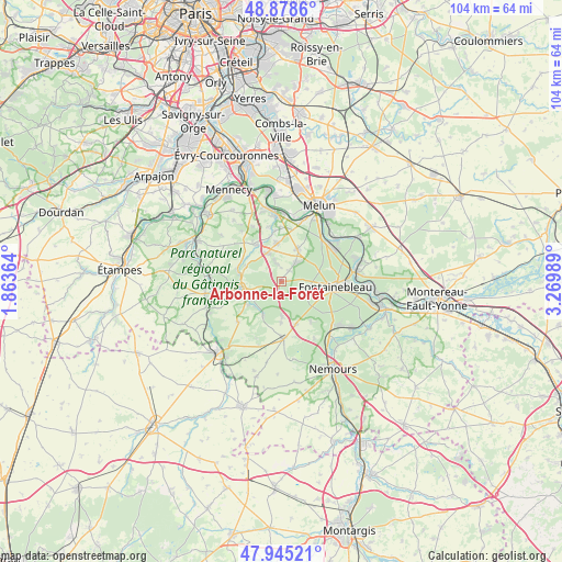
Arbonne-la-Forêt GPS coordinates[2]
48° 24' 50.58" North, 2° 34' 0.372" East
| Map corner | latitude | longitude |
|---|---|---|
| Upper-left | 48.8786°, | 1.86364° |
| Center: | 48.41405°, | 2.56677° |
| Lower-right: | 47.94521°, | 3.26989° |
| Map W x H: | 103.8×103.8 km | = 64.5×64.5mi |
| max Lat: | 51.07786° ⇑33.4% North |
| Arbonne-la-Forêt: | 48.41405° |
| min Lat: | ⇓66.6% South 41.3874° |
| min Long | Arbonne-la-For� | max Long |
| -5.08615° | 2.56677° | 9.52242° |
| W 51.6%⇐ | ⇒48.4% E |
Elevation
Elevation of Arbonne-la-Forêt is 72 m = 236 ft, and this is 121.7 m = 399 ft below average elevation for this country.
| Max E: |
2333 m = 7654 ft | 72.6% |
| Avg. | 193.7 m = 635 ft | |
| Arbonne-la-Forêt | 72 m = 236 ft | |
Min E: |
-1 m = -3 ft | 27.4% |
See also: France elevation on elevation.city.
Geographical zone
Arbonne-la-Forêt is located in North temperate zone (between Tropic of Cancer and the Arctic Circle). Distance of this North polar circle is 2018 km =1253.9 mi to North.| Distance of | km | miles | from Arbonne-la-Forêt |
|---|---|---|---|
| North Pole | 4623.9 | 2873.2 | to North |
| Arctic Circle | 2018 | 1253.9 | to North |
| Tropic Cancer | 2777.2 | 1725.7 | to South |
| Equator | 5383.1 | 3344.9 | to South |


Nearby cities:
15 places around Arbonne-la-Forêt: (largest is in red/bold)
• Achères-la-Forêt
6.6 km =4.1 mi,  177°
177°
• Barbizon
4.2 km =2.6 mi,  39°
39°
• Chailly-en-Bière
6.6 km =4.1 mi,  27°
27°
• Cély
5.7 km =3.5 mi,  333°
333°
• Dannemois
7.9 km =4.9 mi,  304°
304°
• Fleury-en-Bière
3.8 km =2.4 mi,  339°
339°
• Le Vaudoué
7.3 km =4.5 mi,  209°
209°
• Milly-la-Forêt
7.2 km =4.5 mi,  261°
261°
• Moigny-sur-École
8.3 km =5.2 mi,  284°
284°
• Noisy-sur-École
6.8 km =4.2 mi,  219°
219°
• Oncy-sur-École
8.1 km =5 mi,  245°
245°
• Perthes
7.2 km =4.5 mi,  353°
353°
• Saint-Martin-en-Bière
2.5 km =1.6 mi,  0°
0°
• Soisy-sur-École
8.8 km =5.5 mi,  321°
321°
• Ury
8.2 km =5.1 mi,  161°
161°
Sources, notices
• [Note1] Compared only with cities in France existing in our database
• [Src1] Map data: © OpenStreetMap contributors (CC-BY-SA)
• [Src2] Other city data from geonames.org with taken over terms of usage.
• [Src3] Geographical zone / Annual Mean Temperature by Robert A. Rohde @ Wikipedia
