Saint-Martin-Bellevue geodata
Saint-Martin-Bellevue (Auvergne-Rhône-Alpes) is a populated place; located in France in Europe/Paris (GMT+2) time zone. With population of 1,938 people, there are 4941 cities with bigger population in this country. Compared to other cities in France, 66.7% of cities are located further ↑North; 88.9% of cities are located further ←West and 95.5% of cities have lower elevation than Saint-Martin-Bellevue. Note1
Administrative division(s):
- Level 1: Auvergne-Rhône-Alpes
- Level 2: Haute-Savoie
- Level 3: Annecy
- Level 4: Fillière
Current local time in Saint-Martin-Bellevue:
01:25 AM, WednesdayDifference from your time zone: hours


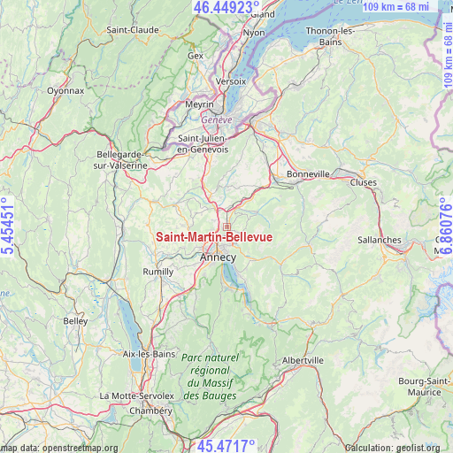
Saint-Martin-Bellevue GPS coordinates[2]
45° 57' 45.432" North, 6° 9' 27.468" East
| Map corner | latitude | longitude |
|---|---|---|
| Upper-left | 46.44923°, | 5.45451° |
| Center: | 45.96262°, | 6.15763° |
| Lower-right: | 45.4717°, | 6.86076° |
| Map W x H: | 108.7×108.7 km | = 67.5×67.5mi |
| max Lat: | 51.07786° ⇑66.7% North |
| Saint-Martin-Bellevue: | 45.96262° |
| min Lat: | ⇓33.3% South 41.3874° |
| min Long | Saint-Martin-Be | max Long |
| -5.08615° | 6.15763° | 9.52242° |
| W 88.9%⇐ | ⇒11.1% E |
Elevation
Elevation of Saint-Martin-Bellevue is 611 m = 2005 ft, and this is 417.3 m = 1369 ft above average elevation for this country.
| Max E: |
2333 m = 7654 ft | 4.5% |
| Saint-Martin-Bellevue | 611 m 2005 ft | |
| Avg. | 193.7 m = 635 ft | |
Min E: |
-1 m = -3 ft | 95.5% |
See also: France elevation on elevation.city.
Geographical zone
Saint-Martin-Bellevue is located in North temperate zone (between Tropic of Cancer and the Arctic Circle). Distance of this North polar circle is 2290.6 km =1423.3 mi to North.| Distance of | km | miles | from Saint-Martin-Bellevue |
|---|---|---|---|
| North Pole | 4896.5 | 3042.5 | to North |
| Arctic Circle | 2290.6 | 1423.3 | to North |
| Tropic Cancer | 2504.6 | 1556.3 | to South |
| Equator | 5110.6 | 3175.6 | to South |


Nearby cities:
15 places around Saint-Martin-Bellevue: (largest is in red/bold)
• Allonzier-la-Caille
5.2 km =3.2 mi,  324°
324°
• Annecy
6.5 km =4 mi,  202°
202°
• Annecy-le-Vieux
4.9 km =3 mi,  192°
192°
• Aviernoz
5.7 km =3.5 mi,  72°
72°
• Charvonnex
1.7 km =1.1 mi,  5°
5°
• Cuvat
3.4 km =2.1 mi,  295°
295°
• Groisy
5.4 km =3.4 mi, 10°
• Les Ollières
2.5 km =1.6 mi,  46°
46°
• Metz
4.9 km =3 mi,  228°
228°
• Meythet
6.9 km =4.3 mi,  224°
224°
• Nâves-Parmelan
4 km =2.5 mi,  138°
138°
• Pringy
3 km =1.9 mi, 233°
• Thorens-Glières
7.7 km =4.8 mi,  62°
62°
• Villaz
3.1 km =1.9 mi,  113°
113°
• Épagny
6.5 km =4 mi,  242°
242°
Sources, notices
• [Note1] Compared only with cities in France existing in our database
• [Src1] Map data: © OpenStreetMap contributors (CC-BY-SA)
• [Src2] Other city data from geonames.org with taken over terms of usage.
• [Src3] Geographical zone / Annual Mean Temperature by Robert A. Rohde @ Wikipedia
