Groisy geodata
Groisy (Auvergne-Rhône-Alpes) is a populated place; located in France in Europe/Paris (GMT+2) time zone. With population of 3,171 people, there are 3069 cities with bigger population in this country. Compared to other cities in France, 66.1% of cities are located further ↑North; 89% of cities are located further ←West and 96% of cities have lower elevation than Groisy. Note1
Administrative division(s):
- Level 1: Auvergne-Rhône-Alpes
- Level 2: Haute-Savoie
- Level 3: Annecy
- Level 4: Groisy


Groisy GPS coordinates[2]
46° 0' 36.288" North, 6° 10' 11.388" East
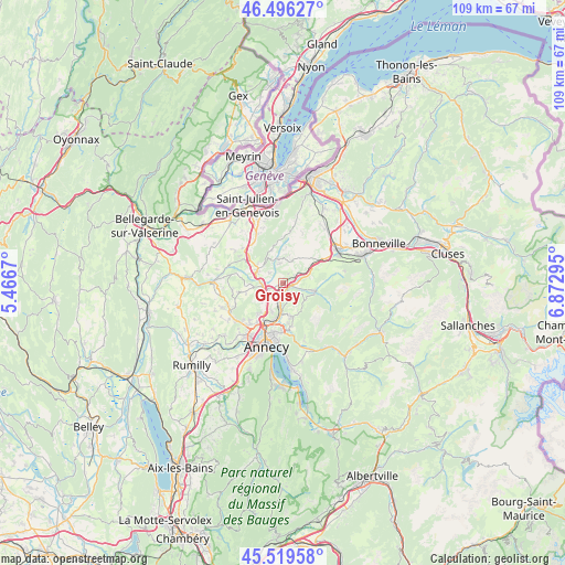
| Map corner | latitude | longitude |
|---|---|---|
| Upper-left | 46.49627°, | 5.4667° |
| Center: | 46.01008°, | 6.16983° |
| Lower-right: | 45.51958°, | 6.87295° |
| Map W x H: | 108.6×108.6 km | = 67.5×67.5mi |
| max Lat: | 51.07786° ⇑66.1% North |
| Groisy: | 46.01008° |
| min Lat: | ⇓33.9% South 41.3874° |
| min Long | Groisy | max Long |
| -5.08615° | 6.16983° | 9.52242° |
| W 89%⇐ | ⇒11% E |
Elevation
Elevation of Groisy is 649 m = 2129 ft, and this is 455.3 m = 1494 ft above average elevation for this country.
| Max E: |
2333 m = 7654 ft | 4% |
| Groisy | 649 m 2129 ft | |
| Avg. | 193.7 m = 635 ft | |
Min E: |
-1 m = -3 ft | 96% |
See also: France elevation on elevation.city.
Geographical zone
Groisy is located in North temperate zone (between Tropic of Cancer and the Arctic Circle). Distance of this North polar circle is 2285.3 km =1420 mi to North.| Distance of | km | miles | from Groisy |
|---|---|---|---|
| North Pole | 4891.2 | 3039.2 | to North |
| Arctic Circle | 2285.3 | 1420 | to North |
| Tropic Cancer | 2509.9 | 1559.6 | to South |
| Equator | 5115.8 | 3178.8 | to South |


Nearby cities:
15 places around Groisy: (largest is in red/bold)
• Allonzier-la-Caille
4.1 km =2.5 mi,  255°
255°
• Aviernoz
5.7 km =3.5 mi,  128°
128°
• Charvonnex
3.7 km =2.3 mi,  192°
192°
• Choisy
8.8 km =5.5 mi, 257°
• Copponex
8.7 km =5.4 mi,  300°
300°
• Cruseilles
5.2 km =3.2 mi,  294°
294°
• Cuvat
5.5 km =3.4 mi,  226°
226°
• Les Ollières
3.7 km =2.3 mi,  166°
166°
• Menthonnex-en-Bornes
4.7 km =2.9 mi,  2°
2°
• Nâves-Parmelan
8.5 km =5.3 mi, 168°
• Pringy
7.9 km =4.9 mi,  205°
205°
• Saint-Martin-Bellevue
5.4 km =3.4 mi, 190°
• Thorens-Glières
6.1 km =3.8 mi,  105°
105°
• Villaz
6.8 km =4.2 mi,  163°
163°
• Évires
5.2 km =3.2 mi,  53°
53°
Sources, notices
• [Note1] Compared only with cities in France existing in our database
• [Src1] Map data: © OpenStreetMap contributors (CC-BY-SA)
• [Src2] Other city data from geonames.org with taken over terms of usage.
• [Src3] Geographical zone / Annual Mean Temperature by Robert A. Rohde @ Wikipedia
