Villaz geodata
Villaz (Auvergne-Rhône-Alpes) is a populated place; located in France in Europe/Paris (GMT+2) time zone. With population of 2,259 people, there are 4262 cities with bigger population in this country. Compared to other cities in France, 66.8% of cities are located further ↑North; 89.2% of cities are located further ←West and 97.3% of cities have lower elevation than Villaz. Note1
Administrative division(s):
- Level 1: Auvergne-Rhône-Alpes
- Level 2: Haute-Savoie
- Level 3: Annecy
- Level 4: Villaz


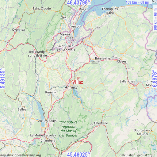
Villaz GPS coordinates[2]
45° 57' 4.572" North, 6° 11' 40.092" East
| Map corner | latitude | longitude |
|---|---|---|
| Upper-left | 46.43798°, | 5.49135° |
| Center: | 45.95127°, | 6.19447° |
| Lower-right: | 45.46025°, | 6.8976° |
| Map W x H: | 108.7×108.7 km | = 67.5×67.5mi |
| max Lat: | 51.07786° ⇑66.8% North |
| Villaz: | 45.95127° |
| min Lat: | ⇓33.2% South 41.3874° |
| min Long | Villaz | max Long |
| -5.08615° | 6.19447° | 9.52242° |
| W 89.2%⇐ | ⇒10.8% E |
Elevation
Elevation of Villaz is 745 m = 2444 ft, and this is 551.3 m = 1809 ft above average elevation for this country.
| Max E: |
2333 m = 7654 ft | 2.7% |
| Villaz | 745 m 2444 ft | |
| Avg. | 193.7 m = 635 ft | |
Min E: |
-1 m = -3 ft | 97.3% |
See also: France elevation on elevation.city.
Geographical zone
Villaz is located in North temperate zone (between Tropic of Cancer and the Arctic Circle). Distance of this North polar circle is 2291.9 km =1424.1 mi to North.| Distance of | km | miles | from Villaz |
|---|---|---|---|
| North Pole | 4897.8 | 3043.4 | to North |
| Arctic Circle | 2291.9 | 1424.1 | to North |
| Tropic Cancer | 2503.4 | 1555.5 | to South |
| Equator | 5109.3 | 3174.8 | to South |


Nearby cities:
15 places around Villaz: (largest is in red/bold)
• Alex
7.5 km =4.7 mi,  154°
154°
• Annecy
7.1 km =4.4 mi,  228°
228°
• Annecy-le-Vieux
5.3 km =3.3 mi, 228°
• Aviernoz
4 km =2.5 mi,  41°
41°
• Charvonnex
4 km =2.5 mi,  317°
317°
• Cuvat
6.5 km =4 mi,  294°
294°
• Dingy-Saint-Clair
5.5 km =3.4 mi, 154°
• Groisy
6.8 km =4.2 mi,  343°
343°
• Les Ollières
3.2 km =2 mi, 340°
• Metz
6.8 km =4.2 mi,  253°
253°
• Nâves-Parmelan
1.8 km =1.1 mi,  186°
186°
• Pringy
5.3 km =3.3 mi,  263°
263°
• Saint-Martin-Bellevue
3.1 km =1.9 mi, 293°
• Thorens-Glières
6.3 km =3.9 mi, 39°
• Veyrier-du-Lac
7.8 km =4.8 mi, 189°
Sources, notices
• [Note1] Compared only with cities in France existing in our database
• [Src1] Map data: © OpenStreetMap contributors (CC-BY-SA)
• [Src2] Other city data from geonames.org with taken over terms of usage.
• [Src3] Geographical zone / Annual Mean Temperature by Robert A. Rohde @ Wikipedia
