Saint-Lieux-lès-Lavaur geodata
Saint-Lieux-lès-Lavaur (Occitanie) is a populated place; located in France in Europe/Paris (GMT+2) time zone. With population of 566 people, there are 13895 cities with bigger population in this country. Compared to other cities in France, 89.5% of cities are located further ↑North; 59.9% of cities are located further →East and 52.6% of cities have higher elevation than Saint-Lieux-lès-Lavaur. Note1
Administrative division(s):
- Level 1: Occitanie
- Level 2: Tarn
- Level 3: Arrondissement de Castres
- Level 4: Saint-Lieux-lès-Lavaur
Current local time in Saint-Lieux-lès-Lavaur:
05:55 AM, WednesdayDifference from your time zone: hours


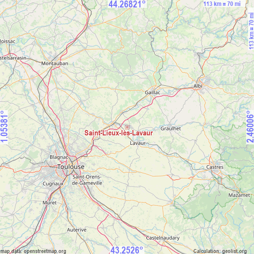
Saint-Lieux-lès-Lavaur GPS coordinates[2]
43° 45' 45.216" North, 1° 45' 24.948" East
| Map corner | latitude | longitude |
|---|---|---|
| Upper-left | 44.26821°, | 1.05381° |
| Center: | 43.76256°, | 1.75693° |
| Lower-right: | 43.2526°, | 2.46006° |
| Map W x H: | 112.9×112.9 km | = 70.2×70.2mi |
| max Lat: | 51.07786° ⇑89.5% North |
| Saint-Lieux-lès-Lavaur: | 43.76256° |
| min Lat: | ⇓10.5% South 41.3874° |
| min Long | Saint-Lieux-lè | max Long |
| -5.08615° | 1.75693° | 9.52242° |
| W 40.1%⇐ | ⇒59.9% E |
Elevation
Elevation of Saint-Lieux-lès-Lavaur is 123 m = 404 ft, and this is 70.7 m = 232 ft below average elevation for this country.
| Max E: |
2333 m = 7654 ft | 52.6% |
| Avg. | 193.7 m = 635 ft | |
| Saint-Lieux-lès-Lavaur | 123 m = 404 ft | |
Min E: |
-1 m = -3 ft | 47.4% |
See also: France elevation on elevation.city.
Geographical zone
Saint-Lieux-lès-Lavaur is located in North temperate zone (between Tropic of Cancer and the Arctic Circle). Distance of this Northern Tropic circle is 2260 km =1404.3 mi to South.| Distance of | km | miles | from Saint-Lieux-lès-Lavaur |
|---|---|---|---|
| North Pole | 5141.1 | 3194.5 | to North |
| Arctic Circle | 2535.2 | 1575.3 | to North |
| Tropic Cancer | 2260 | 1404.3 | to South |
| Equator | 4865.9 | 3023.5 | to South |


Nearby cities:
15 places around Saint-Lieux-lès-Lavaur: (largest is in red/bold)
• Ambres
5.6 km =3.5 mi,  127°
127°
• Bessières
12.7 km =7.9 mi,  288°
288°
• Briatexte
12.2 km =7.6 mi,  95°
95°
• Buzet-sur-Tarn
10.1 km =6.3 mi,  280°
280°
• Coufouleux
6.4 km =4 mi,  340°
340°
• Fiac
13.9 km =8.6 mi,  119°
119°
• Giroussens
1.5 km =0.9 mi,  92°
92°
• Labastide-Saint-Georges
10 km =6.2 mi, 134°
• Lavaur
8.7 km =5.4 mi,  145°
145°
• Lisle-sur-Tarn
10.9 km =6.8 mi,  23°
23°
• Parisot
7.1 km =4.4 mi,  54°
54°
• Rabastens
7.4 km =4.6 mi, 339°
• Roquesérière
10.1 km =6.3 mi,  252°
252°
• Saint-Gauzens
11.6 km =7.2 mi, 98°
• Saint-Sulpice-la-Pointe
5.9 km =3.7 mi, 283°
Sources, notices
• [Note1] Compared only with cities in France existing in our database
• [Src1] Map data: © OpenStreetMap contributors (CC-BY-SA)
• [Src2] Other city data from geonames.org with taken over terms of usage.
• [Src3] Geographical zone / Annual Mean Temperature by Robert A. Rohde @ Wikipedia
