La Roche-sur-Foron geodata
La Roche-sur-Foron (Auvergne-Rhône-Alpes) is a populated place; located in France in Europe/Paris (GMT+1) time zone. With population of 10,026 people, there are 951 cities with bigger population in this country. Compared to other cities in France, 65.4% of cities are located further ↑North; 90.2% of cities are located further ←West and 93.9% of cities have lower elevation than La Roche-sur-Foron. Note1
Administrative division(s):
- Level 1: Auvergne-Rhône-Alpes
- Level 2: Haute-Savoie
- Level 3: Arrondissement de Bonneville
- Level 4: La Roche-sur-Foron


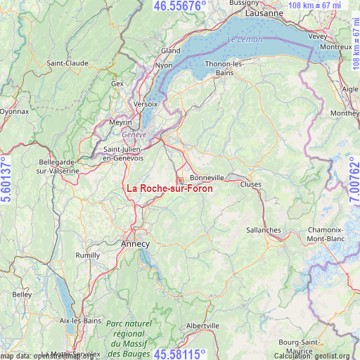
La Roche-sur-Foron GPS coordinates[2]
46° 4' 15.996" North, 6° 18' 16.2" East
| Map corner | latitude | longitude |
|---|---|---|
| Upper-left | 46.55676°, | 5.60137° |
| Center: | 46.07111°, | 6.3045° |
| Lower-right: | 45.58115°, | 7.00762° |
| Map W x H: | 108.5×108.5 km | = 67.4×67.4mi |
| max Lat: | 51.07786° ⇑65.4% North |
| La Roche-sur-Foron: | 46.07111° |
| min Lat: | ⇓34.6% South 41.3874° |
| min Long | La Roche-sur-Fo | max Long |
| -5.08615° | 6.3045° | 9.52242° |
| W 90.2%⇐ | ⇒9.8% E |
Elevation
Elevation of La Roche-sur-Foron is 540 m = 1772 ft, and this is 346.3 m = 1136 ft above average elevation for this country.
| Max E: |
2333 m = 7654 ft | 6.1% |
| La Roche-sur-Foron | 540 m 1772 ft | |
| Avg. | 193.7 m = 635 ft | |
Min E: |
-1 m = -3 ft | 93.9% |
See also: France elevation on elevation.city.
Geographical zone
La Roche-sur-Foron is located in North temperate zone (between Tropic of Cancer and the Arctic Circle). Distance of this North polar circle is 2278.5 km =1415.8 mi to North.| Distance of | km | miles | from La Roche-sur-Foron |
|---|---|---|---|
| North Pole | 4884.4 | 3035 | to North |
| Arctic Circle | 2278.5 | 1415.8 | to North |
| Tropic Cancer | 2516.7 | 1563.8 | to South |
| Equator | 5122.6 | 3183 | to South |


Nearby cities:
15 places around La Roche-sur-Foron: (largest is in red/bold)
• Amancy
1.9 km =1.2 mi,  83°
83°
• Arbusigny
7.1 km =4.4 mi,  290°
290°
• Arenthon
4.6 km =2.9 mi,  28°
28°
• Bonneville
8 km =5 mi, 82°
• Contamine-sur-Arve
8.2 km =5.1 mi,  15°
15°
• Cornier
2.5 km =1.6 mi,  350°
350°
• Etaux
0.8 km =0.5 mi,  246°
246°
• Peillonnex
8.5 km =5.3 mi,  41°
41°
• Pers-Jussy
4.7 km =2.9 mi,  325°
325°
• Reignier-Ésery
7.5 km =4.7 mi,  337°
337°
• Saint-Jean-de-Tholome
8.4 km =5.2 mi,  56°
56°
• Saint-Laurent
5 km =3.1 mi,  124°
124°
• Saint-Sixt
2.8 km =1.7 mi,  138°
138°
• Scientrier
5.2 km =3.2 mi, 17°
• Évires
7.2 km =4.5 mi,  239°
239°
Sources, notices
• [Note1] Compared only with cities in France existing in our database
• [Src1] Map data: © OpenStreetMap contributors (CC-BY-SA)
• [Src2] Other city data from geonames.org with taken over terms of usage.
• [Src3] Geographical zone / Annual Mean Temperature by Robert A. Rohde @ Wikipedia
