Saint-Gengoux-de-Scissé geodata
Saint-Gengoux-de-Scissé (Bourgogne-Franche-Comté) is a populated place; located in France in Europe/Paris (GMT+2) time zone. With population of 532 people, there are 14567 cities with bigger population in this country. Compared to other cities in France, 60.4% of cities are located further ↑North; 74.7% of cities are located further ←West and 79.6% of cities have lower elevation than Saint-Gengoux-de-Scissé. Note1
Administrative division(s):
- Level 1: Bourgogne-Franche-Comté
- Level 2: Département de Saône-et-Loire
- Level 3: Arrondissement de Mâcon
- Level 4: Saint-Gengoux-de-Scissé
Current local time in Saint-Gengoux-de-Scissé:
03:56 PM, SaturdayDifference from your time zone: hours


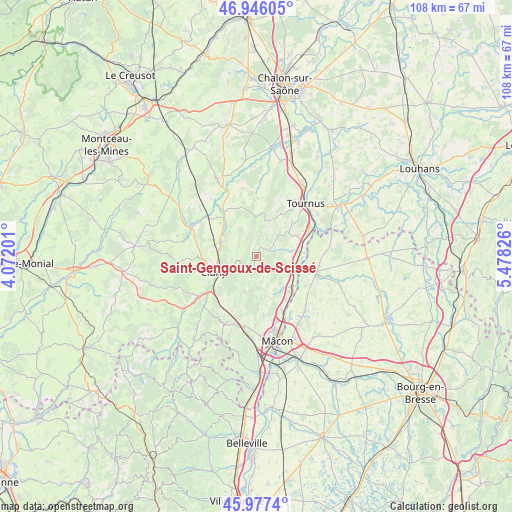
Saint-Gengoux-de-Scissé GPS coordinates[2]
46° 27' 49.968" North, 4° 46' 30.504" East
| Map corner | latitude | longitude |
|---|---|---|
| Upper-left | 46.94605°, | 4.07201° |
| Center: | 46.46388°, | 4.77514° |
| Lower-right: | 45.9774°, | 5.47826° |
| Map W x H: | 107.7×107.7 km | = 66.9×66.9mi |
| max Lat: | 51.07786° ⇑60.4% North |
| Saint-Gengoux-de-Scissé: | 46.46388° |
| min Lat: | ⇓39.6% South 41.3874° |
| min Long | Saint-Gengoux-d | max Long |
| -5.08615° | 4.77514° | 9.52242° |
| W 74.7%⇐ | ⇒25.3% E |
Elevation
Elevation of Saint-Gengoux-de-Scissé is 286 m = 938 ft, and this is 92.3 m = 303 ft above average elevation for this country.
| Max E: |
2333 m = 7654 ft | 20.4% |
| Saint-Gengoux-de-Scissé | 286 m 938 ft | |
| Avg. | 193.7 m = 635 ft | |
Min E: |
-1 m = -3 ft | 79.6% |
See also: France elevation on elevation.city.
Geographical zone
Saint-Gengoux-de-Scissé is located in North temperate zone (between Tropic of Cancer and the Arctic Circle). Distance of this North polar circle is 2234.9 km =1388.7 mi to North.| Distance of | km | miles | from Saint-Gengoux-de-Scissé |
|---|---|---|---|
| North Pole | 4840.8 | 3007.9 | to North |
| Arctic Circle | 2234.9 | 1388.7 | to North |
| Tropic Cancer | 2560.4 | 1591 | to South |
| Equator | 5166.3 | 3210.2 | to South |


Nearby cities:
15 places around Saint-Gengoux-de-Scissé: (largest is in red/bold)
• Azé
3.8 km =2.4 mi,  196°
196°
• Clessé
6.2 km =3.9 mi,  149°
149°
• Cluny
9.6 km =6 mi,  249°
249°
• Igé
7.8 km =4.8 mi, 199°
• Laizé
8 km =5 mi,  162°
162°
• Lugny
2.8 km =1.7 mi,  70°
70°
• Montbellet
7.6 km =4.7 mi,  79°
79°
• Plottes
10.5 km =6.5 mi,  46°
46°
• Reyssouze
11.6 km =7.2 mi,  106°
106°
• Saint-Albain
8.7 km =5.4 mi,  117°
117°
• Saint-Martin-Belle-Roche
10.9 km =6.8 mi, 145°
• Senozan
10.1 km =6.3 mi,  138°
138°
• Uchizy
9.5 km =5.9 mi,  62°
62°
• Verzé
10.1 km =6.3 mi, 197°
• Viré
5.4 km =3.4 mi, 106°
Sources, notices
• [Note1] Compared only with cities in France existing in our database
• [Src1] Map data: © OpenStreetMap contributors (CC-BY-SA)
• [Src2] Other city data from geonames.org with taken over terms of usage.
• [Src3] Geographical zone / Annual Mean Temperature by Robert A. Rohde @ Wikipedia
