Reyssouze geodata
Reyssouze (Auvergne-Rhône-Alpes) is a populated place; located in France in Europe/Paris (GMT+2) time zone. With population of 777 people, there are 10851 cities with bigger population in this country. Compared to other cities in France, 60.7% of cities are located further ↑North; 76.7% of cities are located further ←West and 60.9% of cities have lower elevation than Reyssouze. Note1
Administrative division(s):
- Level 1: Auvergne-Rhône-Alpes
- Level 2: Département de l'Ain
- Level 3: Arrondissement de Bourg-en-Bresse
- Level 4: Reyssouze


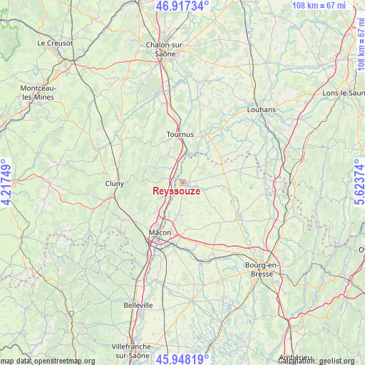
Reyssouze GPS coordinates[2]
46° 26' 5.712" North, 4° 55' 14.196" East
| Map corner | latitude | longitude |
|---|---|---|
| Upper-left | 46.91734°, | 4.21749° |
| Center: | 46.43492°, | 4.92061° |
| Lower-right: | 45.94819°, | 5.62374° |
| Map W x H: | 107.8×107.8 km | = 67×67mi |
| max Lat: | 51.07786° ⇑60.7% North |
| Reyssouze: | 46.43492° |
| min Lat: | ⇓39.3% South 41.3874° |
| min Long | Reyssouze | max Long |
| -5.08615° | 4.92061° | 9.52242° |
| W 76.7%⇐ | ⇒23.3% E |
Elevation
Elevation of Reyssouze is 174 m = 571 ft, and this is 19.7 m = 65 ft below average elevation for this country.
| Max E: |
2333 m = 7654 ft | 39.1% |
| Avg. | 193.7 m = 635 ft | |
| Reyssouze | 174 m = 571 ft | |
Min E: |
-1 m = -3 ft | 60.9% |
See also: France elevation on elevation.city.
Geographical zone
Reyssouze is located in North temperate zone (between Tropic of Cancer and the Arctic Circle). Distance of this North polar circle is 2238.1 km =1390.7 mi to North.| Distance of | km | miles | from Reyssouze |
|---|---|---|---|
| North Pole | 4844 | 3009.9 | to North |
| Arctic Circle | 2238.1 | 1390.7 | to North |
| Tropic Cancer | 2557.2 | 1589 | to South |
| Equator | 5163.1 | 3208.2 | to South |


Nearby cities:
15 places around Reyssouze: (largest is in red/bold)
• Chavannes-sur-Reyssouze
5.8 km =3.6 mi,  94°
94°
• Chevroux
6.3 km =3.9 mi,  157°
157°
• Clessé
8.3 km =5.2 mi,  255°
255°
• Gorrevod
2.6 km =1.6 mi,  133°
133°
• Manziat
8.3 km =5.2 mi,  187°
187°
• Montbellet
5.8 km =3.6 mi,  321°
321°
• Ozan
4.9 km =3 mi,  184°
184°
• Pont-de-Vaux
1.9 km =1.2 mi,  95°
95°
• Saint-Albain
3.5 km =2.2 mi, 257°
• Saint-Bénigne
3.9 km =2.4 mi,  83°
83°
• Saint-Martin-Belle-Roche
7.6 km =4.7 mi,  220°
220°
• Senozan
6.2 km =3.9 mi,  225°
225°
• Sermoyer
8.5 km =5.3 mi,  31°
31°
• Uchizy
8.1 km =5 mi,  340°
340°
• Viré
6.2 km =3.9 mi,  285°
285°
Sources, notices
• [Note1] Compared only with cities in France existing in our database
• [Src1] Map data: © OpenStreetMap contributors (CC-BY-SA)
• [Src2] Other city data from geonames.org with taken over terms of usage.
• [Src3] Geographical zone / Annual Mean Temperature by Robert A. Rohde @ Wikipedia
